Download
1 / 14
140 likes | 327 Views
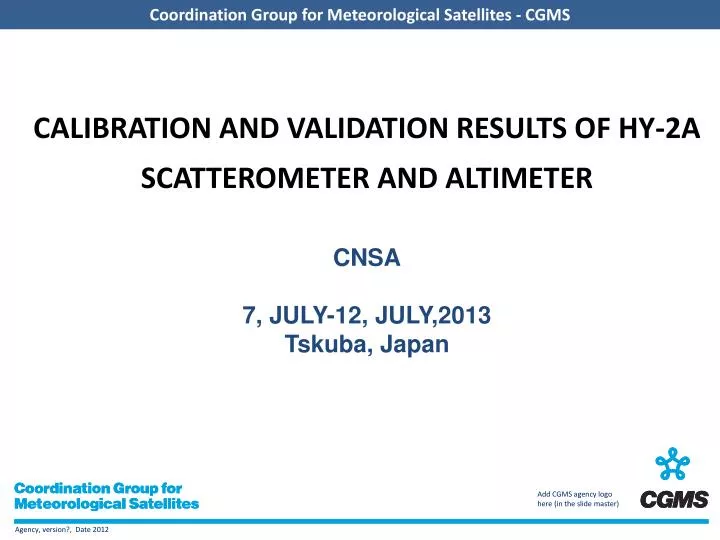
CALIBRATION AND VALIDATION RESULTS OF HY-2A SCATTEROMETER AND ALTIMETER CNSA 7, JULY-12, JULY,2013 Tskuba, Japan. Overview. HY-2A satellite characteristics HY-2A SCATTEROMETER CALIBRATION AND PRODUCT VALIDATION HY-2A RADAR ALTIMETER CALIBRATION AND VERIFICATION Conclusions.

E N D
CALIBRATION AND VALIDATION RESULTS OF HY-2A SCATTEROMETER AND ALTIMETERCNSA7, JULY-12, JULY,2013Tskuba, Japan
Overview • HY-2A satellite characteristics • HY-2A SCATTEROMETER CALIBRATION AND PRODUCT VALIDATION • HY-2A RADAR ALTIMETER CALIBRATION AND VERIFICATION • Conclusions
1. HY-2A satellite characteristics • HY-2A: (« Hai Yang »= Ocean) from the National Satellite Ocean Application Service (NSOAS; P.R. China) has been designed for the monitoring of the Ocean dynamics • HY‐2A payloads: • – Radar altimeter (Ku & C bands) • – Microwave scatterometer (Ku band) • – Microwave radiometer (6.6, 10.7, 18.7, 23.8 & 37.0GHz) • Orbit altitude: ~965 km, sun‐synchronous, with 99°inclination • Repeat cycle: 14 days (for three years) & 168 days • Satellite launched in August 2011
2. HY-2A SCATTEROMETER CALIBRATION AND PRODUCT VALIDATION 2.1 The measurement performance monitoring of HY-2A satellite microwave scatterometer – selected geographical areas of Amazon rainforest that had uniform spatial distribution characteristic --The monitoring results show that the measurement performance of scatterometer is very stability and there is no obvious change. Fig 1 . The measurements performance monitoring of HY-2A satellite microwave scatterometer in 2012
Coordination Group for Meteorological Satellites - CGMS 2. HY-2A SCATTEROMETER CALIBRATION AND PRODUCT VALIDATION 2.2 HY-2A satellite microwave scatterometer calibration • The in-orbit radiometric calibration of HY-2Ascatterometer is implemented using open ocean backscatter measurements by NSCAT-2 Geophysical model function and Ocean surface wind vectors of NCEP FNL. • We analysis level -1B data of HY-2A scatterometer from January 5, 2012 to February 15 ,2012. After excluding the observations Containing rain flagged, every 14 days calibration coefficients were separately calculated for scatterometer observations of descending and ascending tracks. Ultimately we get the HY-2Ascatterometer calibration coefficient is: - 1.7dB (VV) and-1.7dB (HH)
2. HY-2A SCATTEROMETER CALIBRATION AND PRODUCT VALIDATION 2. HY-2A SCATTEROMETER CALIBRATION AND PRODUCT VALIDATION 2.3 HY-2A satellite microwave scatterometer calibration 2.3 HY-2A satellite microwave scatterometer calibration • Buoy measurements have historically been considered the primary comparison data for satellite wind validation. • We validates HY-2A scatterometer Wind vector estimates by comparing them with observations from operational U.S.National Data Buoy Center (NDBC) meteorological buoys, a total of 39 buoys were used, NDBC buoy stations used in the geographical distribution are shown in Figure 2. NDBC buoy stations used in the geographical distribution
2. HY-2A SCATTEROMETER CALIBRATION AND PRODUCT VALIDATION 2.3 HY-2A satellite microwave scatterometer calibration • Representative buoys were selected using objective collocation criteria, The temporal and spatial differences between buoy and satellite observations were restricted to 30 min and 25 km, respectively . And, the wind speed of buoy is corrected to 10-m neutral stability wind speed by the method of Liu and Tang’s method. • We used all HY-2A scatterometer vector wind in 2012 for validation analyses, The analyses result indicated that these rain-free HY-2A scatterometer vector wind measurements have speed and directional RMS accuracies of 1.27 m/s and 20.79 respectively for wind speeds from 2–24m/s, There is a good accuracy for HY-2A scatterometer wind vector. Comparison of HY-2A scatterometer vector wind and NDBC buoys10-m neutral stability(Left:wind speed, right:wind direction)
Coordination Group for Meteorological Satellites - CGMS 3. HY-2A RADAR ALTIMETER CALIBRATION AND VERIFICATION 3.1 Precise Orbit Determination andVerification • We have computed several high accuracy solutions from induced dynamic solution based on DORIS and SLR, dynamic solution based on GPS and SLR, induced dynamic solution based on DORIS, GPS and SLR tracking data. The real time MOE orbits are compared with SLR validation and independent data residuals. The SLR validation result and the independent data residuals of real time MOE on May in 2012 is seen in table 1 and table 2, respectively. The MOE accuracy is about 3.5cm with SLR validation, while the MOE accuracy compared with CNES orbit is superior to 3cm. Table 1 The results of SLR validation for the MOE (May in 2012) Table2 The comparison results for different solutions for the radial accuracy of MOE ((May in 2012)
Coordination Group for Meteorological Satellites - CGMS 3. HY-2A RADAR ALTIMETER CALIBRATION AND VERIFICATION 3.2 HY-2A altimeter data products Validation (1) Comparison of HY-2A altimeter SWH and Jason-2 SWH Figure 4HY-2A altimeter Ku-band SWH from the IGDR product versus the Jason-2 Ku-band SWH from IGDR product( left: before regression right: after regression)
Coordination Group for Meteorological Satellites - CGMS 3. HY-2A RADAR ALTIMETER CALIBRATION AND VERIFICATION 3.2 HY-2A altimeter data products Validation (2) SSH Performances based on crossover differences of HY-2A alone • The analysis of the SHH differences at crossovers between HY-2A altimeter ascending and descending tracks(Figure 5) show some geographical correlated differences are visible with negatives values in northern hemispheric and positives values in southern hemispheric which varies between-3 and+3cm
Coordination Group for Meteorological Satellites - CGMS 3. HY-2A RADAR ALTIMETER CALIBRATION AND VERIFICATION 3.2 HY-2A altimeter data products Validation (2)SSH Performances based on crossover differences of HY-2A alone • After a selection of crossover data(|latitudes|<50°and bathymetry>1000m),The crossover standard deviation is 7.1cm compared to 5.5cm obtained for Jason-2((Figure 6)
Coordination Group for Meteorological Satellites - CGMS 3. HY-2A RADAR ALTIMETER CALIBRATION AND VERIFICATION 3.2 HY-2A altimeter data products Validation (3) SSH Performances Comparison with Jason-2 data based on crossover differences • The SSH differences at HY-2A/Jason-2 crossovers(figure 7)shows a general good agreement between both missions, except some East/West geographic patterns of 2 to 3 cm due to orbit error present on both HY-2A and Jason-2.
Coordination Group for Meteorological Satellites - CGMS 3. HY-2A RADAR ALTIMETER CALIBRATION AND VERIFICATION 3.2 HY-2A altimeter data products Validation (3) SSH Performances Comparison with Jason-2 data based on crossover differences • After a selection of crossover data(|latitudes|<50°and bathymetry>1000m),The performance for HY-2A/Jason-2 with 6.7cm (fig 8)is close tothe reference level(with a standard selection of crossover data(onlatitudes,oceanic variability and bathymetry)ENVISAT/Jason-2:5.7cm). Slide: 13
Coordination Group for Meteorological Satellites - CGMS 4. Conclusions • Through calibration/validation with HY-2A satellite scatterometer and altimeter products, The analysis results shows that HY-2A has a good performances over ocean. • HY-2A scatterometer is very close to the Quick Scatterometer performance, The altimeter SSH is close to the Jason-2 performance. All these results confirm that HY-2A’s scatterometer and altimeter can provide data almost as valuable as other flying scatterometer and altimeter missions .