Download
1 / 18
200 likes | 579 Views
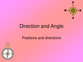
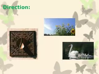
Direction and Scale. Starter. A compass rose is a design on a map that shows directions. It shows north, south, east, west, northeast, northwest, southeast, and southwest. On the compass rose, only north is filled in.

E N D
Starter • A compass rose is a design on a map that shows directions. It shows north, south, east, west, northeast, northwest, southeast, and southwest. On the compass rose, only north is filled in. • Fill in the rest of the directions on the compass rose, using the standard abbreviations: • N=North, S=South, E=East, • W=West, NE=Northeast, • NW=Northwest, SE=Southeast, • SW=Southwest.
Directions • When north is at the top of the compass rose (as it often is), south is at the bottom, east is on the right, and west is on the left. Northeast is between north and east, northwest is between north and west, southeast is between south and east, and southwest is between south and west.
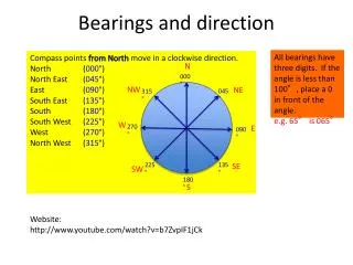
Compass Rose N NW NE W E SW SE S How can we remember the points of the compass? ‘Never eat shredded wheat’..think of your own slogan!
b a c N e d • What direction would I need to travel if I wanted to go from :- • b to d? 2) d to e? • 3) a to d? 4) c to a?
Lesson Objectives • To understand what the compass rose is and how we use it. • To know why we use scale on maps. • To be able to use scale to measure distances.
Scale • What is a scale used for on a map? • Are all maps at the same scale?
The scale on a map can be written in different ways: 1km 0 A scale line Use ‘ : ’which means represents 1 : 25000 This means 1 cm/metre/kilometre on the maprepresents25000 cms/metres/kilometres on land
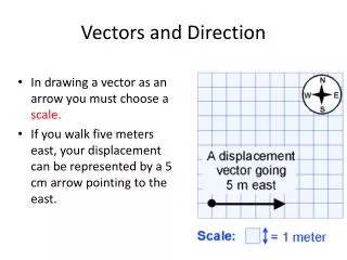
"Take a look at this map! It gives a statement of equivalency: One cm = four miles. The shortest distance between the two towns is a straight line (along Bo Ring Way)! First, place a ruler marked in centimetres (cm) on the map and measure how many cm separate the two towns on the map! The two towns are about 2.5 cm apart! Since each cm on the map represents about 4 miles on the ground, Louberg and Luluville are about 2.5 cm times 4 miles per cm = 10 miles apart on the ground!" Using a scale cm
Bar Scale Another form of scale is a bar scale. All you have to do is take a piece of paper, mark off miles from the bar scale onto the edge of the paper, and then hold the edge of the paper so that it lies along Bo Ring Way from Louberg to Luluville. If Louberg is at the zero miles mark (red arrow), then you can see that Luluville is about 10 miles away (other red arrow)
Postman Pat SW Find the direction Measure from the post office to Julie’s house, from dot to dot. Calculate how many km Pat travels. Measure how many cm = 1km from the scale. 0 1km 2km
Extension Activity • Help Postman Pat make his job easier. • Work out the shortest route that Postman Pat can take while still delivering all his post. • Write the order in your exercise book with the distance and direction travelled.
N Treasure Hunt! 2km 0 Sandy Bay Christchurch To find the treasure take the boat from Cutters Cove NW for 5km. Land the boat and travel by foot NW for 3.5km and then NE for another 4km. Finally travel due south for 3km. This is where the treasure is buried! Cutters Cove
Bearings N What is the bearing between school and home? School Home Easy Guide to Bearings! 1. Draw a north line from your starting point. 2. Join your starting point to your destination with a straight line. 3. Put the line of your projector on the north line with the middle of it on the starting point.
N Sandy Bay Cutters Cove What is the bearing between Sandy Bay and Cutters Cove?
http://academic.brooklyn.cuny.edu/geology/leveson/core/linksa/scale_use.htmlhttp://academic.brooklyn.cuny.edu/geology/leveson/core/linksa/scale_use.html