Download
1 / 30
310 likes | 694 Views
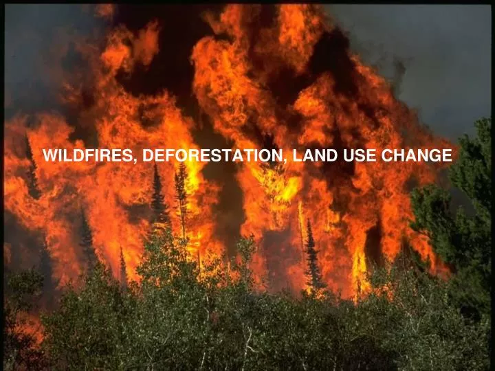
WILDFIRES, DEFORESTATION, LAND USE CHANGE. TOPICS FOR TODAY. Biomass Burning: a source of gases and particles How are wildfires changing? Can we predict wildfires? What is the possible impact? Natural land use change Anthropogenic land use change.

E N D
TOPICS FOR TODAY • Biomass Burning: a source of gases and particles • How are wildfires changing? • Can we predict wildfires? What is the possible impact? • Natural land use change • Anthropogenic land use change
IS A BIOMASS BURNING NATURAL OR ANTHROPOGENIC? Perhaps the answer depends on the type of fire: NATURALANTHROPOGENIC wildfiresland-clearing / slash & burn savannah burningsavannah burning (possibly see above?) biofuels / residential fuels BUT, people usually call it one or the other…note that these categories are important for radiative forcing (vs. effect) Types of fires may also be related to: (1) fuel type (2) burn temperature / modified combustion efficiency
BIOMASS BURNING: A SOURCE OF GASES AND PARTICLES • BB is an important primary source of: • CO2 • 12-35 ppm of increase from 1850 to 2000 • 1990s: 1.6 GtC/yr (compared to 6.4 GtC/yr from FF) • CO: ~1/4 of total source • hydrocarbons (incl CH4) • NOx: ~15% of total source • OC: ~20-60% • BC: ~2/3 • Indirectly important for trop O3 NET radiative forcing = 0.03 W/m2 Sometimes “biomass burning” and “land use change” are referred to interchangeably… what’s the difference? IPCC, 2007
FIRES DEGRADE VISIBILITY Hayman fire (June 8-22, 2002): worst air quality ever in Denver 56,000 ha (~30 miles from Denver and Colorado Springs) June 8, 2002 June 9, 2002 PM10 = 40 μg/m3 PM2.5 = 10 μg/m3 PM10 = 372 μg/m3 PM2.5 = 200 μg/m3 Colorado Department of Public Health and Environment Vedal et al., Env Res, 2006
BOREAL REGION: LARGE SOURCE OF EMISSIONS (WILDFIRES) In 2004, a blocking ridge set up over Canada and Alaska creating one of the largest fire seasons on record. In this event, ozone in Houston was the highest for the past four July months • Emissions can be large from boreal regions (Canada, Alaska, Siberia) because: • Largely unpopulated/unchecked fires (duration, extent) • Dense vegetation (fuel load) • Hot fires (complete burn) • Rich understory, organic soil layer (fuel load)
LONG-RANGE TRANSPORT OF BOREAL EMISSIONS CAN ALSO AFFECT LOWER 48 STATES http://asl.umbc.edu/pub/mcmillan/www/index_INTEXA.html
EFFECTS OF DISTURBANCE Biscuit Fire in Oregon (summer 2002) “A fire first releases a pulse of carbon and then reduces the albedo of a surface from 15 to 20% to around 4%. The blackened surface absorbs much more incident solar energy, and with little live vegetation remaining for evaporative cooling, midday surface temperatures can easily reach 50°C. Albedo may recover from resprouting vegetation within a few months in a tropical grassland, but require decades in a boreal forest.” [Running, 2008]
TOPICS FOR TODAY • Biomass Burning: a source of gases and particles • How are wildfires changing? • Can we predict wildfires? What is the possible impact? • Natural land use change • Anthropogenic land use change
WILDFIRES DRIVE INTERANNUAL VARIABILITY IN OC CONCENTRATIONS IN US Model gives same variability as observed OC in summer at IMPROVE sites in the West OC contribution to total fine aerosol: 40% in low fire years 55% in high fire years same fires every year Spracklen et al., 2007
OBSERVED INCREASES IN FIRES IN NORTH AMERICA(Related to temperature) Area burned in Canada has increased since the 1960s, correlated with T increase. Gillett et al., 2004 5 year means Increased fire frequency over western U.S. in recent decades – related to warmer T, earlier snow melt. Westerling et al., 2007
INCREASED FIRE ACTIVITY RELATED TO TIMING OF SNOWMELT (ESP. AT ELEVATION) R=0.76 Correlation b/w wildfire frequency & snowmelt timing Length of fire season increased by 78 days (between 1970-1986 and 1987-2003). Increase concentrated between 1680-2590 m elevation (more susceptible to drought). Greatest increase in Northern Rockies (accounts for 60%). Westerling et al., 2007
TOPICS FOR TODAY • Biomass Burning: a source of gases and particles • How are wildfires changing? • Can we predict wildfires? What is the possible impact? • Natural land use change • Anthropogenic land use change
PREDICTING WILDFIRE FREQUENCY (IN THE WESTERN US) Wildfires primarily driven by T and precip: develop a statistical model to predict: Annual total biomass consumed by forest fires, 1996-2055 Results show far: Future 2040-2050 biomass consumption by wildfires over the western United States is ~50% greater than for present-day. Spracklen et al., in press
PREDICTED CHANGES IN OC/BC OC (1996-2000) BC (1996-2000) Present Day Delta OC Delta BC Change in 50 years
INCREASED WILDFIRE ACTIVITY LEADS TO INCREASING OZONE IN W US JJA surface ozone 2000 Mean of 5 ppbv enhancement due to fires 2051 [ppbv] Hudman et al., in progress
TOPICS FOR TODAY • Biomass Burning: a source of gases and particles • How are wildfires changing? • Can we predict wildfires? What is the possible impact? • Natural land use change • Anthropogenic land use change
HOW DOES ELEVATED CO2 AFFECT PLANTS? Cramer et al., 2001 ↑CO2: ↑ water use efficiency (reduced stomatal conductance and transpiration) ↑ light efficiency (increased rates of photosynthesis) ↑ nutrient use efficiency Often referred to as CO2 fertilization
TESTING BIOSPHERIC FERTILIZATION AT FACE Free-Air CO2 Enrichment (FACE) sites at Duke Forest • DeLucia et al., Science [1999]: • After 2 years growth rate enhanced by 26% when exposed to +200 ppm CO2 • Increased total NPP by 25% • Oren et al., Nature [2001]: • “Here we present evidence that estimates of increases in carbon sequestration • of forests, …, are unduly optimistic.” • Issue of soil fertility/nutrient limitation
FUTURE CHANGES IN BIOME Note response of high-latitude T changes Notaro et al., 2007
IPCC LAND USE MODEL PROJECTIONS IPCC, 2007 (WG3, Chap 3)
LAI (2100-2000) PREDICTED CHANGES IN VEGETATIONFROM 8 GCM’S Same land model (CLM) driven by 8 different climate projections Very sensitive to precip [mm] Alo and Wang, 2008
LAND COVER AND LAND USE CHANGE CAN HAVE DRAMATIC IMPACT ON EMISSIONS Direct impacts Indirect Impacts Jiang et al., 2008
BARK BEETLE INFESTATION IN THE WESTERN NORTH AMERICA Exacerbated by climate change In bad years equivalent carbon source to 75% of all Canadian fires Kurz et al., 2008 Christine Wiedinmyer, NCAR • Killing off forest ecosystems • Impact on emissions • Local climate/hydrology/ecology
TOPICS FOR TODAY • Biomass Burning: a source of gases and particles • How are wildfires changing? • Can we predict wildfires? What is the possible impact? • Natural land use change • Anthropogenic land use change
TREE PLANTATIONS Globally, plantations account for 5% of forests (187 million ha in 2000), with 62% of this in Asia Plantation Species Plantation Use = fuelwood, soil & water conservation, other Monocultures often represent a disturbance to the larger environment, are susceptible to attack, modify biospheric emissions UN FAO: http://www.fao.org/docrep/004/y2316e/y2316e0b.htm
HUMAN-DRIVEN LAND USE TRANSITIONS According to current satellite-based estimates, 17 million km2, or 14% of the land surface, has been changed by human agricultural activity, and another 28% is used for domestic animal grazing [Running et al., 2008] Foley et al., 2005
URBANIZATION Urbanized population by country (2006) Potential climate impacts? Heat island (IPCC says negligible so far) Reduced soil moisture Localization of pollution (cf Brown Couds) (Effect on food systems, distribution networks, etc.) UNICEF State of the World’s Children Report, 2008 Percentage of population living in urban regions has increased from 34% to 47% from 1960s to 1990s according to The World Bank. Large increases anticipated, particularly in Asia.