Download
1 / 39
400 likes | 736 Views
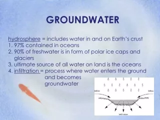
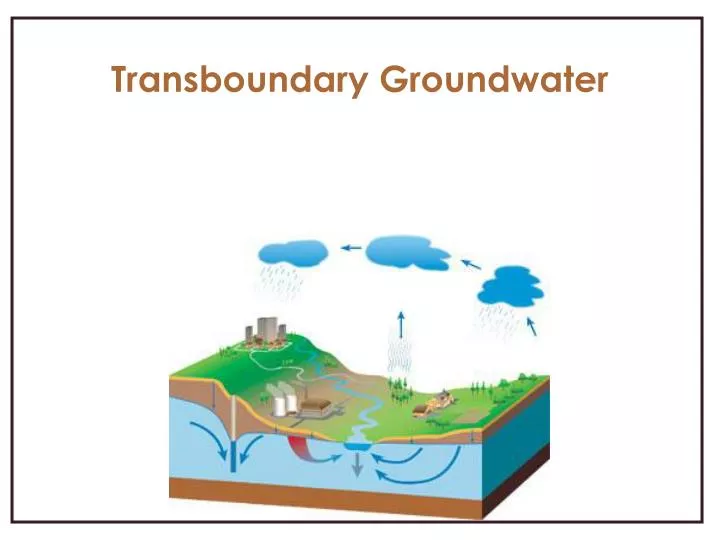
Transboundary Groundwater. The Hydrologic Cycle. Surface and Groundwater interrelationship. Groundwater is influenced by land-development patters Overexploitation of water: Discharge rate is more than recharge rate Decreases water levels Contamination. Problems in Groundwater.

E N D
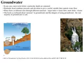
Surface and Groundwater interrelationship • Groundwater is influenced by land-development patters • Overexploitation of water: • Discharge rate is more than recharge rate • Decreases water levels • Contamination
Problems in Groundwater • Disperses beneath the surface, irrespective of state boundaries • Characteristics vary in each aquifer • Often deep or unevenly distributed geographically • An aquifer definition cannot provide concrete conclusion about ownership
Country A Country B
While international boundaries may follow natural physical features as rivers, the aquifers underlying them do not
Definition of an aquifer • A saturated permeable geologic unit that can transmit significant quantities of water under ordinary hydrologic gradients • A geologic unit that can store and transmit water at rates fast enough to supply reasonable amounts to well
An aquifer is entirely in the territory of one country but is linked hydrologically to an international river
An aquifer is entirely in the territory of one country but is linked hydrologically with another aquifer in a neighboring country
An aquifer is entirely in the territory of one country but its recharge area is in a neighboring country
Helsinki Rules 1967 • International Drainage Basin • An international drainage basin is a geographical area extending over two or more states determined by the watershed limits of the system of waters, including surface and underground water, flowing into a common terminus • Excluded confined aquifers which constitute a large portion of groundwater
Seoul Rules 1987 • An aquifer that contributes waters to, receives water from, surface waters of an international basin constitutes part of an international basin for the purpose of the Helsinki Rules
Seoul Rules 1987 • An aquifer intersected by the boundary between two or more States that does not contribute water to, or receive water from, surface waters of an international drainage basin constitutes an international drainage basin
Bellagio Draft Treaty 1989 • Defines an aquifer to be: • a subsurface waterbearing geologic formation from which significant quantities of water may be extracted. • Groundwater: • The water in aquifers.
Bellagio Draft Treaty 1989 • The overriding goal of the treaty is to achieve joint, optimum utilization of the available waters, facilitated by procedures for avoidances or resolution of differences over shared groundwaters in the face of the over increasing pressures on these priceless resources
The terminology used in international legal principles must coincide with that used by scientists to avoid any confusion
1997 Convention: • "confined" to mean "unrelated to surface water“ • Reflected the old interpretation of the term • Under current scientific terms, a confined aquifer refers to an aquifer in which the water is stored above atmospheric pressure; the term has no relation to an aquifer's hydrologic connections to surface waters; confined aquifers can be hydrologically connected to surface waters
Obligation not to cause significant harm • Human activities at the ground surface, e.g. landfill of waste, can result in aquifer pollution • The polluted groundwater from one side of an international boundary can travel to the other • Once polluted, aquifer cleanup is slow and expensive; the detection of its sub surface distribution can also be expensive
Obligation not to cause significant harm • The differences between surface and groundwater resources is the time needed to detect pollution • The aquifer systems impacts generated by the present generation may be detected by the future generations
Karstic aquifers • Characterized by the presence of preferred pathways (e.g., conduits) in which flow speeds are very much larger than average • Contaminants within these pathways travel much faster, and consequently have much shorter travel times, than predicted by standard models based on Darcy’s law and the advection-dispersion equation
Karstic aquifers • This is a dangerous situation; for example, conventional modeling may predict a water supply to be safe from contamination, when in fact it is not. The result of an inaccurate prediction of contaminant behavior can be a costly clean-up
International Shared Aquifer Resource Management (ISARM) • Supported by: • IAH: International Hydrological Program • UNESCO: United Nations Educational, Scientific and Cultural Organization. • FAO: Food and Agriculture Organization. • UNECE: United Nations Economic Commission for Europe
International Shared Aquifer Resource Management (ISARM) • In any legal agreement to be drawn up for the equitable share of transboundary resource, ISARM sees that the initial stage must be the correct identification of flow and movement of water followed by its quantification
International Shared Aquifer Resource Management (ISARM) • Knowledge of basic hydrological processes • Understanding of the extent and nature of the aquifer • How it relates to other aquifers and hydrogeologic features • How the recharge and discharge of water takes place within the aquifer • Where potential sources of contamination are located
International Shared Aquifer Resource Management (ISARM) • We need to know • Precipitation • Groundwater levels • Stream flow • Evaporation • Water use
Factors affecting the behavior and the development potential of aquifers • Hydraulic parameters • Rainfall and recharge zones • Confined and unconfined areas • Natural discharge zones • Present and planned groundwater development zones • Water quality, potential risks of its deterioration • Vulnerability to polluting agents
There are several examples of transboundary aquifers where recharge is received on one side while the natural discharges (and sometime better yields) are across the border • Examples of this condition are found in the Mountain Aquifer extending over Israel and Palestine
Example • The mountain aquifer lies primarily underneath the West Bank and consists of three basins: • The western • The northeastern • The Eastern • 83% of the recharge areas for these basins lie within the West Bank
Example • Eastern Aquifer: • 172 MCM/year recharge • 54 MCM/year was currently being pumped by the Palestinians • 40 MCM/year by the Israelis • The remaining 78 MCM/year was available to be developed
Example • Northeastern Aquifer: • Yield 145 MCM/year • 103 MCM/year being used by the Israelis • 32 MCM/yr being used by the Palestinians
Example • Western Aquifer: • Estimated recharge of 362 MCM/year • 340 MCM/year used by Israelis • 20 MCM/year used by the Palestinians
Example • Several studies have questioned these estimates as overly optimistic, especially the estimated size of the eastern aquifer • Israel currently uses 93% of the annual recharge to the aquifer • Palestinians receive only about 17% of the water supply underlying West Bank territory and nothing from the Jordan River. • Israel supplies Palestinians with 63% of the total water consumed in the West Bank via Mekerot pipelines
Thank You! Reem Khalil November, 17 2005