Download
1 / 26
330 likes | 740 Views
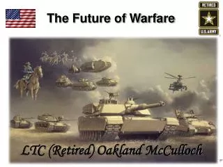
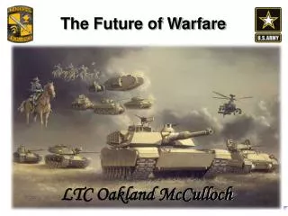
InnoVision Future Warfare Systems Office. Laying the Geospatial-Intelligence Foundation for Future Warfare Brief to Precision Strike Program Review. Jon D. Estridge Chief, Air Warfare/Targeting Division NGA Future Warfare Systems (IW) InnoVision Directorate.

E N D
InnoVisionFuture Warfare Systems Office Laying the Geospatial-Intelligence Foundation for Future Warfare Brief to Precision Strike Program Review Jon D. Estridge Chief, Air Warfare/Targeting Division NGA Future Warfare Systems (IW) InnoVision Directorate
What is NGA and What Do We Do?Our vision… Know the Earth…Show the Way …Providing GEOINT in all its forms, and from whatever source imagery and geospatial– to ensure the knowledge foundation for planning, decision, and action. …D/NGA as the functional manager for GEOINT: Department Of Defense Directive Number 5105.60 (dated 11 October 1996) …Affording easy access to GEOINT data, for all stakeholders. …Creating tailored, customer- specific GEOINT; providing analytic services and solutions; and sharing insight.
Our Contribution to National SecurityGeospatial Intelligence provides the knowledge basis for decision, planning, and action Geospatial Intelligence: Who are its customers? • National policymakers • Combatant commanders • Homeland Security agencies • Intelligence Community analysts • Military Departments (Services) - - Title 10
Production Facility in Country X Main Vehicle Production Post-Flood July 200x GEOINT Production Building Storage Buildings Administration Building Definition: GEOINT is earth-referenced information about natural and man-made objects or events with National Security implications Geospatial Information Imagery Intelligence Imagery What is NGA and What Do We Do?National Geospatial-Intelligence Agency (NGA) is a National Intelligence and Combat Support Agency Mission: Provide Timely, Relevant, and Accurate GEOINT in support of National Security
Geospatial Intelligence (GEOINT) • A 4-D framework of information for comprehending objects and events, planning and executing operations, and assessing effects • How are the enemy’s physical and virtual infrastructures constructed?… • How do they interrelate and operate?… • What are my COA options and COEs?… • Where am I?… • Where are the Friendlies?… Hostiles?… Non-Combatants?… • How do I move or navigate in the battlespace?… • What is the environment?… GEOINT Provides the Basic Foundation for Effects-Based Operations
Key Elements of NGA Transformation • All-digital Operating Environment – transition from a paper-centric to a layered, data-rich network-centric environment accessed via single portal • Foundation Data –Specific information on essential features that change rarely or slowly (i.e., point positioning data, topographic features, elevation data, safety of navigation) • Mission Specific Data –Intensified Foundation Data encompassing greater detail or additional features and/or attributes to meet specific mission requirements • Geospatial-Intelligence Knowledge Base (GKB) –NGA data environment composed of two content layers: foundation layer and intelligence layer (weather, order of battle, intelligence reports, features, multi-intelligence, elevation)
2000 ’01 ’02 ’03 ’04 ’05 ’06 ’07 ’08 ’09 ’10 2011 The Transition
Customer Self-Serve Portal • Provides Stakeholders with One-Stop Access to All of NGA’s Holdings • Means Through which Web-Based Collaboration Occurs
The Changing Challenge…. Denial and Deception Above Surface Moving Static 0 - 4 Hours 12 - 24 Hours 4 - 12 Hours Traditional NTM Coverage Below Surface Uncharacterized Characterized
What is GEOINT and Why is it Important?A short picture history of the impact of GEOINT 1943 1970 1991 2005 2010 1500 B-17 sorties 9000 x 250 lb. bombs One 60’ x 100’ target W.W. II 30 F- 4 sorties 176 x 500 lb. bombs One Target Vietnam 1 F-117 sortie 2 x 2000 lb. bombs Two Targets per Sortie Desert Storm 1 B-2 sortie 16 x 2000 lb. bombs 16 Targets per Pass Available Today 1 FA-22 sortie 8 x Small Diameter Bombs Future Weapon Attacks Mobile Targets ONE SHOT ONE KILL
Accuracy, Without Precision Precision, Without Accuracy Accuracy, With Precision Weapon Performance: Precision & Accuracy • It’s always a matter of precision AND accuracy: • Both matter if you’re shooting a weapon at a coordinate! • Latitude: 350342.791N • Longitude: 1072256.017E • Height above Ellipsoid: 529.38m • Circular Error/Linear Error 90 = 4.1m/3.8m • In and of themselves, PGMs are not inherently any more accurate than any other type of weapon; but, their behaviors are more predictable and controllable • The focus must be on our ability to achieve a delivery accuracy commensurate with our ability to achieve precision trajectory control Precision Accuracy
Future Warfare Systems Office Future Combat Systems
Future Warfare Systems Office (IW) Mission • Identify and meet DoD and Military Service needs for Geospatial Intelligence for emerging and future warfare systems to ensure their desired effectiveness • When necessary, facilitate technical, operational, or programmatic solutions to eliminate shortfalls
The Idea Expeditionary Fighting Vehicle • Introduced by General Clapper • Warfare systems of the future will increasingly depend on the information provided by NGA • NGA must be part of the process and fully engaged from the inception of acquisition programs • GEOINT cannot be an afterthought Future Combat Systems F/A-22
User Needs & Technology Opportunities (Program A B C IOC FOC Initiation) Production & System Development Operations & Concept Technology Deployment Refinement & Demonstration Support Development Design FRP Concept LRIP/IOT&E Readiness Decision Decision Review Review Pre-Systems Acquisition Systems Acquisition Sustainment NGA’s Focus on Future Warfare Systems • Interface early in acquisition cycle • Participate as a special member to the DAB • Attend IIPTs, OIPTs • Ensure NGA understands specific Geospatial Intelligence needs of future warfare systems • Ensure Warfare Community understands NGA’s planned capabilities • Ensure coherence between Services’ future systems and NGA’s Geospatial Intelligence
Potential Benefits – for Warfare Programs and NGA NGA/IW’s Goals • Lower technical and cost risk • For future MDAP systems • For the National System for Geospatial-Intelligence (NSG) • Increased NGA Responsiveness • Optimized Warfare System Performance • Better Informed Budget Priorities and Decisions • Better Technology Investments • More Focused NGA Transformation • Understand Future Warfare System GEOINT Needs • Educate Warfare System Stakeholders on NGA’s Transformation Goals and Initiatives • Identify GEOINT Support “Disconnects” Early in Warfare System’s Development • Inform NGA transformation Goals . . . and Benefits
IW Program Alignment Scott Robertson, A. Director John Powers, A. Deputy Amy Wandless, BX Randy Anders, A. TX OSD Liaisons USD(I) USD(AT&L) Key Programs and Initiatives • C4ISR • ACS • JBMC2 • DJC2 • DCGS • WIN-T • JTRS • JLENS • LAND/SpecOps • FCS • EFV • NLOS • Soldier System • PRV • Complex Terrain • Special Ops Support • -Rotary Wing A/C • NAVAL • LCS • DD (X) • JHSV • ASDS • ERGM • VXX • MMA • ASW ConOps • AIR/SPACE/TGT • F/A-22 & F-35 • JUCAS • SDB • AOC • JMPS • AMD • PAC 3/MEADS • CV-22
Air Warfare Future Systems • F/A-22, F-35 (Joint Strike Fighter) • Next generation fighter aircraft • Extremely robust radar and sensor suite (direct targeting) • JSF developing “digital cockpit” with leap ahead technologies • Non Traditional ISR – IW authored early draft CONOPS, adopted by Air Combat Command (ACC) as baseline for USAF document • Early program spirals focused on air worthiness • Challenges • JSF cockpit moving map (Defining digital map support) • Ensure JMPS integrated with future GEOINT • Limited on board space for NGA support data, partnering with programs to develop registration/data storage to support targeting • Unknown requirement for fidelity of high resolution elevation data, ongoing testing with Level II DTED (SRTM) and DPPDB • F/A-22 SAR standards • Accessing NTISR data to make available via National System for Geospatial Intelligence (NSG)
Future Munitions • Small Diameter Bomb (SDB) • First in family of miniature munitions • Minimize collateral damage, engage multiple targets per sortie • DPPDB is source of precise coordinates (accuracy) • NGA teaming with OSD DOT&E to support live tests • USAF submitted SDB accuracy requirement Apr 05 • Challenges • Maintain or improve accuracy, currency, and coverage of DPPDB holdings supporting GPS/INS seeking wpns • Ensure programs understand capability & limitations • Target characterization (4m wpn vs 20m knowledge) • GEOINT foundation for target system analysis • Teaming with USAF to define future accuracy reqt
Takeaways • GEOINT is critical to effectiveness of future DoD warfare systems • Targeting, navigation, mission planning, situational awareness • NGA is committed to fully supporting Future Warfare Systems! • Must continue to engage early in process • JCIDS (FCB), IIPTs, Service Labs, etc. • Encouraging specified vs implied requirements • DRAFT JP 3312.01
Know the Earth…Show the Way NATIONAL GEOSPATIAL-INTELLIGENCE AGENCY
NGA Organization Director Deputy Director STAFF Offices Executives Military Business Technical Western LINE Directorates Analysis and Production Source Operations InnoVision Enterprise Operations Acquisition NOW NEXT AFTER NEXT ENABLER Directorates Human Development Financial Management Security & Installations
Supporting Transformation • DoD’s and NGA’s Transformations: Our Mutual Objectives • Our Nation’s military is transforming how it fights - new threats, new capabilities, and new operational concepts • Those changes are driving NGA to change • We understand where the Department is going and are transforming to meet our Geospatial Intelligence needs • Discovering and understanding the needs of and future warfare systems is a full time job • Evolving systems’ needs for geospatial intelligence are substantial and require DoD-wide scrutiny • NNGA’s role in supporting defense acquisition • The process is costly and requires: • Close cooperation among Commands, Services, and Agencies • Recognition that this is a DoD-wide interest NGA NATURAL ENVIRONMENT Info Superiority Precision Engagement Dominant Maneuver Global Attack Aerospace Superiority Agile Combat Support
What is GEOINT and Why is it Important? Definition: Information about any object - natural or man-made - that can be observed or referenced to the earth, and has national security implications • Where am I? • Where are the Friendlies? • Where are the Enemies? • Where are the Non-Combatants? • How do I move or navigate among them? • What is the Environment? • What does it mean? • What is the impact?
How is NGA Transforming?Trends transforming NGA YESTERDAY TODAY AND TOMORROW GEOINT Visualization, COP, and 4D NTM, Commercial, Airborne, in all Forms in the Electromagnetic Spectrum Best Source (Persistent) Surveillance Time-sensitive Targeting Interactive Tactical and National Intelligence Robust Forward Deployment Domestic Applications Multi-INT Fusion Maps and Pictures Mapping 2D and Text NTM and EO Government Only (Sampling) Reconnaissance Deliberate Targeting Separate Tactical and National Intelligence Limited Deployment Foreign Intelligence Single INT “Persistent TPED” Convergence


![Future Strategic Issues/Future Warfare [Circa 2025]](https://cdn4.slideserve.com/682141/dennis-m-bushnell-chief-scientist-nasa-langley-dt.jpg)