InterMountain WFO/HPC Prototype Collaboration Simulation
730 likes | 870 Views
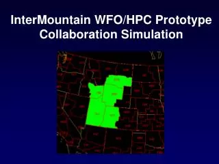
InterMountain WFO/HPC Prototype Collaboration Simulation. Presentation Goals. Introduce GoTo Meeting Provide practical overview of IM Collaboration aspects Purpose, ground rules Provide you tips on how to handle difficult questions Tie it all together using a real case using Goto Meeting.

InterMountain WFO/HPC Prototype Collaboration Simulation
E N D
Presentation Transcript
Presentation Goals • Introduce GoTo Meeting • Provide practical overview of IM Collaboration aspects • Purpose, ground rules • Provide you tips on how to handle difficult questions • Tie it all together using a real case using Goto Meeting
GoTo Meeting • PC based software allowing you to broadcast your screen contents live • Combined with a telephone, GoTo meeting it provides a very powerful remote information sharing tool • We will run NAWIPS on the PC facilitate IM WFO collaboration • EZ details on how to set this up in MDD binder
NAWIPS on the PC ? • Yes – you remotely log into to a workstation from your PC and can launch NMAP, NTRANS, etc • This will allow the participating WFOs to literally SEE the data sets we are using to make our decisions – vs trying to explain it over the phone • MANDATORY – use the help sheet found at the MDD desk to launch GoTo Meeting and NAWIPS on the PC
Collaboration Deadlines Timelines and Triggers • Event Driven and No earlier than 0530/1730Z • After issuance of PMDHMD • Triggers • Significant Uncertainty in Pattern Evolution • Two or More adjacent impacted WFOs • Request for meeting by WFOs or HPC via 12 Planet • Meeting info provided by HPC on 12 Planet • Use alternate WWD phone #/passcode and obtain the GotoMeeting ID on the fly when you start a meeting
Collaboration Ground Rules • Strive for 15 minute session max • IM WFOs/HPC have agreed to focus collaboration on pattern evolution only • Leave details/local effects to the WFOs – no specifics on accumulations, no facilitation of posting of watches/warnings/highlights, etc.
HPC Strategy • HPC is the meeting facilitator - leading off with a focused and concise justification of pattern evolution preference – then soliciting input by “going around the table” • HPC provides info needed for WFOs to get on the same page regarding synoptic scale pattern evolution • HPC shows only data critical in establishing our preference – and always culminates in a preference relative to the GFS and NAM • These are the only two pieces of guidance in WFOs GFE
Tips • Show output on the BAWX scale – IM WFOs appreciate being able to see upstream features • 850mb/pmsl fields are not particularly useful in the IM region- 700mb, 500mb, and 250mb are key • Incorporate SREF output !!!! • When appropriate show Standardized Anomalies • Keep discussion simple – focus on location, timing, and strength of key features • Remember - its not sufficient to summarize decisions by stating “we feel more UKMET-ish today”. Complete the picture by showing what “UKMET-ish” means relative to the GFS and NAM
AVOID • Avoid regurgitating information they already know • Avoid using a review of NAM and GFS solutions to start off the meeting – the IM WFOs already are familiar with this info prior to joining the session • You can simply jump right into comparisons with other outputs they have not seen (SREF) and/or initialization issues, trends • Avoid overloading them with data • Balance what you WANT to show with what they actually NEED to see to establish your point
Be Vigilant for • …WFOs getting bogged down in discussion of Watches/Warnings • It is acceptable for a WFOs to briefly state their intentions of watches/warnings without going into a lot of detail • especially if done as a summary or conclusion to their input • Don’t let WFOs dwell on watches/warnings - step in and remind them to work out these details off line • Reserve time on Goto Meeting session for pattern evolution issues
Other Tips • Be confident in yourself – although you don’t possess the knowledge on local details – you certainly do have useful information to offer regarding pattern evolution • Make the collaboration session worth their time - never say “I don’t have an opinion about which way to lean” • If you really don’t know which way to lean – admit it, but ALWAYS supplement that with your gut feeling • Your gut feeling is the least you can provide them – it will be more useful for them than “I don’t know”
Something we are going to have to learn on the way • The WFOs idea of “large scale” is much smaller than our idea of “large scale” • IM WFOs edit at 2.5 km and 1.25 km resolution – large scale to them may just mean an area greater than their CWA (which is still mesoscale) • Knowing this will better prepare you to answer questions and help you avoid sticky situations
How to handle questions focused on local details • Will our winds end up being more northeasterly or northwesterly ? • Will the south part of our CWA get into the region of significant FGEN at 750mb or not ? • How much snow will we get in our eastern CWA ? • The fgen with the 700mb front will be stronger at which level ?
Take a Breath • Listen to the question • Respond with what they need using the perspective of a MDD forecaster • Although your response will likely NOT directly answer what they asked – it will provide the info they NEED in order to walk away from the session on the same page with pattern evolution
Responses • Reiterate your preferred solution relative to the NAM/GFS • Tie your solution to their question in terms of timing and strength • Let the WFO decide how the local scale will respond given this solution “How much snow will we get in our eastern CWA ? “ Since we are favoring a slower and more northern solution than the GFS we would expect your eastern CWA to be in the region where higher QPF is expected. The local effects will obviously dictate the actual amounts. “Will our winds end up being more northeasterly or northwesterly ?” Since we are favoring a less amplified solution than the NAM and GFS, we are expecting the surface high to arrive later than progged - if at all. “Should we issue a watch or warning ?” We’re not in as good of a position to make that call as you are in the local office. You will have to coordinate that with your adjacent WFOs off line.
Remember • Mistakes will be made • Expect a bumpy ride out of the gate – but a smoother ride as we get into mid season
Utah Low Example • No ob data in this example • GFS, NAM, SREF MEAN output only • 250mb, 500mb, 700mb only • Which solution do you favor ???
500mb GFS/NAM/SREF Comp • 60 hr loop • Notice how similar solutions appear to be
Dig deeper ! • “Similar solutions” is NOT the end of the story • 500mb Trends offer some more insight • Trends suggest a slower and slightly more amplified solution than latest runs
But even that is not the whole story • 700mb GFS/NAM/SREF Comp should be a routinely viewed field by you on this desk • 60 hr loop • Note the differences at 700mb – especially by f24 – SREF and NAM favoring a dual center • These differences – although small – have a huge bearing on timing of upslope/downslope – particularly in UT/MT after the low passes by
