Download
1 / 6
70 likes | 289 Views
Basic Map Features. Various types of Maps Today WE are just interested in a couple: Regional Maps Contour Maps Political Maps. Information Necessary for All Maps. Title Direction or Orientation (Where is North) Sometimes referred to as Cardinal Direction Symbol

E N D
Basic Map Features Various types of Maps Today WE are just interested in a couple: Regional Maps Contour Maps Political Maps
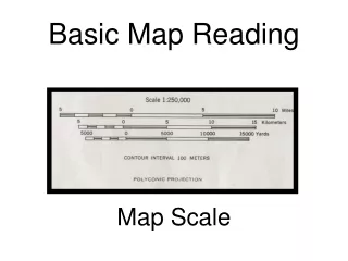
Information Necessary for All Maps • Title • Direction or Orientation (Where is North) • Sometimes referred to as Cardinal Direction Symbol • Scale – gives idea of how things related in distance • Legend – symbol translator (cities, roads, regions) • Author/Creator • Labels or Color Coding • Sources of Information • Border • Fringing (areas around water)
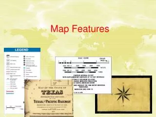
Examples of Standard Map Features Cardinal Direction Symbol Legend Labels Scale
Regional Maps • These maps show areas that similar geographic, topographical or biological characteristics
Political Maps • Political maps are designed to show governmental boundaries such as nations, states, counties, cities jshussey@wsfcs.k12.nc.us
Contour Maps (Topographical Maps) • A map that shows elevations above sea level and surface features of the land by means of contour lines.