Download
1 / 26
360 likes | 794 Views
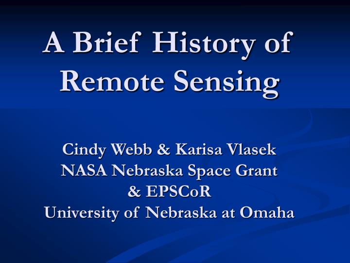
A Brief History of Remote Sensing Cindy Webb & Karisa Vlasek NASA Nebraska Space Grant & EPSCoR University of Nebraska at Omaha. What is Remote Sensing?.

E N D
A Brief History of Remote SensingCindy Webb & Karisa VlasekNASA Nebraska Space Grant & EPSCoRUniversity of Nebraska at Omaha
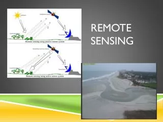
What is Remote Sensing? “In the broadest sense, the measurement or acquisition of information of some property of an object or phenomenon, by a recording device that is not in physical or intimate contact with the object or phenomenon under study; e.g., the utilization at a distance (as from aircraft, spacecraft, or ship) of any device and its attendant display for gathering information pertinent to the environment, such as measurements of force fields, electromagnetic radiation, or acoustic energy.” Quote taken from http://www.vtt.fi/tte/research/tte1/tte14/virtual/defin.html
What is Remote Sensing? The technique employs such devices as the camera, lasers, and radio frequency receivers, radar systems, sonar, seismographs, gravimeters, magnetometers, and scintillation counters.” Scintillation counters from http://beckman.com/products/Discipline/Life_Science_Research/pr_disc_gen_scint.asp?bhcp=1 Magnetometer from http://www.ssec.honeywell.com/magnetic/magnetometers.html Moderate-resolution Imaging Spectroradiometer Image provide by http://eos-am.gsfc.nasa.gov/modis.html Seismograph from http://www.terraplus.com/sa/cart/detail.asp?pg={5612B911-E226-40E4-B35E-504277C92A7B} Quote taken from http://www.vtt.fi/tte/research/tte1/tte14/virtual/defin.html
Cameras served as the first remote sensors over 150 years ago. How did remote sensing begin? Pictures of Cameras from http://www.historiccamera.com/cgi-bin/ads/suite/classifieds/classifieds.cgi, cameras pictured not necessarily used in remote sensing
1859 – Gaspard Felix Tournachon • 1859 – Gaspard Felix Tournachon took cameras up into a balloon to make land surveys. He was not very successful, but this began aerial photography. Unfortunately, this first picture is lost. • 1860s – Aerial photos from balloons continued to be the standard. Self-Portrait from http://www.profotos.com/education/referencedesk/masters/masters/felixnadar/felixnadar.shtml
1873 – James Clark Maxwell The theory of the electromagnetic spectrum was developed by James Clerk Maxwell. The electromagnetic spectrum is arranged by frequency and wave length. Image from http://www.lbl.gov/MicroWorlds/ALSTool/EMSpec/EMSpec2.html
1882 – E. Archibald E. Archibald of England began mounting cameras on kites and this method stayed popular through the last two decades of 19th century. Left: “Here is a well-preserved photo (1889) from a kite, snapped by a remote mechanism operated by A Balut, covering Labrugauere, France:” Picutre from http://rst.gsfc.nasa.gov/Intro/Part2_7.html Quote taken from http://rst.gsfc.nasa.gov/Intro/Part2_7.html
1897 – Rocket Ships “Historically, the first photos taken from a small rocket, from a height of about 100 meters, were imaged from a rocket designed by Alfred Nobel (of Prize fame) and launched in 1897 over a Swedish landscape:” Photo from http://rst.gsfc.nasa.gov/Intro/Part2_7.html Quote taken from http://rst.gsfc.nasa.gov/Intro/Part2_7.html
1903 - Pigeons Cameras were attached to pigeons. The cameras were programmed to take a picture every 30 seconds as the pigeon flew along. Unfortunately, most pigeons were shot down by opposing troops. Their flight path was not predictable which posed an additional problem. Images from http://rst.gsfc.nasa.gov/Front/overview.html
1904 – Alfred Maul The first rocket to obtain aerial photographs at 600 meters, less than one mile, was launched by Alfred Maul. Photos from http://rst.gsfc.nasa.gov/Intro/Part2_7.html
1908 – Wilbur Wright 1908 – Wilbur Wright piloted the first plane as his passenger, L.P. Bonvillain, took aerial photographs in France. Pictures from http://www.wam.umd.edu/~stwright/WrBr/Wrights.html Portrait from http://www.wam.umd.edu/~stwright/WrBr/Wrights.html
1908 – Wilbur Wright Below are pictures of Wilbur describing his airplane to King Alfonso XIII of Spain (left) and a picture of his flight on September 21, 1908 which lasted 1 hour and 25 4/5 seconds (right). Pictures from http://www.wam.umd.edu/~stwright/WrBr/Wrights.html
1914-1918 – Cameras in Planes Cameras were mounted on planes or held by aviators. Normally these pictures were used for reconnaissance missions. Photos from http://rst.gsfc.nasa.gov/Intro/Part2_7.html
1946 – U.S. Army Rockets were launched by the United States Army, reaching higher altitudes (70-100 miles) than before. Photos from http://rst.gsfc.nasa.gov/Intro/Part2_7.html
From the end of WWI to the early 1960s, aerial photographs remained the standard. Washington, D.C., 1949--U.S. Geological Survey, aerial mapping photograph Plattsburgh, New York, 1940--U.S. Geological Survey, aerial mapping photograph Jefferson County, Colorado, 1937--National Archives, Cartographic and Architectural Branch, aerial mapping photograph Photos from http://mac.usgs.gov/isb/pubs/factsheets/fs12796.html
1960 – TIROS-1 • 1960 – The first non-photo sensors were television cameras mounted on unmanned spacecraft and devoted to looking at clouds. TIROS-1, Television Infrared Observation Satellite, was first sensor launched. It has since been renamed NOAA, the National Oceanic and Atmospheric Administration. • To the right are two recent NOAA images. Image of solar storm on October 28, 2003. Severe weather outbreak that caused 88 tornadoes on November 10, 2002. Images from http://www.noaa.com/
1960s – Man also entered space taking photographs. Images from http://mediaarchive.ksc.nasa.gov/index.cfm
1972 – ERTS-1 Launched NASA launched ERTS-1, the first Earth Resources Technology Satellite. Multi-spectral data from onboard sensors were used for crops, minerals, soils, and urban growth analysis. The name of the satellite was soon changed to Landsat. Image provided by http://earthobservatory.nasa.gov/Library/Landsat/
1980-1990 - Landsat 4 The launching of Landsat 4 introduced a new generation of sensors. They were placed in lower orbits and carried improved instruments. In 1984, it began malfunctioning and Landsat 5 was launched early as a result. Image from http://www.astronautix.com/craft/lansat45.htm
This is a Landsat 7 image of the recent fires in Southern California. This image was acquired on October 26, 2004. Image from http://landsat7.usgs.gov/gallery/
Famous Remote Sensing Images The following slides contain some of the most famous finding and images that remote sensing has produced. Some of these images have been invaluable in depicting the changes that have occurred over time. • 1980-1990 – Discovery of hole in ozone layer • 1986-1992 – Chernobyl • 1986-1992 – Effects of deforestation • 1992 – Hurricane Andrew
1980 to 1990 – A hole in the ozone layer “It is important to appreciate that the atmosphere behaves differently from year to year. Even though the same processes that lead to ozone depletion occur every year, the effect they have on the ozone is altered by the meteorology of the atmosphere above Antarctica. This is known as the 'variability' of the atmosphere. This variability leads to changes in the amount of ozone depleted and the dates when the depletion starts and finishes.” Image from http://www.atm.ch.cam.ac.uk/tour/tour_images/toms/toms90.gif
1986 – Chernobyl 1986 Image of Chernobyl 1992 Image of Chernobyl “The 1986 and 1992 images clearly show farm abandonment. Agriculture appears as a collage of bright red (growing crops) and white (highly reflective bare ground). Many of these areas appear a flat tan-green in 1992, indicating natural vegetation which has taken over the abandoned fields.” Quote and picture taken from taken over the abandoned fields.” http://edc.usgs.gov/earthshots/slow/Chernobyl/Chernobyl
Effects of deforestation “Approximately 30% (3,562,800 sq km) of the world's tropical forests are in Brazil. The estimated average deforestation rate from 1978 to 1988 was 15,000 sq km per year.” Rondônia, Brazil 1975 Rondônia, Brazil 1986 “Systematic cutting of the forest vegetation starts along roads and then fans out to create the "feather" or "fishbone" pattern shown in the eastern half of the 1986 image. The deforested land and urban areas appear in light blue; healthy vegetation appears red.” Rondônia, Brazil 1992 Images and quote from http://edcwww.cr.usgs.gov/earthshots/slow/Rondonia/Rondonia
1992 – Hurricane Andrew This is an image of Hurricane Andrew taken on August 25, 1992. Image from http://rsd.gsfc.nasa.gov/rsd/images/andrew.html
Sources for quotes • http://www.vtt.fi/tte/research/tte1/tte14/virtual/defin.html • http://rst.gsfc.nasa.gov/Intro/Part2_7.html • http://www.atm.ch.cam.ac.uk/tour/part2.html#oct • http://edc.usgs.gov/earthshots/slow/Chernobyl/Chernobyl • http://edcwww.cr.usgs.gov/earthshots/slow/Rondonia/Rondonia