Download
1 / 26
260 likes | 901 Views
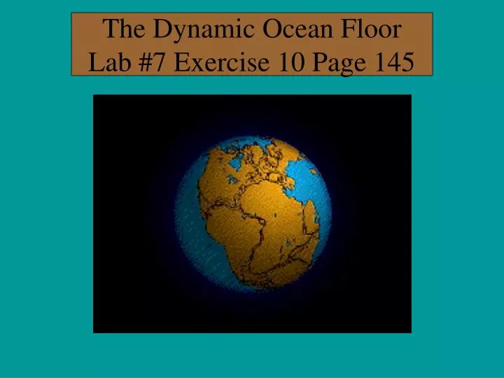
The Dynamic Ocean Floor Lab #7 Exercise 10 Page 145 . Timeline . 400 million years ago fishes evolved. 200 million years ago Pangaea split apart, and the start of the Triassic period. (Dinosaurs)

E N D
Timeline • 400 million years ago fishes evolved. • 200 million years ago Pangaea split apart, and the start of the Triassic period. (Dinosaurs) • Broke up into two smaller super continents, called Laurasia and Gondwanaland, during the Jurassic period. • 150 million years later, the Earth looks like it does now.
Plate Tectonics • What exactly is it? • The movement of plates and continents. • Proposed in 1912 by Alfred Wegener. • Not accepted until early 1960s. • Has had a major impact on Earth Sciences. • Occurs in the lithosphere by sea floor spreading
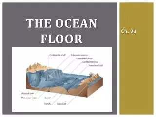
Lithosphere • Is the outer most shell of the Earth • This includes the crust and the mantle. • Means stone sphere • Continental crust is 35 km thick • Oceanic crust on 5 km thick. • Lithosphere total 100 km thick • Oceanic crust and continental crust sits on top of the Lithosphere.
Asthenosphere • Means weak sphere • Second layer of the Earth. • Approximately 600 km thick. • Outer section of this layer is liquid, this allows the lithosphere to move. • Convection currents play an important role.
Plate Tectonics • The plates along the Lithosphere are moving, and the continents are along for the ride. • Its know that rocks are younger at the Mid-Ocean ridge then at the continents. • Why? • This is verified by magnetic reversal information preserved in the minerals of the mid-ocean ridge. • The first positive proof that the plates were indeed moving.
Plate Boundaries • Plate boundaries are found at the edge of the lithospheric plates. • Earthquakes coincide with plate boundaries. • The three boundaries are characterized by their distinct motions.
Convergent Moving together 3 Types Divergent Moving apart Subduction (#1) One plate goes below another Continental Vs. Oceanic Mid Atlantic Ridge #2 Continental Vs. Continental Both plates push up Mts. form Transform # 3 Plates slide past each other Plate Boundaries
Divergent Boundary • Two plates move away from one another. • This is a zone of weakness. • As two plates move apart at the mid-ocean ridges, magma from the mantle up wells through a crack in the oceanic crust and cooled by the sea creating new ocean floor. • Energy is released in the form of earthquakes. • Shallow focus earthquakes (less then 100 km in depth) occur in this area.
Mid-Atlantic Ridge • Mountain Ranges along the ocean floor. • It has a distance of 600 miles. • Longer and also higher then any other mountain range on any continent. • The ridges are home to Earth's highest mountains, and deepest canyons. • The shape of the mid-ocean ridge is controlled by the rate the plates move apart.
Older crust is pushed laterally away from the ridge; thus the sea floor spreads apart.
Where convection cells ascend sea floor spreading • takes place. • Where the convection cells descend they drag • crust down, causing subduction. • This pushing and pulling provides the forces that • drives plate tectonics.
1st Type of Convergent Plate Boundary Subduction Crust descends at angles from 35 to 90 degrees.
Subduction • Here one plate is overriding another forcing one into the mantle. • Explains why crust older than the Cretaceous period cannot be found in any ocean basin. • Deep focus quakes (100-600 km) occur in this area. • As the magma melts pressure builds up and the result is volcanic eruptions.
Convergent Plate Boundary • When two continents meet head-on, neither is subducted, the crust buckles and is pushed upwards.
Transform Boundary • Third type of plate boundary. • Material is neither created nor destroyed at these boundaries, but rather plates slide past each other. • These are pressure valves • The location of shallow focus earthquakes Classic example: San Andreas fault in California.
Evidence for Pangaea • Fossils of glossopteris; a tree - like plant from the Permian Period and dominant plant of Gondwana are found throughout India, South America, southern Africa, Australia, and Antarctica. • Glossopteris: seeds too large to be effectively wind-transported • The areas in orange have ancient rocks that are very similar. • Also the Appalachian mountains connect with • Carpathian mountain range in Northern Europe.
Fossil Evidence Mesosaurus: purely freshwater reptile
Paleomagnetism • Ancient magnetism in rocks • Used to determine the rate and the time the plates separated. • As magma rises to the ocean floor, the minerals follow a pattern. • When the Earth’s polarity changes the mineral pattern will also change. • It is estimated that it takes 70,000 years for the polarity to rotate.
Paleomagnetismand the Ocean Floor • See pages 149-150 • Chart on page 150 shows the pattern of polarity over the past four million years. • As new crust on the ocean floor is created it spreads out evenly on both sides of the mid ocean ridge.
Determining the rate of sea floor spreading • This example is for the Pacific plate page 150. • The green area is 2 million years old; thus the rock needed 2,000,000 years to travel from the ,mid ocean ridge to that distance. • From the ridge to the green area is a distance of 80 Km. • 1 Km = 100,000 cm • So 65 Km = 8,000,000cm (mult. 80 X 100,000)
Chap Summary page 153 Questions 1-10 • Ignore 6