Download
1 / 13
130 likes | 134 Views
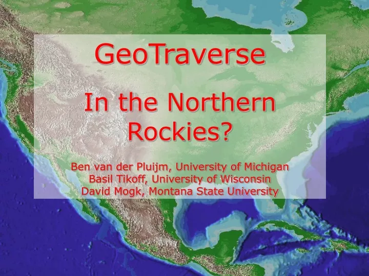
GeoTraverse In the Northern Rockies? Ben van der Pluijm, University of Michigan Basil Tikoff, University of Wisconsin David Mogk, Montana State University. GeoTraverse Mini-workshop: Charge and Purpose.

E N D
GeoTraverseIn the Northern Rockies?Ben van der Pluijm, University of MichiganBasil Tikoff, University of WisconsinDavid Mogk, Montana State University GeoTraverse
GeoTraverse Mini-workshop: Charge and Purpose • GeoTraverse is as a cross-continent, transect-based research concept that supports integrated, multidisciplinary (geologic and geophysical) study of the three-dimensional structure and spatio-temporal evolution of the crust and uppermost mantle of the United States. • The purpose of the GeoTraverse workshop was to examine a geologically-based scheme on how to design and coordinate one or more transects for coast-to-coast coverage of the conterminous United States. Cast of ~30 experienced scientists Co-conveners: Basil Tikoff (Wisconsin) and Ben van der Pluijm (Michigan) GeoTraverse
GeoTraverse: Motivation • Success of EarthScope (and future funding) requires broad involvement by the geologic community and enhanced visibility for the general public • Among the EarthScope products, there need to be geologic transect views through North America • Need for enhanced spatial resolution of crust to link geology with available USArray activities • The GeoTraverse is scientifically integrative and synoptic, and optimizes public outreach GeoTraverse
What is the GeoTraverse concept? • Coast-to-coast geologic transect focusing on the US crust and uppermost mantle • ~100km wide (or broader?) densified passive source swath around an active source line (various equipment demand), integrating geology, seismology and other geophysical methods • Curved, continuous traverse (small offsets as mandated by logistics) • Proceed in concert with planned USArray steps • Incorporate, where possible, recognized natural laboratories and iconic settings, such as National Parks and Monuments (outreach) GeoTraverse
The GeoTraverse Concept • Intellectual framework: “Building a continent” • Engages broader geologic community by offering a framework that embraces regional activities and opportunity for new discoveries (“no geologist left behind”) • Transform how geologists do continental science • Data collection driven and real-time sharing with entire community (not selected groups) • Combine regional approaches with continent-scale vision that highlights transitions between geologic provinces (“crossing time zones”) • Include discovery-oriented science to answer new question • Offer a highly visible framework for outreach and education GeoTraverse
GeoTraverse:“Crossing Time Zones” GeoTraverse
GeoTraverse: Integration(example from Lithoprobe) Courtesy of Ron Clowes GeoTraverse
Regional GeoTraverses Funding based on competitive, process-oriented proposals by research teams. Independent of USArray (Bigfoot) timeline. GeoTraverse
Literal GeoTraverse Combine discovery- and process-oriented science Move in concert with USArray (Bigfoot) Line for illustrative purposes only GeoTraverse
Mini-workshop outcomes • The needed cultural change in geologic research (data collection, interaction) produced initial reservation for the GeoTraverse concept • The potential, longer-term benefits of a geologic framework can outweigh these reservations, especially when closely coordinated with regional activities • There is a recognized need for an intellectual framework of EarthScope’s geologic component that may be met by GeoTraverse GeoTraverse
GeoTraverse: Challenges • Where to locate one or more traverse(s) to optimize the project’s intellectual outcomes (process- and discovery-oriented) • How best to collaborate with regional groups to reach a decision on locations • Weigh the demand for full or partial equipment use (“Little foot”) • How to execute and coordinate multi-year effort GeoTraverse
EARTHSCOPE WORKSHOP:INTEGRATED GEOLOGIC FRAMEWORK FOR EARTHSCOPE'S USARRAY • Friday-Sunday, February 3-5, 2006 • An NSF-sponsored workshop will be held on February 3-5, 2006, St. Louis, to discuss to the development of a nationwide geological framework for the USArray component of the EarthScope initiative. • The workshop will focus on two related issues: • whether to develop integrated science experiments (Traverses, Corridors, or 2D seismic grids), and, if so, how to do it; and, • 2) pooling the knowledge and experiences from the regional workshops into a national framework to enhance both EarthScope research and outreach, particularly focusing on the boundaries between geological provinces. We hope to address how the time component of geological studies can be integrated with geophysical data, and to discuss the potential role of active seismic studies for providing detailed crustal information. GeoTraverse
GeoTraversecontact: vdpluijm@umich.edu GeoTraverse