Download
1 / 35
350 likes | 538 Views
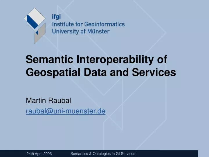
Semantic Interoperability of Geospatial Data and Services. Martin Raubal raubal@uni-muenster.de. Semantics of distance?. The Economist, May 3, 2003. The Economist, May 17, 2003. Topological Operators for areas, lines, points . Overlap in a GIS dialog window.

E N D
Semantic Interoperability of Geospatial Data and Services Martin Raubal raubal@uni-muenster.de Semantics & Ontologies in GI Services
Semantics of distance? The Economist, May 3, 2003
Overlap in a GIS dialog window Semantic Interoperability of Geospatial Data and Services
“Where can I cross the Havel?” Road data (e.g., GDF)
Composite Service plant ID 457 plant location R: 3405138 H: 5760997 Input Leakage Information Get Plant Location Get Nearest Airport airport code FMO emission rate 29 mg/s Get Wind Calculate Gas Dispersion Plume dispersion map Create Gas Dispersion Map wind report XML... plume GML... Semantic Interoperability of Geospatial Data and Services
Application „wind is blowing from“ „wind is blowing to“ Level points_to_compulsion true points_to_compulsion false à à Name: Name: „ prevailing_direction “ Name: „ wind “ Name: „ wind “ „ prevailing_direction “ Data Type: Data Type: „string“ Data Type: „string“ Data Type: „string“ XML-ComplexType 2. same name, different data 1. different name, same data 3. same name, same data type, type, same domain concept type, same domain concept different or differently restricted domain concept(s) Semantic Heterogeneities Semantic Interoperability of Geospatial Data and Services
Generalized Problem • Buffers, topology, navigation, and gas plume examples show problems with the semantics of geographic information describing • entities (e.g., road, ferry) • processes (e.g., driving, wind) • relations (e.g., distance, overlap) • Context is essential for semantics • Today‘s SDI separate data from operations (GML) • context contained in operations is lost • systems or users misinterpret data • Ontologies are supposed to provide that context • Today, they don‘t • They could do better • How? Semantic Interoperability of Geospatial Data and Services
Concept relates to activates Symbol Referent stands for ? [Ogden and Richards, 1923] What is Semantics ? “Tank“
Semantics of what ? • We are not trying to capture the meaning of natural language expressions! • We formalize the semantics of technicalsymbols used in GIS, databases, web services of information communities. • But: information is from and for humans • It derives from data through human interpretation. • It emerges at the user interfaces of GI technologies. • Thus, we need to capture meaning(cognitive semantics). Semantic Interoperability of Geospatial Data and Services
Medium-term research program(3-5 years) solve 3 semantic interoperability problems: data contents service chains users e.g., parcels touching a road e.g., directions from road data e.g., gas plume from wind
Semantic Interoperability • “capacity of (geographic) information systems and services to work together without the need for human intervention” (Harvey et al. 1999) • ... is the only real interoperability Interoperating components share an understanding of their interfaces. • today: „syntactic interoperability“ Interoperating components share an interface, defined by a type signature. GM_Object :: distance (geometry : GM_Object) : Distance Semantic Interoperability of Geospatial Data and Services
Today: annotation ISO 19107, Spatial Schema „The operation "distance" shall return the distance between this GM_Object and another GM_Object. This distance is defined to be the greatest lower bound of the set of distances between all pairs of points that include one each from each of the two GM_Objects. A "distance" value shall be a non-negative number associated to a distance unit such as meter or standard foot. If necessary, the second geometric object shall be transformed into the same coordinate reference system as the first before the distance is calculated. If the geometric objects overlap, or touch, then their distance apart shall be zero. Some current implementations use a "negative" distance for such cases, but the approach is neither consistent between implementations, nor theoretically viable. "Distance" is one of the units of measure data types defined in ISO TS 19103. NOTE The role of the reference system in distance calculations is important. Generally, there are at least three types of distances that may be defined between points (and therefore between geometric objects): map distance, geodesic distance, and terrain distance.“ Semantic Interoperability of Geospatial Data and Services
Goal: axiomatization Service interfaces, requests, and responsescontainsymbols with undefined semantics GM_Object::distance(geometry :GM_Object) :Distance Alexandria ::distanceStades(Syene) = 5040 • type symbols (standing for classes of objects and literals) • values (standing for individual objects and literals) • operators (standing for methods) Semantic Interoperability of Geospatial Data and Services
Ontology in Philosophy A philosophical discipline—a branch of philosophy that deals with the nature and the organization of reality. Science of Being (Aristotle, Metaphysics, IV, 1), asks the questions: • What exists? • What characterizes being? • Eventually, what is being? Semantic Interoperability of Geospatial Data and Services
Ontology in Computer Science • An ontology is an engineering artifact. It is constituted by • a specific vocabulary used to describe a domain • assertions on the intended meaning of the vocabulary. • Thus, an ontology describes a formal specification of a certain domain: • shared understanding of a domain of interest • formal and machine manipulable model of a domain “An explicit specification of a conceptualization” (Gruber 1993) Semantic Interoperability of Geospatial Data and Services
Ontologies Semantic Interoperability of Geospatial Data and Services
CORINE Land Cover categories Semantic Interoperability of Geospatial Data and Services
Are ontologies enough? • They contain relationships between terms • superclass and subclass, is_a, part_of, has_property, synonym • Their axioms are often • absent or • in obscure and untested logical axioms • They fail to capture context • activities determine semantics (e.g., driving across a river) • They are not grounded • what does „artifact“ or „entity“ or „process“ mean? Semantic Interoperability of Geospatial Data and Services
interpretation interpretation Spatial Reference Systems The underlying problem geoinformation = < x, z > ??? Semantic Interoperability of Geospatial Data and Services
Vision Users of geographic information should be able to refer thematic data to semantic reference systems, just as they refer geometric data to spatial reference systems. Software should support the • referencing and grounding process • projections to simpler semantic spaces • semantic translation among different reference systems. Semantic Interoperability of Geospatial Data and Services
A GML file in 2010 ... <PropertyName>SourcePoint <gml:Point%20srsName="EPSG:4326"> <gml:coordinates>-76.9466745614984,38.58321344095582 </gml:coordinates> </gml:Point> <PropertyName>EmissionRate <gml:Flow%srsName="ECSS:2408"> <gml:EmissionRate>29</gml:EmissionRate> ... Semantic Interoperability of Geospatial Data and Services
Semantic Reference Systems Spatial Reference System [ISO 19112] „system for identifying positions in the real world“ • e.g., geodetic reference systems Temporal Reference System [ISO 19108] „basis against which time is measured“ • e.g., calendars Semantic Reference System [t.b.d.] basis on which thematic data are interpreted:‚forest‘, ‚wetland‘‚ ‚road width‘ etc. • e.g., ontologies Semantic Interoperability of Geospatial Data and Services
Long-term research program(5-7 years) • Create methods and tools to design and use semantic reference systems for: • grounding (e.g. “move”) • projecting (e.g. roads and ferries to edges) • translating (e.g. cadastre to navigation) • Based on real-world case studies. • transportation, emergency management, planning Semantic Interoperability of Geospatial Data and Services
Grounding in Image Schemas • Sensory-motor patterns of cognition (Johnson). container, surface, path, link, center-periphery, force... • Developed through bodily experience. • Have internal structure. • Enable the perception of meaningful information from the environment. Semantic Interoperability of Geospatial Data and Services
projection Ferry example: Semantic Projection Semantic Interoperability of Geospatial Data and Services
Application „wind is blowing from“ „wind is blowing to“ Level points_to_compulsion true points_to_compulsion false à à Name: Name: „ prevailing_direction “ Name: „ wind “ Name: „ wind “ „ prevailing_direction “ Data Type: Data Type: „string“ Data Type: „string“ Data Type: „string“ XML-ComplexType 2. same name, different data 1. different name, same data 3. same name, same data type, type, same domain concept type, same domain concept different or differently restricted domain concept(s) Gas plume example: Translation Semantic Interoperability of Geospatial Data and Services
provides meaning restricts meaning Domain Concept + property A (range)+ property B (range) provides meaning restricts meaning Application Concept + property A+ property B (range restriction)(range restriction) + property C Semantic Reference System Semantic Interoperability of Geospatial Data and Services
Protégé Implementation Semantic Interoperability of Geospatial Data and Services
The Way Forward • Need to identify achievable small steps • Solve them through experimental research (not big system implementations!) • Goal: support reasoning about semantics of GI • Some steps: • Annotate and discover data • Annotate and discover services • Translate between database schemata • Translate between services • Negotiate meaning • Capture vagueness • Acknowledge human perception & cognition Semantic Interoperability of Geospatial Data and Services
Conclusions • Semantic interoperability is the important problem to solve in order to make GI Services work together. • Spatial reference systems motivate semantic reference systems • from static ontologies to computational reference systems • Upper-level ontologies need meaningful abstractions • image schemas: processes in space and time • Progressstep-wise from information search through semantic translation to meaning negotiation. • Ask first what needs to be said about space, then how. Semantic Interoperability of Geospatial Data and Services
For more information... • MUSIL web site (Muenster Semantic Interoperability Lab): http://musil.uni-muenster.de Semantic Interoperability of Geospatial Data and Services