Download
1 / 15
150 likes | 311 Views
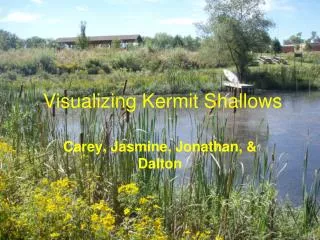
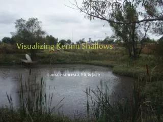
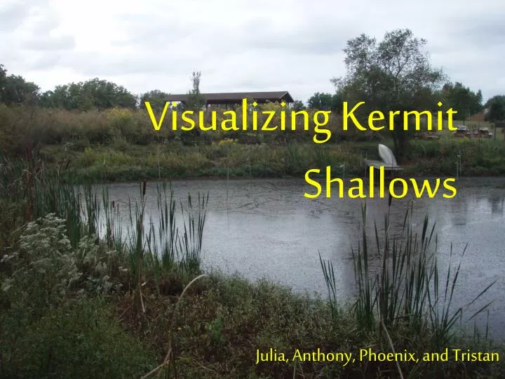
Visualizing Kermit Shallows. Julia, Anthony, Phoenix, and Tristan. Pond Definition & Parts.

E N D
Visualizing Kermit Shallows Julia, Anthony, Phoenix, and Tristan
Pond Definition & Parts • A pond is commonly described by limnologists as a quiet body of water so shallow that rooted plants grow completely across it. Its water temperature is fairly uniform from top to bottom and tends to change with the air temperature. There is little wave action, and the bottom is usually covered with mud. Typically, plants grow along the shore. The amount of dissolved oxygen may vary greatly in a 24-hour period. A lake is usually larger than a pond. The water is too deep for plants to grow except around the shore. The temperature for the water is relatively stable from day to day, but in northern lakes, temperature “layering” occurs in the summer. The amount of dissolved oxygen during a 24-hour period remains about the same. Because of the broad expanse of water exposed to the ,shores on the down-wind side are commonly wave-washed, barren stands of sand or rocks. What people know as a pond or a lake locally, however, differs from one region to another. In some places it would be called a marsh. Many of the broad lakes in Florida are shallow, and though they may lack plants in the middle, their water temperature and amount of dissolved oxygen follow the pattern of ponds.
Pond Definition & Parts • The Littoral Habitat extends from the water’s edge outward as far as rooted plants grow. In most ponds and in many shallow lakes, this area may stretch from shore to shore. In many lakes there are typically three distinct concentric borders of flowering plants, except where the shore is so rocky or swept by waves that plants cannot grow. Closest to the shore is the emergent plant zone. It is dominated by plants that are rooted to the bottom and have stems and leaves above the surface. Grasses, sedges, and rushes are plants typical of the emergent zone in ponds and lakes the world over. Many kinds of frogs, birds, and mammals find food shelter here. A variety of algae, protozoan's, worms, insects, snails, and small fish live among underwater plant stems. Broad, flat-leaved water lilies and such floating plants as water ferns and duckweeds characterize the floating leaf plant zone. Because the masses of floating leaves shade out the light, bottom plants may be scarce. Some snails, bugs, and mayflies lay their eggs on the underside of leave. Many kinds of algae live in this zone either attached to later plants or floating free. Sunfishes and others breed and nest here. The innermost brand on vegetation forms the submersed plant zone. Pondweeds, hornworts, and waterweeds are typical of this zone. All have leaves that are either long and sinuous or bushy and very branched, characteristic and adaptations of those few flowering plants that grow completely submerged. The flowers are pollinated above the surface; the seeds germinate and the young plants develop only under water. The littoral zone, dominated by higher plants is the richest in the pond community. Here are the greatest number or species, both plant and animal . The littoral zone is easiest for the observer to visit and study.
Filtering Data In this data only 13 stakes were used, the 14th and 15th stakes on each side were added in as 0 values as can be seen on the next slide.
Pond Profile Data Collection • 1. A transit line was put around the pond starting at the northwest corner and leveled using bubble levels. • 2. Stakes were put every 5 m around the pond.
Pond Profile Data Collection • 3. Flags were placed on each stake so that they could be found. • 4. Starting at the northwest corner, a string with flags at every 5 m was run across the pond. The first 5 meter flag on the string was placed on the stake on the north side and brought down level with the transit string. The string was leveled on the south side of the pond using a bubble level above the corresponding stake. The string was kept tight. • 5. Measurements were taken at each flag on the string using a 2.4 m pole that had been marked off in .5 dm units. Measures above dry soil were given positive values (+) and measurements below water level were given negative values (-). • 6. Measures were taken for all 15 stakes on the north and south side.
Excel • Color Contour – A Figure that shows the depth of the pond in colors • Wire Contour- A figure that shows the depth of the pond in a wire thing.
Excel • Flat Color Contour- Shows the depth of the pond from a view from the air in color. • Flat Wire Contour-Shows the depth of the pond from the air in a wire like shape.
What do the visualizations tell us about the pond? 1. We learned the pond was deeper on the east end towards the middle. 2. We also learned that pond has a gentle slope on the edges. 3. The pond is triangular a triangular shape.
References • gnuplot download (version 4.4). Retrieve August 23, 2010, from • http://sourceforge.net/projects/gnuplot/files/ • Microsoft Excel. (2003). Microsoft. • NCSA Visualization Suite. Retrieved August 23, 2010, from • http://education.ncsa.illinois.edu/resources/software_tools/vizsuite.html • Reid, G. K. (2001). Pond Life. New York, NY: St. Martin’s Press.