Download
1 / 9
90 likes | 274 Views
Topographic Maps. Topographic maps are 2-D representations of a 3-D surface. This is done using contour lines . Contour lines connect points of equal elevation. . Topo. Maps generally depict quadrangles (rectangular sections of earth’s surface)

E N D
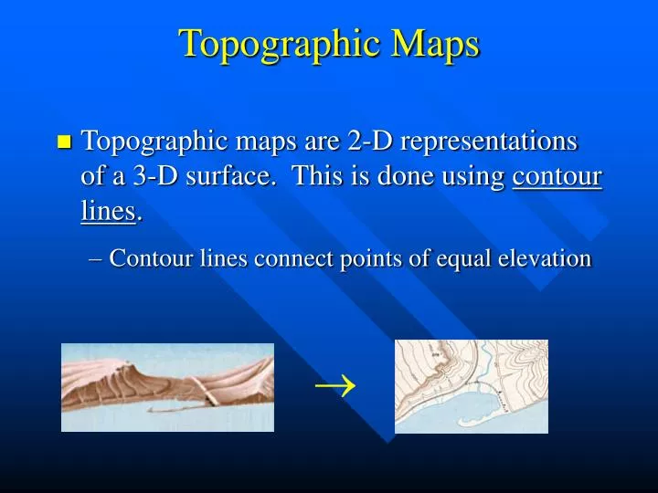
Topographic Maps • Topographic maps are 2-D representations of a 3-D surface. This is done using contour lines. • Contour lines connect points of equal elevation
Topo. Maps generally depict quadrangles (rectangular sections of earth’s surface) • Bounded on top and bottom by lines of latitude and on right and left by lines of longitude • 3 divisions of latitude and longitude lines ° - degree ´ - minute 1° = 60 ´ = 3600 ´´ ´´ - second
Public Land Survey System (PLSS) further divides up the quadrangle. It is based on a principle meridian (N-S) and base line (E-W) • Vertical lines (ranges) and horizontal lines (townships) run parallel to the principle meridian and base line. Range 18 E Township 32 N
The intersection of a township line and a range line create a 6 x 6 mile square township • Each township is divided into 36 sections S24, T32N, R18E of the Wisconsin PLSS
Each section is divided into 4 quarters (NW, NE, SW, SE) SW 1/4, S24, T32N, R18E of the Wisconsin PLSS
Each quarter is divided into another 4 quarters. Further divisions occur, which will be neglected Final Orientation: SE 1/4, SW 1/4, S24, T32N, R18E
Contour lines can be used to give an idea of the slope of the landscape • Depression: Contours have small dashes pointing inward (Ex. Sinkhole)
Stream Flow: Direction of stream flow can be inferred using contour lines (Rule of V’s). V’s point in the upstream direction
Cliffs: Elevation changes the fastest when contour lines are packed together