Download
1 / 39
390 likes | 501 Views
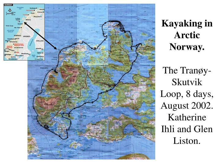
Kayaking in Arctic Norway. The Tran ø y-Skutvik Loop, 8 days, August 2002. Katherine Ihli and Glen Liston. Our boats. Svalbard kayaks borrowed from Jan-Gunnar Winther. Our trip took us around the Tran ø y Lighthouse. Following the rocky coast. The Lofoton Islands in the distance.

E N D
Kayaking in Arctic Norway.The Tranøy-Skutvik Loop, 8 days, August 2002. Katherine Ihli and Glen Liston.
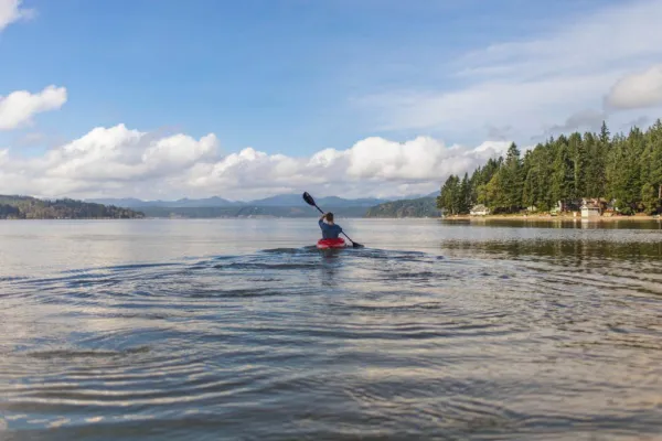
Our boats. Svalbard kayaks borrowed from Jan-Gunnar Winther.
The perfect season for blueberries and low-bush cranberries!Like the Norwegians, we ate these with our reindeer stew (made by Jan-Gunnar’s mother, Helga).
From here we carry the boats 100 yards across the sand to the right, and onto the exposed sea.
After a day of paddling we find protection from the open sea.
The lake in the background is about 3 feet above the sea at high tide. During storms, the sea water (and some fish!) splash over this rocky boundary, creating a lake that has salt water on the bottom and relatively fresh water on the top. This means that if you fish the bottom waters you catch salt-water fish, and in the top you catch fresh-water fish.
… and a nice place to camp. The open sea is 100 yards behind the tent. We spent an extra half day here waiting for the sea to calm down so we could continue our journey.
Another protected site after a few hours on the open (and rough!) sea.
After lunch, we carried the boats across this spit of sand, and continued on our way.
Half-way through the trip we spent the night (and took showers) in a lodge in Skutvik.
We land at the site where Vikings started their half-mile portage to avoid the open sea.
We carried the kayaks together, one trip for each boat, and two trips for equipment.
The “sand” on this beach is really broken-up pieces of coral and sea shells (obviously from some other period!).
Perfect northern Norway weather, and the perfect white sandy beach!
During high tide, this coral-sand spit is covered by water. This area was swarming with sea-life (starfish, crabs, fish, snails, etc.)
Heading out on our final paddling day (the tide is coming in, and the beach is getting smaller).
The End.Special thanks to Jan-Gunnar for loaning us the kayaks!