Download
1 / 19
200 likes | 358 Views
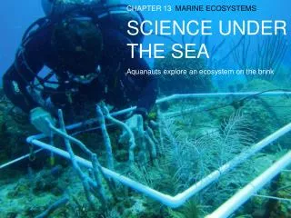
Under the Sea. Chapter 4. Bathymetry. Discovery & study of the ocean floor History: throw heavy rope tied to a rock over the side of the boat measured fathoms as arm lengths Improvements: Echo Sounding, Multi-beam Systems & Satellite Systems. Echo Soundings.

E N D
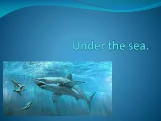
Under the Sea Chapter 4
Bathymetry • Discovery & study of the ocean floor • History: • throw heavy rope tied to a rock over the side of the boat • measured fathoms as arm lengths • Improvements: • Echo Sounding, Multi-beam Systems & Satellite Systems
Echo Soundings • After Titanic (1912) & WWI increase in bathymetry. Why? • Looked for better way to study ocean • Developed a sound pulse and listen for echo • Similar to dolphins, porpoises, & ocras which use echolocation
Echo Sounding Problems • ship position not certain • speed of sound varies with temp, pressure, salinity and affects readings • images were fuzzy
Multi-beam Systems • 121 beams from ship to take echo sounding • more accurate reading • Like “mowing the lawn” gave a section to interpret rather than a single point
Satellite Altimetry • Satellites measure small variations in the elevation of surface water • Many radar pulses each second • Used sophisticated calculations to determine the sea floor
Topography of Ocean Floors • Seabed topography is due to isostatic equilibrium • Balancing of less dense continental plate and more dense oceanic plate over mantle • Submerged outer edge of continent = continental margin • Deep sea floor = ocean basin
Continental Margins • Active Margins: • continental margins of converging plates • Lots of volcanic & earthquake activity • Ex: Pacific Plate • Passive Margins: • continental margins of diverging plates • Little volcanic & earthquake activity • Ex: Mid-Atlantic Ridge
3 types of Continental Margins • Continental Shelf • Continental Slope • Continental Rise
Continental Shelf • Shallow submerged extension of continent • Features: hills, depressions, sedimentary rocks, & mineral/oil deposits • Gentle incline • Consists of material from erosion (ex: river mouths) which can determine the width of shelf • Affected by sea level: ice age can change isostatic equilibrium • Used for resources: minerals & oil
Continental Slope • Transition between the continental shelf & the ocean floor • Sediments from shelf are transported over the side creating a slope • Often scraped off by subduction • Shelf break = abrupt transition from continental shelf to the continental slope
Submarine Canyons • Canyons cut into shelf & slope • Fan-shaped • Usually right angle to shoreline • Formed from erosion and/or earthquakes • Earthquakes create turbidity currents (avalanche of sediment)
Continental Rise • Sediment at base of slope transported from shelf • Deep-ocean currents &/ turbidity currents
Deep-Ocean Basins • Oceanic ridge systems and adjacent sediment-covered plains • Includes: • Oceanic Ridges • Hydrothermal Vents • Abyssal Plains & Abyssal Hills • Seamounts & Guyots • Trenches & Island Arcs
Oceanic Ridges • Mountainous chain of basaltic rock at center of spreading center • Formed from divergent boundaries • Old rocks far away from center • Young rocks at center • Not in straight line, broken up by transform faults and fracture zones (remnants of transform faults)
Hydrothermal Vents • Hot springs from ridge floor • Forms from water into cracks of ridge floor and venting out • Water is hot, acidic, filled with minerals, and gases • Unusual organisms live here
Abyssal Plains & Abyssal Plains • Plains: • flat sediment covered floor found on periphery of all oceans • Sediment from turbidity currents or winds • Hills: • small volcanoes, from diverent boundaries, parallel / borders ridges
Seamounts & Guyots • Formed from old hotspots • Seamounts: • old volcanoes never breeched surface • Guyot: • former islands eroded down • Ex: 100+ small islands of Hawaii
Trenches & Island Arcs • Trenches: • Deep depression in ocean floor • Deepest part of ocean • Forms from subduction zones • Island Arcs: • chain of volcanic islands from subduction zones • Ex: Aleutian Islands