Download
1 / 50

E N D
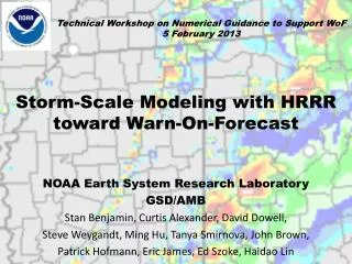
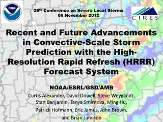
WARN ON FORECASTAND HIGH IMPACT WEATHER WORKSHOP09 February 2012Use of Rapid Updating Meso‐ and Storm‐scale Data Assimilation to Improve Forecasts ofThunderstorms and Other High Impact Weather: The Rapid Refresh and HRRR Forecast SystemsNOAA/ESRL/GSDCurtis Alexander, David Dowell, Steve Weygandt, Stan Benjamin, Ming Hu, Tanya Smirnova, Patrick Hofmann, Haidao Lin, Eric James and John Brown
Hourly Updated NOAA NWP Models Rapid Refresh (RAP) replaces RUC at NCEP in 2012 WRF, GSI with RUC features 13km Rapid Refresh (RAP) (mesoscale) 13km RUC (mesoscale) 3km HRRR (storm-scale) RUC – current oper Model, new 18h fcst every hour High-Resolution Rapid Refresh Experimental 3km nest inside RAP, new 15-h fcst every hour
Model Configurations ESRL/GSD/AMB NCEP Real-Time Retrospective RAP Retro RUC Oper RAP Primary RAP Dev2 RAP NCO RAP Dev NWS HRRR Dev HRRR Primary HRRR Retro CoSPA (FAA) AMB RAP/HRRR verification system
ESRL/GSD/AMB Model Verification Deterministic Probabilistic
Spring 2011 Hourly HRRR Initialization from RAP Hourly HRRR 15-h fcst 15-h fcst Use 1-h old LBC to reduce latency Lateral Boundary Conditions Interp to 3 km grid Interp to 3 km grid 18-h fcst 18-h fcst Initial Condition Fields 18-h fcst 1-hr fcst Use most recent IC (post-DFI) to get latest radar info DDFI DDFI 1-hr fcst 1-hr fcst Back- ground Fields Analysis Fields Reduced Latency: ~2h for 2011 3DVAR 3DVAR Hourly RAP Obs Obs Time (UTC) 11 z 12 z 13 z
Rapid Refresh Partial Cycling GFS model GFS model RAP spin-up cycle RAP spin-up cycle Observation assimilation 00z 03z 06z 09z 12z 15z 18z 21z 00z Observation assimilation RAP Hourly cycling throughout the day - Hourly cycling of land surface model fields - 6 hour spin-up cycle for hydrometeors, surface fields
ESRL/GSD/AMBModel Analysis/Forecast BiasInherent in Model Physics?Non-Optimal Use of Obs?Limitations of Data Assimilation Method?Need Accurate Mesoscale Environment for High Impact Prediction
RAP vs. RUC surface – cold season Diurnal bias variation 6-h fcst 2m Temper- ature (K) COLD WARM RUC daytime quite cool, RAPgood Both too moist, especially during day RAP RUC RUC RAP LOW HIGH 2m Dew Point (m/s) 3-week comparison 9 – 30 Jan 2012 Eastern US only Steve Weygandt
RAPvs. RUC surface – warm season Diurnal bias variation 6-h fcst COLD WARM RAP RUC RUC daytime slightly cool, RAPwarm, esp. overnight Both too moist, especially at night RUC worse than RAP 2m Temperature (K) RUC RAP LOW HIGH 2m Dew Point (m/s) 2-month comparison 20 April – 20 July 2011 Eastern US only Steve Weygandt
RAPvs. RUC Precipitation Verification RAP CSI (x 100) 13-km CONUS Comparison 2 X 12 hrfcst vs. CPC 24-h analysis 1 May – 15 July 2011 Matched RUC | | | | | | | | 0.01 0.10 0.25 0.50 1.00 1.50 2.00 3.00 in. RAP bias (x 100) 100 (1.0) RUC SPRING/ SUMMER Steve Weygandt | | | | | | | | 0.01 0.10 0.25 0.50 1.00 1.50 2.00 3.00 in.
RAP and RUC Humidity Bias CONUS All 00/12 UTC Raobs 08 July – 08 Sept 2011 00 hr (analysis) 06 hrfcsts RAP RUC RAP - RUC RAP RUC RAP - RUC RUC/RR drier/moister below 650 mb, opposite above RR a closer fit to the observations by 6 hrs in lower trop Water vapor is the dominant source of the RH bias
RAP and RUC Humidity Bias CONUS All 00/12 UTC Raobs 11-22 August 2011 NO RADAR DA 00 hr (analysis) 06 hrfcsts RAP RUC RAP - RUC RAP RUC RAP - RUC Without radar DA, model bias even more pronounced
Spring 2012 versions RAP (ESRL RAP and HRRR) Changes evaluated in current RAP/HRRR 2012 change bundle
RAP PBL pseudo-obs assimilation Rapid Refresh prim ( ) vs. dev ( ) RAP-dev has PBL-based pseudo-observations Residual mixed layer better depicted in RAP-dev (w/ PBL pseudo-obs) Observed 00z 7 July 2011 Albany, NY sounding prim dev 23z 6 July 2011 RAP sounding
Dewpoint bias in 6h RAP forecasts, eastern US, Aug 2011 Reduced moisture bias as measured by 2-m dewpoint Retro RAP with soil adjustment and temp-dependent hydrometeor building from radar Dry Bias Moist Bias Real-time RAP
Improved cloud analysis by assuming conservation of virtual potential temperature Before DA After DA conserving θv Before DA After DA NOT conserving θv
Latest 2012 Candidate HRRR EvaluationReflectivity ≥ 35 dBZ, 03 km ScaleSelect Cases 11-22 August 2011 Eastern US HRRR 2010 HRRR 2011 HRRR 2012 – Reduced high BIAS in first 6 hours and improved CSI CSI 03 km BIAS 03 km Optimal
Latest 2012 Candidate HRRR EvaluationReflectivity ≥ 25 dBZ, 40 km ScaleSelect Cases 11-22 August 2011 Northeast Southeast HRRR 2010 HRRR 2011 HRRR 2012 CSI 40 km BIAS 03 km Optimal Optimal
HRRR improvements from RAP upgrades (for 2012 HRRR CoSPA – more accurate convection, reduced false alarm) RAP HRRR 2012 proto-type retro test RAP HRRR 2011 real-time NSSL mosaic Valid 16z 14 Aug 2011 12z + 4 hr fcsts
NSSL mosaic Observations HRRR 2010 HRRR 2012 HRRR 2011 18z 17 Aug 2011 Initializations 8 hr forecasts Valid 02z 18 Aug 2011
Diabatic Digital Filter Initialization (DDFI) -40 min -20 min Init +20 min Backwards integration, no physics Forward integration, full physics Apply latent heating from radar reflectivity, lightning data Obtain initial fields with improved balance, vertical circulations associated with ongoing convection RUC/RR model forecast Radar reflectivity assimilation in RUC and Rapid Refresh
Rapid Refresh (GSI + ARW) reflectivity assimilation example Upper-level Divergence Low-level Convergence NSSL radar reflectivity (dBZ) K=17 U-comp. diff (radar - norad) K=4 U-comp. diff (radar - norad) 14z 22 Oct 2008 Z = 3 km
HRRR Reflectivity 00z 12 August 2011 00 hr forecasts RAP – Radar data RAP – No radar data Convergence Cross-Section
HRRR Reflectivity 01z 12 August 2011 01 hr forecasts RAP – Radar data RAP – No radar data Convergence Cross-Section
HRRR Reflectivity Verification DDFI in 13-km RAP (parent model) AND in 3-km HRRR Eastern US, Reflectivity > 25 dBZ 14-24 July 2010 BIAS 03 km CSI 40 km Optimal 2x Latent heating rate in RAP 1x Latent heating rate in RAP 1/3x Latent heating rate in RAP 1x Latent heating in RR and HRRR 2x Latent heating rate in RAP 1x Latent heating rate in RAP 1/3x Latent heating rate in RAP 1x Latent heating in RR and HRRR Application of DDFI at both scales results in spurious convection Significant loss of skill
HRRR Reflectivity Verification Eastern US, Reflectivity > 25 dBZ 11-20 August 2011 BIAS 03 km CSI 40 km RUC->HRRR Radar RAP->HRRR Radar RAP->HRRR No Radar RUC->HRRR No Radar Optimal RAP->HRRR Radar RAP->HRRR No Radar RUC->HRRR Radar RUC->HRRR No Radar Reflectivity DA in RAP/RUC increases HRRR forecast skill HRRR bias depends strongly on parent model
t015 min t0 t045 min t030 min NSSL 3D mosaic reflectivity-based temperature tendency t045 min t060 min t030 min t015 min t0 HRRR composite reflectivity David Dowell interpolation from RAP,hydrometeor specification Reflectivity DA on 3-km (HRRR) Grid HRRR (3-km) grid produces convective storms explicitly Reflectivity-based temp. tendencies are applied during sub-hourly cycling(forward model integration only, no digital filtering)
ESRL/GSD/AMBHRRR Forecast Post-ProcessingTime-Lagged (TL) Ensemble
Spatio-temporal scale of probabilities Forecasts valid 21-22z 27 April 2011 Forecasts valid 22-23z 27 April 2011 10-11 hrfcst 11-12 hrfcst HRRR 11z Init 09-10 hrfcst 10-11 hrfcst HRRR 12z Init 08-09 hrfcst 09-10 hrfcst HRRR 13z Init All six forecasts summed to form probabilities valid 22z 27 April 2011
The HCPF and HTPF HRRR Convective/Tornado Probabilistic Forecast (HCPF/HTPF) Estimate likelihood of convection and tornado production • Intensity – ≥ 25 m2 s-2Maximum Updraft Helicity 2-5 km AGL • Time – Two hour search window centered on valid times • Location – 45 km (15 gridpoints) search radius of each point • Members – Three consecutive HRRR initializations HTPF = # grid points matching criteria over all members total # grid points searched over all members Caveats: Refinement needed to discriminate surface/elevated rotation Evaluate additional environmental fields that support tornado formation Evaluate additional diagnostic fields Tornado scale not resolved
Case Selection from 2011 *Note: Maximum SPC forecast categories through 20z Day 1
Tornado Periods Stronger Forcing 25 dBZ, 40 km 40 dBZ, 40 km 25 dBZ, 03 km 40 dBZ, 03 km 14-16 April 2011 06 hr fcsts 03 hr fcsts CSI 09 hr fcsts 12 hr fcsts
Tornado Periods Stronger Forcing 25 dBZ, 40 km 40 dBZ, 40 km 25 dBZ, 03 km 40 dBZ, 03 km 26-28 April 2011 06 hr fcsts 03 hr fcsts CSI 09 hr fcsts 12 hr fcsts
Tornado Periods Stronger Forcing 25 dBZ, 40 km 40 dBZ, 40 km 25 dBZ, 03 km 40 dBZ, 03 km 22-25 May 2011 06 hr fcsts 03 hr fcsts CSI 09 hr fcsts 12 hr fcsts
ESRL/GSD/AMBHRRR TL EnsembleProbabilistic ComparisonIn Outbreaks
27 April 2011 HTPF 13z + 09hr fcst Valid 22z 27 April 2011 1630z SPC Tornado Probability 27 April 2011 Storm Reports Tornado = Red Dots Tornado Probability (%)
27 April 2011 HTPF 13z + 09hr fcst Valid 22z 27 April 2011 Observed Reflectivity 22z 27 April 27 April 2011 Storm Reports Tornado Probability (%) Reflectivity (dBZ) Tornado = Red Dots
22 May 2011 HTPF 13z + 11hr fcst Valid 00z 23 May 2011 1300z SPC Tornado Probability 22 May 2011 Storm Reports Tornado = Red Dots Tornado Probability (%)
22 May 2011 HTPF 13z + 11hr fcst Valid 00z 23 May 2011 Observed Reflectivity 00z 23 May 22 May 2011 Storm Reports Tornado Probability (%) Reflectivity (dBZ) Tornado = Red Dots
23 May 2011 HTPF 13z + 11hr fcst Valid 00z 24 May 2011 1300z SPC Tornado Probability 23 May 2011 Storm Reports Tornado = Red Dots Tornado Probability (%)
23 May 2011 HTPF 13z + 11hr fcst Valid 00z 24 May 2011 1300z SPC Tornado Probability With MUCAPE LPL < 50 mb AGL 23 May 2011 Storm Reports Tornado = Red Dots Tornado Probability (%)
23 May 2011 HTPF 13z + 11hr fcst Valid 00z 24 May 2011 Observed Reflectivity 00z 24 May 23 May 2011 Storm Reports Tornado Probability (%) Reflectivity (dBZ) Tornado = Red Dots
24 May 2011 HTPF 13z + 11hr fcst Valid 00z 25 May 2011 1630z SPC Tornado Probability 24 May 2011 Storm Reports Tornado = Red Dots Tornado Probability (%)
24 May 2011 HTPF 13z + 11hr fcst Valid 00z 25 May 2011 Observed Reflectivity 00z 25 May 24 May 2011 Storm Reports Tornado Probability (%) Reflectivity (dBZ) Tornado = Red Dots
Summary HRRR Challenges from a WOF/HIP perspective Reduce latency from 2 hrs to 1 hr, 30 min, etc…? Tradeoff between assimilating latest mesoscale observations (more latency) and some radar observations (less latency) Model moisture (and other) bias dominates convective forecast behavior: initial condition error, model error, both? Mesoscaleenvironment remains a strongdriver of storm-scale predictability Weaker (stronger) forcing and smaller (larger) favorable environments do translate to lower (higher) skill forecasts Small (large) run-to-run variability doesn’t always translate to a higher (lower) skill forecast