Download
1 / 21
210 likes | 295 Views
Geoff Blewitt University of Nevada, Reno, USA Zuheir Altamimi IGN, Paris, France with J. Davis, R. Gross, C. Kuo, F. Lemoine, R.Neilan, H.P. Plag, M. Rothacher, C.K. Shum, M.G. Sideris, T. Schöne, P. Tregoning, and S. Zerbini.

E N D
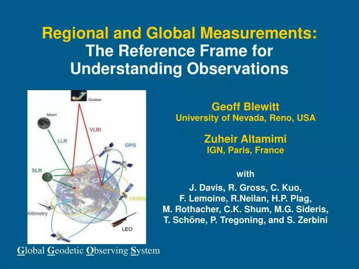
Geoff Blewitt University of Nevada, Reno, USA Zuheir Altamimi IGN, Paris, France with J. Davis, R. Gross, C. Kuo, F. Lemoine, R.Neilan, H.P. Plag, M. Rothacher, C.K. Shum, M.G. Sideris,T. Schöne, P. Tregoning, and S. Zerbini Regional and Global Measurements:The Reference Frame for Understanding Observations Global Geodetic Observing System
Overview • Introduction • Defining a reference system and reference frames • Geodetic techniques for realizing theInternational Terrestrial Reference Frame (ITRF) • Errors related to reference systems and their effects • Challenges and future requirements • Recommendations
Introduction • Terrestrial Reference Frames • One of the biggest sources of error in quantifying long-term variation in sea level • 2 mm/yr origin error (Earth center of mass) 0.4 mm/yr in global sea level from satellite altimetry • 0.1 ppb/yr (10-10/yr) scale error 0.6 mm/yr global sea level rate • Frame-related errors are comparable in magnitudeto individual physical contributions • Glaciers, Greenland, Antarctic, thermal expansion, ...
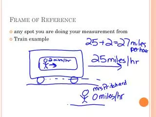
Defining a Reference System & Frames:Terminology for the non-geodesist • Three conceptual levels [Kovalevsky et al., 1989]: • Ideal Terrestrial Reference System (TRS) is a mathematical, theoretical system • The Conventional TRS is the sum of all conventions (models, constants,...) that are necessary to realize the TRS • A Conventional TRF, which uses above to realize the TRS. • In effect: • The TRS is an ideal, conventional model • The TRF is a list of station coordinates and velocitiesbased on space geodetic observations • The “meaning” of coordinates and velocities should only be taken within the context of the conventional TRS
Reference Systems are Essential • Need to tie sets of observations in a consistent model • (1) Sea level from satellite altimetry • Sea surface in the frame of the satellite orbits • Reference system needed for consistency over decades • TRS origin = Earth center of mass “Geocentric sea level” • not directly related to impacts • not directly related to ocean volume • (2) Relative Sea Level Sea Surface Ocean Bottom • RSL directly relates to coastal impacts and to ocean volume • RSL can be related to observations that are tied within a TRS • surface loading theory, sea-level equation, mass conservation Static sea surface (t) Earth’s gravitational shape (t)Ocean bottom (t) Earth’s geometrical shape (t)
Mass Exchange Geocentric Sea Level Land Load Satellite Altimetry Relative Sea Level Equipotential Sea Surface Deformed Ocean Bottom Total Load Moment of Inertia Angular Velocity Gravitation Momentum Earth Rotation Load Potential Geocenter Motion Centrifugal Potential LLN Theory Frame Theory Gravity Potential Solid Earth Deformation Gravitational Potential Satellite Gravimetry StationPositioning A Geodesist’s View of Sea Level Importance of Ocean’s “Static” Response Tide Gauges
Example: Seasonal Variation in Global Sea Level from Earth’s Shape [Blewitt and Clarke, 2003]
TechniqueSignalSource Obs. Type VLBI MicrowaveQuasars Time difference SLROpticalSatellite Two-way absolute range GPSMicrowaveSatellites Range change Celestial FrameUT1 Yes No No Polar Motion Yes Yes Yes Scale Yes Yes Yes Geocenter No Yes Yes Geographic Density No No Yes Real-time Yes Yes Yes Decadal Stability Yes Yes Yes Geodetic Techniques for Realizing ITRF • Mix of techniques is necessary to realize a frame that is stable in origin, scale, and with sufficient coverage • VLBI • SLR • GNSS (GPS,....) • DORIS • Also important to understand biases and so improve the frame • Requires links between techniques From Ries et al., 2005, presented at NASA Sea Level Workshop
Geodetic Systems are Essential • Observations of Geocentric Sea Level • Satellite altimeters (TOPEX, JASON, …) • Observations on Earth’s Shape • GPS and the International GNSS Service (IGS) • Observations on Earth’s Gravity Field • Geodetic satellite missions (LAGEOS, GRACE,…) • Observations to maintain the Reference Frame • International Terrestrial Reference Frame (ITRF) • Global Geodetic Observing System (GGOS) • Observations to improve Solid Earth models • Observations of terrestrial water and ice
Errors Related to Reference Systemsand their Effects (1) • Hierarchy of Errors • Model error in the reference system conventions • Station motion model, gravity field, etc. • External error in alignment of the reference frame • Origin, scale and orientation, and their stability in time • Internal error in coordinates of stations in the frame • Stations used for relative positioning of user’s station • All above is in addition to user’s observational errors
Errors Related to Reference Systemsand their Effects (2) • Errors in TRS conventions map into • Errors in station positions and satellite orbits • Errors in sea surface, gravity, Earth surface geometry • Errors in origin and scale map into • Errors in geocentric sea level • Errors in TRF station coordinates map into • Errors in motion of tide gauges • Errors in altimeter bias calibration • As conventions and frames are updated, so do the entire position time series, hence interpretation • Unlike tide gauge data, cannot simply “archive” positions
mm/yr Example: Effect of Origin Translation [Plag, 2006, Kierulf and Plag 2006] • (IGS – ITRF2000) origin rate: v = (–1.5, –2.2, –2.1) mm/yr • Effect on T/P sea level trend = –0.09389vx –0.04847vy –0.11536vz • local = 3 mm/yr; global mean = 0.4 mm/yr, T/P mean = 0.5 mm/yr
SLR Origin & Scale Variation (wrt ITRF2000) 0.5 mm/yr 1.6 mm/yr -0.66 mm/yr 0.6 mm/yr
Challenges and Future Requirements • ITRF needs to be made more robust and stable • Current accuracy: 1–2 mm/yr origin, 0.1 ppb/yr scale • Target accuracy: 0.1 mm/yr origin, 0.01 ppb/yr scale • Global sea level monitoring critically depends on: • GNSS to locate satellites and Earth’s surface (tide gauges) • SLR to realize the origin as the Earth center of mass • VLBI and SLR to realize a stable scale • Control of biases in geodetic systems • Threats?
Threats: ITRF on “shaky ground”:current collocations • Links between SLR-VLBI-GNSS are weakening in time • Uneven station distribution leads to biases • No long-term systematic commitment to support ITRF (8) (59) (16) (2)
ILRS Network Number of stations
Recommendations • Strengthen ITRF: Make more robust and stable • Research to realize 0.1 mm/yr and 0.01 ppb/yr stability • Strengthen geodetic infrastructure to realize the same • Improve network design (distribution and collocation) • Support GGOS as the paradigm for geodetic integration • Continue overlapping altimetric missions indefinitely • Monitoring of biases to ensure long-term consistency • Establish long-term commitment to ITRF • Reference frames need international recognition (GEO) as a traverse activity that affects many aspects of Earth observations in general, including sea level monitoring
Evidence from at the Greenwich Meridian, 2006-05-06 “ITRF on shaky ground”
Recommendations • Strengthen ITRF: Make more robust and stable • Research to realize 0.1 mm/yr and 0.01 ppb/yr stability • Strengthen geodetic infrastructure to realize the same • Improve network design (distribution and collocation) • Support GGOS as the paradigm for geodetic integration • Continue overlapping altimetric missions indefinitely • Monitoring of biases to ensure long-term consistency • Establish long-term commitment to ITRF • Reference frames need international recognition (GEO) as a traverse activity that affects many aspects of Earth observations in general, including sea level monitoring