Download
1 / 15
150 likes | 331 Views
The Land of the Nile. Do Now. Take out your vocabulary sheets Turn to page 135 of your textbook Which part of Mesopotamia received heavy rainfall? Which portion was drier and required irrigation?. The Nile River. The Nile River is the world’s longest river

E N D
Do Now • Take out your vocabulary sheets • Turn to page 135 of your textbook • Which part of Mesopotamia received heavy rainfall? Which portion was drier and required irrigation?
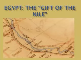
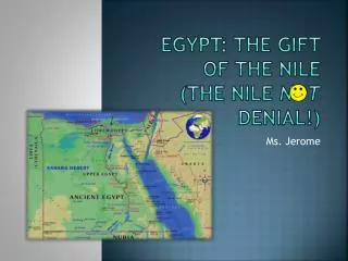
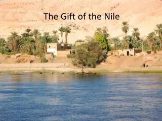
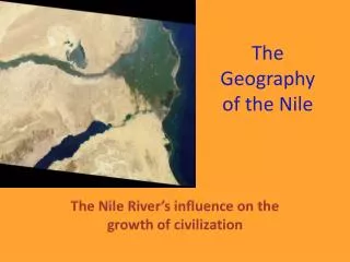
The Nile River • The Nile River is the world’s longest river • From east-central Africa, it flows north for 4,160 miles until it empties into the Mediterranean Sea
The Nile River • The Nile flows from higher land in the south to lower land in the north
The Nile River • The ancient land once called Lower Egypt lies at the Nile’s mouth at the Mediterranean Sea and is made up mainly of the Nile Delta.
Delta • A delta is a triangular piece of rich land formed from soil deposited at the mouth of some rivers.
The Nile River • The higher land to the south was known as Upper Egypt. • There, the narrow and fertile Nile Valley follows the Nile River for more than 600 miles.
The Nile River • Even farther south, the Nile runs between desert cliffs in a series of six cataracts, or waterfalls.
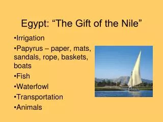
The Nile River • The Nile River cuts across the arid, or dry, desert known as the Sahara. • Only in the fertile lands by the Nile could early Egyptians grow crops of wheat and barley.
The Nile River • Heavy rains fall in the mountains at the Nile’s source to the far south. • This rainfall caused the river to overflow its banks. • The yearly flooding deposited silt along each bank, making the soil fertile.
The Nile River • This physical setting supported permanent settlement. • By 4000 B.C., farming villages lined the Nile River from the delta to the first cataract. • To the ancient Egyptians, the Nile was called “the giver of life.”
Comparison Ancient Egypt Modern Egypt
Activity • Draw the Nile River from page 135 of your textbook. • Be sure to label your drawing with a key. • Make sure you include the surrounding area, such as the Red Sea, the Mediterranean Sea, and the Sahara Desert. • Include at least 5 facts that you learned about the Nile River in a separate key on your paper.
Wrap Up • Name some of the facts that you learned about the Nile River