Download
1 / 24
240 likes | 332 Views
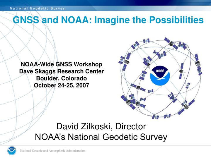
GNSS and NOAA: Imagine the Possibilities. NOAA-Wide GNSS Workshop Dave Skaggs Research Center Boulder, Colorado October 24-25, 2007. David Zilkoski, Director NOAA’s National Geodetic Survey. 1983 GPS and Its Components: Limited Application of Use. A Limited Number of Satellites

E N D
GNSS and NOAA: Imagine the Possibilities NOAA-Wide GNSS WorkshopDave Skaggs Research CenterBoulder, ColoradoOctober 24-25, 2007 David Zilkoski, Director NOAA’s National Geodetic Survey
1983 GPS and Its Components: Limited Application of Use • A Limited Number of Satellites • Analysis Centers • GPS Receivers • NGS began using GPS in 1983. This Macrometer V1000 is the first GPS receiver owned by NOAA.
Today’s GPS and Components: Three Major Changes • 24 GPS Satellites with Increased Types and Accuracy of Signals • Increased Mobility and Usefulness of GPS Receivers and …
3) Global Navigation Satellite System (GNSS) GPS other constellations augmentations WAAS EGNOS CORS NDGPS LAAS QZSS GLONASS Galileo
NOAA Leads IGS Analysis Centers • NOAA’s National Geodetic Survey was selected to coordinate International GNSS Service (IGS) analyses for the next four years. • NGS was selected out of 10 other IGS analysis centers to perform the main product combination and quality control operations. • Products consist of satellite orbits, clocks, and associated Earth orientation parameters. Image Credit: www.iag-aig.org
Today – GPS is Used by Many NOAA Programs NOAA PPBES Programs the benefit from Height Mod: Coastal & Marine Resources (CMR) Coral Reef Conservation (COR) Ecosystem Observations (EOP) Ecosystem Research (ERP) Habitat (HAB) Climate & Ecosystems (CLE) Climate Observations & Analysis (COA) Climate Predictions & Projections (CPP) Coasts, Estuaries, & Oceans (CEO) Environmental Modeling (MOD) Hydrology (HYD) Local Forecasts & Warnings (LFW) Space Weather (SWX) Tsunami (TSU) Aviation Weather (AWX ) Marine Transportation System (MTS) Marine Weather (MWX) NOAA Emergency Response (EMR) Surface Weather (SFC) Regional Decision Support (RDS) • National Hurricane Center • Inundation models • National Weather Service • Tsunamis • GPS Ionosphere • Weather Models • Marine Fisheries • SWaPS, Benthic Mapping • Ocean and Atmospheric Research • Climate Change and Sea Level Rise • Atmospheric Models • National Ocean Service • NWLON (CO-OPS) • Digital coasts (CSC) • Coastal mapping/shoreline (NGS/Coast survey) • Coral Reef Conservation Program (OCRM/NCCOS) • Coastal Zone Managers (OCRM)
Navigation, Positioning, and Docking of NOAA’s Fleet • GNSS enabled digital displays provide all-weather navigation, positioning, and docking. • GNSS provides the foundation for safe operations during adverse weather, such as fog and blinding storms. • GNSS real-time navigation and water-level data prevents groundings and collisions with bridges.
GNSS Helps Prevent the Destruction of Marine Environments Caused by Industry • 98-percent of nation’s tonnage in international commerce moves by sea. • Without accurate geodetic information, nautical charts would be riddled errors, accidents, groundings, and spills of hazardous cargo would increase. Exxon Valdez
GNSS and NOAA’s Emergency Response • GNSS allows NOAA to track the current location and movement of oil spills, which allows for positioning of defensive equipment to protect marine environments. • Environmental sensitivity maps and spill-response models help cleanup managers identify the most vulnerable ecological areas near a spill and predict how the spill will respond to weather, current, and tide conditions. • GNSS guides emergency responders to disaster areas quickly, accurately, and efficiently.
GNSS and Weather Forecasting • GNSS is a reliable, low-cost technology for measuring water vapor, which is essential for predicting storms.
GNSS Guides Marine Resources in Estuarine and Coastal Wetlands • Coastal zone managers are able to make more informed decisions about fisheries programs, stock assessments, algal blooms, and other issues affecting the health and vitality of coastal ecosystems.
GNSS and the Shallow Water Positioning System (SWAPS) SWAPS provides research opportunities to quantify patterns of damage and recovery on shallow coastal habitats, including: • The potential for surveying large areas rapidly without the need to deploy divers, • The ability to return to specific locations within damaged areas without establishing perimeter tags or markers, and • The ability to survey an area remotely without specialized field personnel.
Time Transfer for NLDN Slide Courtesy of Seth Gutman
“We are harnessing power in the sky to chart a prosperous new course on the ground.”- Vice President and Noble Prize for Peace Recipient Al Gore How could the future look?
Underwater Positioning of Remote Operating Vehicles (ROVs) • Deep water ROVs return to same location within centimeters. ITRF2000 Longitude: 123° 07' 13'‘ West Latitude: 37° 43' 04''North Elevation: -503 meters
Water Levels Anywhere, Anytime, and Any Place! • GNSS on Buoys improve hydrographic charts that translate into improved marine traffic control, safety, and productivity in ports, rivers, and open ocean. ITRF2000 Longitude: 74° 29' 56'‘ West Latitude: 37° 14' 38'' North Elevation: 54 meters Images Credit: NOAA and www.nhptv.org
Increased Efficiency and Better Environmental Stewardship with Precision Agriculture • Onboard computers in farm equipment can regulate the precise mix of chemicals for every square foot based on known soil qualities and GNSS positioning, effectively reducing the amount of fertilizer and pesticides used. • Harmful farm runoff, which contaminates watersheds, decreases as position accuracy increases. • Crop output can increase as GNSS guided robotic farm equipment can be used 24-7. Image Credits In Order: precisionpays.com, ncsu.edu, and USACE
GNSS and Digital Elevation Maps (DEMs) • With the help of GNSS, more accurate DEMs can be produced to support Community Resiliency efforts by better detecting local relative sea-level rise and water-levels in flood prone areas. • DEMs in coastal ecosystems provide a better understanding of a wetland’s ability to serve as a storm-surge buffer.
More Accurate Positioning of UAVs Provide: • Climate Quicker Data Collection • Weather Research Closer to Data Source • Fisheries Enforcement Expanded and More Frequent Monitoring • Coastal Zone Studies More Accurate Data • Fire Monitoring Replaces Human Monitoring • Search and Rescue Provides an Aerial View in Harsh Terrain Search and Rescue Forest Fires Hurricane Monitoring Slide Courtesy of Scott Raydar
UAV Fire Fighting Capability & Prediction Smoke jumpers & firefighters arrive Firefighters receive HALE images on their PDAs Firefighters employ hand held radios connecting them to each other, their command post, and the tankers Courtesy Northrop Grumman
GNSS Enabled UAVs in the Gulf of Mexico Harmful Algal Bloom along Florida Coastline Slide Courtesy of Scott Raydar
GNSS Applications in Various Ecosystems Pipeline Movement Argos-Linked Tagged Loggerhead Sea Turtles Tracked by NOAA Polar Satellite Coastal Erosion Monitoring Slide Courtesy of Scott Raydar