Download
1 / 54
540 likes | 710 Views
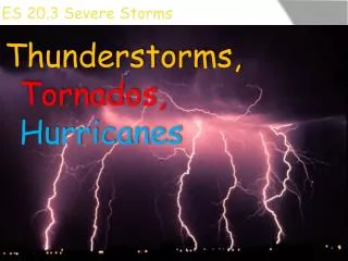
Severe Storms. Most Violent weather is associated with low pressure systems because air of different properties mixes there Thunderstorms Tornadoes Hurricanes Winter Storms. Thunderstorms. Flash Flooding Hail Lightning Downbursts Tornadoes. Flash Flooding. Lightning. Thunder.

E N D
Severe Storms Most Violent weather is associated with low pressure systems because air of different properties mixes there • Thunderstorms • Tornadoes • Hurricanes • Winter Storms
Thunderstorms • Flash Flooding • Hail • Lightning • Downbursts • Tornadoes
Thunder and Lightning • Superheated air expands and creates shock wave • Can be heard up to 30 miles away • Flash-Sound Interval: 5 sec/mi (3 sec/km) • Notone second = one mile • “Heat Lightning” is ordinary lightning illuminating the clouds
Lightning Rods • Benjamin Franklin, 1752 • Do not allow lightning strikes to be conducted to the ground • Pointed shape allows excess charge to bleed harmlessly into the atmosphere (corona discharge)
The Fujita Scale Based on Damage and Engineering Studies • F0 40-73 mph 29% • F1 74-112 mph 40% • F2 113-157 mph 24% • F3 158-206 mph 6 % • F4 207-260 mph 2 % • F5 261-318 mph <1 % • F6? How to identify?
Conditions for Tornado Formation • Energy Source (convection or uplift) • Cold Front and Squall Line • Supercells and Mesocyclones • Vorticity (something to create a spin) • Usually but not always spin according to Coriolis Effect • Spin is indirectly connected - inherited from larger weather systems
Where Tornados Occur • U.S. and Canada probably have most severe storms • Cool Canadian air meets warm, moist Gulf air • Highest reported frequency by area is Britain • Other places: India, Australia, China
Tornado Myths • Take shelter in the southwest corner • Take shelter under a bridge or overpass • Open windows to equalize pressure • Buildings explode from pressure drop • Tornados avoid rivers, hills, mountains • Certain localities are “protected” • Tornados avoid cities • Should you attempt to evade?
Things Often Mistaken For Tornadoes • Heavy Precipitation • Downbursts • Dust Devils • Cold Funnels • If There’s No Evidence of Rotation, It’s Not a Tornado
Hurricanes • Hurricane: Atlantic and East Pacific • Typhoon: West Pacific • Cyclone: Indian Ocean • Intense Low-Pressure Systems • Need 60 m (200 feet) of ocean water at 26.5 C or warmer to form
Hurricane-Free Regions • No Coriolis effect at equator, hence no hurricanes within 5 degrees of equator • No warm sea water in South Atlantic, hence no South Atlantic Hurricanes • No warm sea water in Southeast Pacific, hence no Southeast Pacific Hurricanes • Apart from Caribbean coast, no hurricanes in South America (maybe?)
Coriolis Effect at Equator • Westbound: Deflected away from Equator • Eastbound: Directed along Equator • Unlikely for winds but does happen in oceans (Equatorial Countercurrent) • Weather systems can’t spin
Saffir-Simpson Scale Defined by instruments • 74-95 mph 1-2m storm surge • 96-110 mph 2-3 m • 111-130 mph 3-4 m • 131-155 mph 4-6 m • >155 mph > 6 m
Naming Hurricanes • No naming system until 1953 • Women’s names 1953-79 • Regional Name Lists • Lists maintained by World Meteorological Organization • Names can be retired after especially significant storms
Dangers of Hurricanes • Wind Pressure • Flying Debris • Storm Surge • Flash Flooding • Tornadoes
Eye of Hurricanes • 100 km or less in diameter • 30 minutes or so calm weather • Definitely not the end of the storm! • Post-eye storm is stronger • “Centrifugal” force counteracts inward air flow • In strongest storms, air flow can get so congested a second eyewall forms (Andrew)
Decay of Hurricanes • Need warm water for energy • Decay rapidly over land • Lose strength over cold water • Can still cause destructive flooding long after cyclonic structure is gone • Degenerate into low pressure systems