Download
1 / 48
480 likes | 586 Views
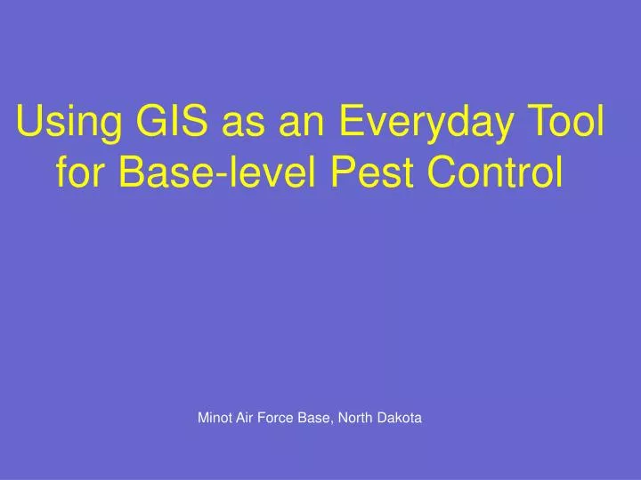
Using GIS as an Everyday Tool for Base-level Pest Control. Minot Air Force Base, North Dakota. Key Elements for System Design. Must be useful---give us information that adds to our overall program. Must SAVE time, not add time to the job. Cheap (Not quite as critical)

E N D
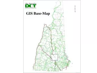
Using GIS as an Everyday Tool for Base-level Pest Control Minot Air Force Base, North Dakota
Key Elements for System Design Must be useful---give us information that adds to our overall program. Must SAVE time, not add time to the job. Cheap (Not quite as critical) Invasive Species, Pollution Prevention $$$ Easy to Use
Benefits Helps to Better Plan Jobs More Accurate Records Prioritize Work Protect Sensitive Areas Assist With Making Accurate Pesticide Applications
Plan Work Use ArcView with the base map and/or create maps using GPS to quickly measure areas needing treatment
Buy and mix the right amount of chemical (Aerial photo may also be used to discover previously unidentified breeding sites.)
Use GPS/Palm to map areas needing treatment. Use ArcView to calculate area to be treated.
Benefits While it’s possible to measure areas to be treated without using GIS, once a few simple skills are mastered using ArcView the task becomes extremely simple and accurate. Accurate measurements let us order the right amount of chemical and mix the right amount for each job. This capability alone has justified the cost and training requirements* for having GIS capabilities readily available in the shop. *Training requirements are less than many would anticipate.
Plan Work---Job Orders Map all jobs scheduled, all jobs of a single type (such as ground squirrels @ Minot), or jobs assigned to each person/team. Shows where the jobs are in general, and where they are in relation to each other for more efficient use of time.
Shows location of jobs. Some are two people calling about the same problem. This is hard to determine from a list of addresses, but easy to see on a map.
Jobs by who they are assigned to---can show how to better distribute work.
Accurate Records Using GPS units attached to handhelds, record exact* locations from survey and control operations, along with pertinent details about each site recorded in a mobile database. *Not really exact—we use “recreation type” GPS units that are accurate within a few feet.
Pendragon Forms used on Palm to record mosquito information.
Treated areas stay on the map for a time corresponding to the effective life of the chemical.
Size and density of leafy spurge found are recorded with Palm/GPS at the site and automatically transferred to the map shown here.
Links to Photos Pictures from digital cameras can be linked to their GPS coordinates and information about the site. This data can be used to measure effectiveness of control operations over time.
You can link digital photos taken in the field to the GPS coordinates. If you do, you can click on the points (stars in this case) and see the picture.
This picture provides an objective record of the density of weed growth at this location. This information will assist in future evaluations of treatment.
Prioritize Work Maps can be used to prioritize work based on severity of problem, stage of growth of the pest, or high-risk areas. Examples: Severity/size of noxious weed infestation Very high counts in mosquito larvae surveys Mosquitoes in 4th instar or pupae stages Breeding sites near child care centers, schools, hospitals
Red squares indicate pupae were found. Yellow circles show there were lots of them. Treat ASAP
GPS linked maps for control work Maps on the PC are transferred back to the handheld w/GPS to guide technicians in control operations, ensure correct areas are found and treated, and ensure areas are not accidentally treated twice. This is especially beneficial when using Altosid (methoprene) for mosquito larvae control since larvae will still be found in areas that have already been treated.
Yellow stars show areas treated Red dots show trees needing treatment, but not yet done.
Map shows areas that need to be treated and also those that do not.
Leafy Spurge surveyed in June (flowers—easy to see), spray in September.
Map Fogging Routes Palm w/GPS (or GPS alone) can be used to record ground fogging operations (similar to system for aerial spraying). Shows applicator where he or she has been and keeps a permanent record of route w/time and speed. Also useful when using WeedSeeker spray boom to record area treated and verify that proper speed is maintained for accurate pesticide application.
Date & Time of Application at one Point Record of fogging. These GPS coordinates were obtained using a Garmin eTrex GPS and are sufficiently accurate for our purposes.
Protect Sensitive Areas Map sensitive areas to ensure pesticides are not accidentally applied to restricted areas. Use Palm/GPS to show applicators exactly where they are at all times and where the restricted areas are.
Red areas need to be avoided to leave food supply for growing flea beetle populations. You are here.
Is It Hard to Use? No! Perhaps the most important lesson to learn from the system we use at Minot is that a comprehensive GIS system can become an integral part of a pest management program --Without adding a lot of additional work --Without extensive knowledge of GIS --Without extensive training, although some training is essential
How It Works Different tasks require different actions, as an example here are the steps that need to take place in order to display information on a map
Public Sub Scrub_GPS() Dim db As Database Dim rec As Recordset Set db = CurrentDb() Dim strGPS As String Dim intLen As Integer 'Check for records with bad GPS readings, either with a "V" or that are too short 'Delete these records and, if there are a lot of them, warn the user that something's up with the Palm entries Set rec = db.OpenRecordset("PROCESS_MOSQUITOES") Do If rec("GPS_Converted") = "New" Then strGPS = rec("sktr_GPS") Dim intCount As Integer If InStr(1, strGPS, "V") Then rec.Delete intCount = intCount + 1 End If End If rec.MoveNext Loop Until rec.EOF Set rec = db.OpenRecordset("PROCESS_MOSQUITOES") Do strGPS = rec("sktr_GPS") If rec("GPS_Converted") = "New" Then intLen = Len(strGPS) If intLen < 10 Then rec.Delete intCount = intCount + 1 End If End If rec.MoveNext Loop Until rec.EOF Set rec = db.OpenRecordset("PROCESS_GPS") Do If rec("GPS_Converted") = "New" Then strGPS = rec("GPS") intLen = Len(strGPS) If intLen < 10 Then intCount = intCount + 1 rec.Delete End If End If rec.MoveNext Loop Until rec.EOF Do If rec("GPS_Converted") = "New" Then strGPS = rec("GPS") If InStr(1, strGPS, "V") Then intCount = intCount + 1 rec.Delete End If End If rec.MoveNext Loop Until rec.EOF If intCount > 5 Then MsgBox "Please check Palm GPS info--significant invald info being reported" 'Oops? End If End Sub
End Function 'This sub will update individual larvae stage information in the "Palm/Attachments" table 'This is necessary because the Palm sends the larvae information all in one field--easy on the 'person entering data, but clunky for the database. Sub updates 7 new fields with Yes/No for each stage 'along with fields for no larvae found and predator critters present (this could affect larvacide choice) 'Larvacide recommendations are made for areas not treated, based on the various instars found 'Products recommended are Agnique, Altosid, Bti or Duplex (Bti + Altosid) Sub Larvae_Stage() 'Declare variables for calcualations Dim db As Database Dim rec As Recordset Set db = CurrentDb() ' The following follow this format:"Set rec=db.OpenRecordset ("Enter table to use here") '***************************************************************************************** Set rec = db.OpenRecordset("PROCESS_MOSQUITOES") '****************************************************************************************** Dim intCounter As Integer Do rec.Edit 'Declare variables to hold data from the Palm entry Dim strPupae As String Dim str1stInstar As String Dim str2ndInstar As String Dim str3rdInstar As String Dim str4thInstar As String Dim strPredatoryCritters As String strTip = "Pending" strPupae = "No" str1stInstar = "No" str2ndInstar = "No" str3rdInstar = "No" str4thInstar = "No" strPredatoryCritters = "No" strNone = "No" 'Determine elasped time for each record, only the last 5 days are used since earlier data is invalid intElaspedTime = DateDiff("d", rec("sktr_TimeStamp"), Now()) 'Only show records for the past 5 days If intElaspedTime <5Then 'A counter is added to show how many records are actually sent to ArcView for mapping (this is mostly 'a warm fuzzy) intCounter = intCounter + 1 'Check larvae/pupae stages found, update tables and variables 'Variables will be used to recommend a larvacide If InStr(1, rec("sktr_PalmInstar"), "1st", vbTextCompare) Then rec("sktr_1stInstar") = True str1stInstar = "Yes" Else str1stInstar = "No" End If
If InStr(1, rec("sktr_PalmInstar"), "2nd", vbTextCompare) Then rec("sktr_2ndInstar") = True str2ndInstar = "Yes" Else str2ndInstar = "No" End If If InStr(1, rec("sktr_PalmInstar"), "3rd", vbTextCompare) Then rec("sktr_3rdInstar") = True str3rdInstar = "Yes" Else str3rdInstar = "No" End If If InStr(1, rec("sktr_PalmInstar"), "Pupae", vbTextCompare) Then rec("sktr_Pupae") = True strPupae = "Yes" Else strPupae = "No" End If If InStr(1, rec("sktr_PalmInstar"), "4th", vbTextCompare) Then rec("sktr_4thInstar") = True str4thInstar = "Yes" If intElaspedTime > 3 Then 'after 3 days assume they've pupated strPupae = "Yes" End If 'Check various combinations of larvae stage to recommend a larvacide 'Areas with 1st instar larvae need Bti, areas w/3rd and 4th need altosid 'Those with both will be treated with "Duplex" 'Those areas with pupae present will need to be treated with Agnique, Agnique is also used for 'areas with 4th instar larvae where the survey is over 3 days old (assuming there are pupae there now) If str1stInstar = "Yes" Then If str3rdInstar = "Yes" Or str4thInstar = "Yes" Then strTip = "Duplex" Else: strTip = "Bti" End If End If If str2ndInstar = "Yes" Then If str3rdInstar = "Yes" Or str4thInstar = "Yes" Then strTip = "Duplex" Else: strTip = "Bti" End If End If If str3rdInstar = "Yes" And str1stInstar = "No" Then strTip = "Altosid" End If If str4thInstar = "Yes" And str1stInstar = "No" Then End If
If strPupae = "Yes" Then strTip = "Agnique" End If If str4thInstar = "Yes" And intElaspedTime > 3 Then strTip = "Agnique" End If If str4thInstar = "Yes" And strTip = "Pending" Then strTip = "Altosid" End If If strPupae = "Yes" And strTip = "Pending" Then strTip = "Agnique" End If If rec("sktr_Treated") = "Y" Then strTip = "Treated" End If If strTip = "Bti" And strPredatoryCritters = "Yes" Then strTip = strTip & " or Altosid" End If If strTip = "Duplex" And strPredatoryCritters = "Yes" Then strTip = strTip & " or Altosid" End If If rec("sktr_NoneFound") = True Then strTip = "Consider pellets" End If Sub GPS_Conversion2() 'On Error GoTo Error_GPS_Conversion3 'Converts GPS Readings from Palm to Decimal Degrees for use with ArcView 'Can use Garmin, Rand McNalley or Magellan Readings with 3 or 4 decimal places for seconds 'Table for conversions must include the following-- 'Number (Double) fields for Latitude and Longitude and a text field for 'GPSType' '(The GPS type can be deleted if desired) 'Plus a text field from the Palm 'Aquire GPS' action & one for "main_GPS_Converted" 'Declare variables for calcualations Dim db As Database Dim rec As Recordset Dim DegLat As Integer Dim MinLat As Integer Dim SecLat As Integer Dim DegLong As Integer Dim MinLong As Integer Dim SecLong As Integer Dim WhereLat As Byte Dim WhereLong As Byte Set db = CurrentDb() ' The following follow this format:"Set rec=db.OpenRecordset ("Enter table to use here") '***************************************************************************************** Set rec = db.OpenRecordset("PROCESS_GPS") '****************************************************************************************** Dim FieldName As String 'Replace "GPS" with the text field for GPS readings from the Palm '**************************************************************************************** FieldName = "GPS" '****************************************************************************************** Do rec.Edit DegLat = 0 'Keeps erroneous data from being recorded on fields w/no GPS readings
'PathAttach is located here in the sub so changes can be made to records that were 'already converted. This path is located in the "Local Setup" module Dim intCount As Integer 'Use for debugging If rec("GPS_Complete") = "New" Then 'Used to find inaccurate GPS data. If InStr(1, rec(FieldName), "V", vbTextCompare) Then rec("GPS_Complete") = "Invalid GPS" Else intCount = intCount + 1 'Used for debugging 'Garmin eTrex If Mid(rec(FieldName), 22, 1) = "E" Or Mid(rec(FieldName), 22, 1) = "W" Then DegLat = Left$(rec(FieldName), 2) MinLat = Mid$(rec(FieldName), 3, 2) SecLat = Mid$(rec(FieldName), 6, 4) DegLong = Mid$(rec(FieldName), 12, 3) MinLong = Mid$(rec(FieldName), 15, 2) SecLong = Mid$(rec(FieldName), 18, 4) 'Check to see where you're at..... If Mid(rec(FieldName), 10, 1) = "N" Then WhereLat = 1 'Northern Hemisphere Else WhereLat = 0 'Southern Hemisphere End If If Mid(rec(FieldName), 22, 1) = "W" Then WhereLong = 1 'Western Hemisphere Else WhereLong = 0 'Eastern Hemisphere End If ElseIf Mid(rec(FieldName), 11, 1) = "W" Or Mid(rec(FieldName), 11, 1) = "E" Then DegLat = Left$(rec(FieldName), 2) MinLat = Mid$(rec(FieldName), 3, 2) SecLat = Mid$(rec(FieldName), 6, 4) DegLong = Mid$(rec(FieldName), 13, 3) MinLong = Mid$(rec(FieldName), 16, 2) SecLong = Mid$(rec(FieldName), 19, 4) 'Check to see where you're at..... If Mid(rec(FieldName), 10, 1) = "N" Then WhereLat = 1 'Northern Hemisphere Else WhereLat = 0 'Southern Hemisphere End If If Mid(rec(FieldName), 11, 1) = "W" Then WhereLong = 1 'Western Hemisphere Else WhereLong = 0 'Eastern Hemisphere End If rec("GPS_Type") = "Garmin eTrex" ' Optional ElseIf Mid(rec(FieldName), 34, 1) = "W" Or Mid(rec(FieldName), 34, 1) = "E" Then DegLat = Mid$(rec(FieldName), 11, 2) MinLat = Mid$(rec(FieldName), 13, 2) SecLat = Mid$(rec(FieldName), 16, 4) DegLong = Mid$(rec(FieldName), 23, 3) MinLong = Mid$(rec(FieldName), 26, 2) SecLong = Mid$(rec(FieldName), 29, 4) 'Check to see where you're at.....
If Mid(rec(FieldName), 21, 1) = "N" Then WhereLat = 1 'Northern Hemisphere Else WhereLat = 0 'Southern Hemisphere End If If Mid(rec(FieldName), 34, 1) = "W" Then WhereLong = 1 'Western Hemisphere Else WhereLong = 0 'Eastern Hemisphere End If 'rec("GPS_Type") = "Other" ' Optional ElseIf Mid(rec(FieldName), 37, 1) = "W" Or Mid(rec(FieldName), 37, 1) = "E" Then DegLat = Mid$(rec(FieldName), 14, 2) MinLat = Mid$(rec(FieldName), 16, 2) SecLat = Mid$(rec(FieldName), 19, 4) DegLong = Mid$(rec(FieldName), 26, 3) MinLong = Mid$(rec(FieldName), 29, 2) SecLong = Mid$(rec(FieldName), 32, 4) 'Check to see where you're at..... If Mid(rec(FieldName), 24, 1) = "N" Then WhereLat = 1 'Northern Hemisphere Else WhereLat = 0 'Southern Hemisphere End If If Mid(rec(FieldName), 37, 1) = "W" Then WhereLong = 1 'Western Hemisphere Else WhereLong = 0 'Eastern Hemisphere End If 'Take data gathered above and convert to decimal degrees If rec("GPS_Complete") = "New" Then rec("GPS_Complete") = "Done" End If If DegLat <> 0 Then 'Convert Latitude If WhereLat = 1 Then 'Northern Hemisphere rec("Latitude") = ((DegLat + MinLat / 60) + (SecLat / 10000 / 60)) ElseIf WhereLat = 0 Then 'Southern Hemisphere rec("Latitude") = ((DegLat + MinLat / 60) + (SecLat / 10000 / 60)) * -1 End If 'Convert Longitude If WhereLong = 1 Then rec("Longitude") = ((DegLong + MinLong / 60) + (SecLong / 10000 / 60)) * -1 ElseIf WhereLong = 0 Then rec("Longitude") = ((DegLong + MinLong / 60) + (SecLong / 10000 / 60)) End If 'End of loop for new entries End If 'End of loop for DegLat value End If End If rec.Update rec.MoveNext Loop Until rec.EOF
Sub ArcView2() On Error GoTo Err_ArcView2 DoCmd.SetWarnings False 'All noxious weeds DoCmd.TransferDatabase acExport, "dBase IV", PathArcView, acTable, "ArcView_NoxiousWeeds", "Weeds", False 'Export Ornamental GPS info 'DoCmd.TransferDatabase acExport, "dBase IV", PathArcView, acTable, "ArcView_(Ornamentals)", "TreeBug", False 'All jobs by building number or GPS DoCmd.TransferDatabase acExport, "dBase IV", PathArcView, acTable, "ArcView_AllbyBldg", "PestTrack", False DoCmd.TransferDatabase acExport, "dBase IV", PathArcView, acTable, "ArcView_AllbyGPS", "GPS", False 'Send dakrat volunteers info 'DoCmd.TransferDatabase acExport, "dBase IV", PathArcView, acTable, "ArcView_DakratVolunteers", "Help", False 'Export Dakrats 'DoCmd.TransferDatabase acExport, "dBase IV", PathArcView, acTable, "ArcView_Dakrats2", "Dakrats", False DoCmd.TransferDatabase acExport, "dBase IV", PathArcView, acTable, "ArcView_Dakrats", "D-Jobs", False 'Export Mosquitoes DoCmd.TransferDatabase acExport, "dBase IV", PathArcView, acTable, "ArcView_Skeeters", "Skeeter", False Exit_ArcView2: Exit Sub Err_ArcView2: MsgBox Err.Description Resume Exit_ArcView2 End Sub
Those are the steps that need to take place for everything to work. Here’s what YOU have to do to make those steps happen--- Just Click This Button
Is It Hard to Use? No! Perhaps the most important lesson to learn from the system we use at Minot is that a comprehensive GIS system can become an integral part of a pest management program --Without adding a lot of additional work --Without extensive knowledge of GIS --Without extensive training, although some training is essential But—you need a system that can automate most or all of the processing needed and make things easy for the user.
Software/Hardware Access Database—Can work with IPMIS, but requires an extra step Pendragon Forms—Palm Database software---$230 + $60 addl units GPS Tracker Mapping Software for Palm---$ 40.00 Uses a picture of an ArcView map, rather than a real map. ArcView 3.1 (8 soon) Palm 515 Handheld----$295 or less Simple to operate and very reliable. Garmin eTrex & Connecting Cables---$150.00 Although a recreational-grade GPS, the eTrex has given us excellent results. Accuracy (about 20 ft—although it usually seems closer) is more than sufficient for our use. We do not use differential GPS.
Disclaimer The system we’re using works very, very well—but is probably not the ideal way to do this. Software and hardware decisions we made were based on what we already had on hand and what we could afford. If we had it all to do over again, we might make significantly different decisions. But--
Key Elements for System Design Must be useful---give us information that adds to our overall program. Must SAVE time, not add time to the job. Cheap--Because it can be Easy to Use
Lessons Learned - - 3 Years & Counting GIS is a great management tool. The technology is extremely well-suited to pest control work. Bad News—It is NOT easy to build a system from scratch Good News---You shouldn’t have to. Because of the nature of geographic information, one system could be used in many different locations with very few modifications
Questions? Vicki Johnson 5th CES/CEOHE 320 Peacekeeper Place Minot AFB, ND 58705 DSN 453-2393/4930 Email: vicki.johnson@minot.af.mil