Download
1 / 41
410 likes | 548 Views
Open Source GIS in Salmon Nation Equity, Ecology, and Economics Presented by Aaron Racicot – GIS Programmer aaronr@ecotrust.org November 16, 2005. A Citizen of Salmon Nation. Outline. Introduction Benefits/Limitations of Open Source Technology Overview OS GIS – Desktop Environments

E N D
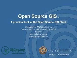
Open Source GIS in Salmon Nation Equity, Ecology, and Economics Presented by Aaron Racicot – GIS Programmer aaronr@ecotrust.org November 16, 2005 A Citizen of Salmon Nation
Outline • Introduction • Benefits/Limitations of Open Source • Technology Overview • OS GIS – Desktop Environments • OS GIS – Server Tools • Workflows of interest • Desktop “paper map” publishing • Web map publishing • Web-Based real-time decision support • Where is it all going? • Where to go for more info
Who am I… B.S. Computer Science M.S. Environmental Science Telemark/BC Skiing Rafting Guide Mountain Rescue Open Source User/Developer GIS Programmer Split Personality
What is Open Source? Free Software! “Free software” is a matter of liberty, not price.
Freedom • Four basic freedoms (The Free Software Foundation): • The freedom to run the program, for any purpose. • The freedom to study how the program works, and adapt • it to your needs. Access to the source code is a precondition for this. • The freedom to redistribute copies so you can help your • neighbor. • The freedom to improve the program, and release your • improvements to the public, so that the whole community • benefits. Access to the source code is a precondition for this.
Benefits/Limitations of Open Source Benefits: • Software cost = $0 • Source code is available and modifiable • User and development communities flourish • Development cycles are VERY fast Limitations: • Total cost is NOT = $0 • Many applications are not as polished as the proprietary counterparts • Compatibility with proprietary software can be an issue
GIS Software Background Historically two main categories of GIS • Desktop environments • Server tools Desktop (commercial solutions): Analysis and Data Manipulation (ArcInfo, ArcGrid) Cartography (ArcView, ArcMap) Image analysis (ERDAS Imagine) Server (commercial solutions): Database Storage (ArcSDE, Oracle Spatial) Web Mapping (ArcIMS) Web Services (ArcWeb) Image and Data Processing (ArcInfo, ArcGrid)
What about Open Source GIS We want to take a look at the Open Source alternatives and what the cost/benefits of both proprietary and OS solutions are.
OS GIS – Desktop Environments GRASS GIS
OS GIS – Desktop Environments Pro’s: • Wide variety of platforms supported (UNIX, Linux, Windows, Mac OS) • You can pick the best tool for the job • Most conform to the OGC standards for interoperability Con’s: • Separate packages all with their own strengths • Requires multiple installs and maintenance • User interfaces are often the last part of development • Harder to produce traditional “paper maps”
OS GIS - Server Tools GRASS GIS GDAL/OGR R-Statistics
OS GIS – Server Tools • Pro’s: • Wide variety of platforms supported (UNIX, Linux, Windows, Mac OS) • Often very fast and efficient for the job • Many formats supported • Con’s: • Linking them together is often hard • Write support is often not supported for proprietary formats • Ability to integrate into proprietary systems is limited (i.e. can not link PostGIS database to ArcMap)
Workflows of Interest Most GIS applications have a similar work flow pattern… • Gather spatially explicit data • Process that data to suit the user needs • Produce outputs useful to the end user
Work Flow – Paper Map Publishing User Request Data Gathering Data Formatting Data Processing Map Formatting Map Production User Response
Workflow – What OSGIS is good at User Request Paper Map Publishing Data Gathering Data Formatting Data Processing Map Formatting Map Production Great at data processing but poor at formatting and creating paper maps User Response
Example – Paper Map Publishing QGIS ArcMap
Work Flow – Web Map Publishing Web User Request Web Services Map Formatting Static Data Storage Map Production Web User Response
Work Flow – What OSGIS is good at Web User Request Web Map Publishing Web Services Map Formatting Static Data Storage Map Production Web User Response Great at all aspects of traditional web-based mapping
Examples – Web Map Publishing Chameleon Custom DHTML/JavaScript
Examples – Web Map Publishing Cartoweb3 CampToCamp Ka-Map DM Solutions
Work Flow – Real-Time Web DST Real-Time Web Decision Support Tools Web User Request Web Services Data Gathering Data Formatting Data Processing Static Data Storage Map Formatting Map Production Web User Response
Work Flow – What OSGIS is good at Real-Time Web Decision Support Tools Web User Request Web Services Data Gathering Data Formatting Data Processing Static Data Storage Map Formatting Map Production The Problem Is The Arrows! Connecting a web request to server side GIS analysis is tricky Web User Response
Example – Real-Time Web DST Siuslaw Watershed Restoration Initiative
Work Flow – Real-Time Web DST Mapserver on the front end… GRASS on the back end… Data Gathering Data Formatting Data Processing Mapserver GRASS
Ecotrust Example At Ecotrust we are trying to help pull it all together in an Open Source context - QGIS and GRASS as a desktop supplement - PostGIS to store vector data layers - Mapserver as a web-based front end - Chameleon as a client user interface - GRASS as a server side GIS for DST development - OGR/GDAL to pre-process all of the vector and raster data - R-Statistics for graphing and statistical work
Ecotrust Example - OCEANSystem R-Statistics User driven… Web interactive tools… GIS analytical computing… Mapserver Chameleon PostGIS GRASS
Ecotrust Example - OCEANSystem QGIS/GRASS
Where is it all going? • Real-Time Decision Support Tools • Integration of OS software across organizations • “Google” type interfaces (smooth user experience) • AJAX driven • Streaming media • Seamless datasets • Large datasets require more pre-processing • Pressure on large private companies to become more responsive to end user needs • Integration of OSGIS with proprietary software – required for migration path… • Start of services based business…
The Future of GIS in Salmon Nation QGIS/GRASS GIS Web-Based Mapserver Fully Integrated Open-Source GIS UMN Mapserver – Making data accessible via the web. Geo-spatial server viewed through a web browser. Taking our vision to a growing audience. QGIS/GRASS GIS – Fully functional server GIS doing the heavy lifting. Runs on the server located at Ecotrust. Adding the analytical glue to make smart decisions based upon sound GIS analysis. Making GIS analysis accessible and affordable for Salmon Nation R-Statistics
Where to go for more info OSGIS • Maptools - http://www.maptools.org • FreeGIS - http://freegis.org/ • Open Source GIS - http://opensourcegis.org/ Standards • OGC - http://www.opengeospatial.org/ Desktop • GRASS - http://grass.itc.it/ • QGIS - http://qgis.org/ • UDIG - http://udig.refractions.net/confluence/display/UDIG/Home • JUMP – http://jump-project.org/ • OpenEV - http://openev.sourceforge.net/ Server/Web • Mapserver - http://mapserver.gis.umn.edu/ • GRASS - http://grass.itc.it/ • PostGIS - http://postgis.refractions.net/ Tools • Remote Sensing - http://remotesensing.org/tiki-index.php • GDAL/OGR - http://gdal.maptools.org/index.html • PROJ.4 - http://proj.maptools.org/
The End Tool Screen Shots Follow
Backup – PostGIS Geometry WKT Geometry