Download

1 / 33
410 likes | 673 Views
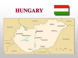
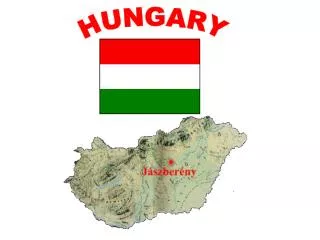
Geography of Hungary. Geology of Hungary. I. Main regions of Hungary Kisalföld, Alföld, Alpokalja, Transdanubian Hills, Transdanubian Mountains, Northern Mountains II. Relief

E N D
Geology of Hungary I. Main regions of Hungary Kisalföld, Alföld, Alpokalja, Transdanubian Hills, Transdanubian Mountains, Northern Mountains II. Relief 67% is plain, the rest are hills and low mountains; lowest altitude 78m, highest altitude 1014 m; 93.030 km² (110.); extension of East-West 520km, of North-South 320 km III. Use your map to fill in the gaps (the bold peaks and the related mountains are part of the paper)!
Vocabulary - Geology geology földtan relief domborzat surface felszín landscape táj plain síkság hills dombság mountain hegység altitude tengerszint feletti mag. extension kiterjedés era (földtörténeti) idő epoch (földtörténeti) időszak period (földtörténeti) kor archean ősidő proterozoic előidő paleozoic óidő mesozoic középidő cenozoic újidő tertiary harmadidőszak quaternary negyedidőszak hydrosphere vízburok atmosphere légkör lithosphere kőzetburok genesis keletkezés craton ősföld mica csillámpala shale agyagpala slaty palás limestone mészkő dolomite dolomit sandstone homokkő clay agyag sand homok pebbles kavics fluvial sediment folyami üledék loess lösz granite gránit rhyolite riolit andesite andezit basalt bazalt ore érc peat tőzeg lignite lignit oil kőolaj natural gas földgáz
Minerals of Hungary I. Ores are rocks with high metallic content. The different types of metals (heavy-, non-ferrous-, precious metals) develop mainly in and in the neighbourhood of a blocked mass of magma in the crust. This way accumulation of ores are mainly connected with volcanism. Bauxite is the main exception because it forms through a sedimentary process (denudation – transport – deposition). II. Energy resources are sedimentary rocks accumulated in oceanic or maritime basins, on shores. 1. Oil and natural gas are remnants of planktons transformed in anaerob environment under great pressure over long periods of time. Oil and gas usually migrates form the place of origin to traps sealed up by watertight rocks. Most oil reserves are geologically young formed in the Tertiary epoch. Available stock in the world will be exploited in the coming decades. 2. Coal (peat – lignite – brown coal – hard coal – bituminious coal) forms when large forests bury and timber gets under great pressure without oxygen for a long peroid of time. The best and largest coal deposits developed in the Paleozoic (Carboniferous period) and – at the present rate of extraction – are enough for centuries.
V. Natural resources of Hungary. Fill in the gaps using your atlas (the bold minerals and the related extraction sites are part of the paper)! Region of extraction: Mecsek, Dél-Alföld, Nógrádi-medence, Mátra, Bakony, Rudabányai-hg., Mecsek, Mátraalja Settlement of extraction: Algyő, Halimba, Rudabánya, Visonta, Kővágószőlős, Komló, Salgótarján, Recsk Geological period of development: Paleozoic(1), Mesozoic(3), Tertiary(4) Utilization: alum earth production, non-ferrous metallurgy, steel production, production of basic starting materials for chemicals, supplying nuclear power stations, production of thermal power, metallurgy, fuel production
Vocabulary - Minerals natural resource természeti erőforrás energy resource energiahordozó raw material nyersanyag mineral ásványkincs extract kitermel open pit mining külszíni fejtés deep cultivation mélyművelés deposit telep heavy metal nehézfém iron vas uranium urán nickel nikkel manganese mangán non-ferrous metal színesfém copper réz lead ólom zinc cink tin ón precious metal nemesfém gold arany silver ezüst bauxite bauxit alum earth timföld crust földkéreg denudation lepusztulás deposition felhalmozás sedimentary rock üledékes kőzet maritime tengeri remnant maradvány anaerob oxigénmentes watertight vízzáró exploit kiaknáz decade évtized peat tőzeg lignite lignit hard coal feketekőszén bituminious coal antracit timber faanyag utilization hasznosítás chemicals vegyipar nuclear power station atomerőmű thermal power hőenergia fuel üzemanyag
Climate of Hungary Hungary is situated in the temperate zone and has humid continental climate. Prevailing winds are the westerlies, that bring about large amount of water vapour from the Atlantic ocean in swirling cyclones containing cold fronts and warm fronts. The cyclones are responsible for the quick changes in our weather. In the neighbourhood of cyclones anticyclones form, that bring about sunny, clear weather. In the summer anticyclones are responsible for drought and in wintertime for very cold weather. The most important action centres influencing the climate of the Carpathian basin are: a, the oceanic effect from west which makes summers cool and winters mild and brings about more precipitation b, the continental effect from east which makes summers very hot and winters very cold and both seasons very dry c, the mediterranean effect from south that makes summers very hot and winters more mild and wet
I. Main climatic figures • Duration of sunshine varies between 1800-2100 hour/year • Annual mean temperature is around 10-11°C • Warmest month is July, the coldest January • The mean annual temperature range is 19°C • Patterns in the change of temperature around the year a, the ice saints (Pancras, Servatius, Boniface: 12-14.05.) bring a break in spring warming caused by cold polar air masses b, Medard day (08.06.) brings a drop of temperature and lasting rainfall caused by a strong inflow of oceanic air masses c, indian summer of late septembers and early octobers are brought about by calming cyclone activity • Winds are not strong, the usual direction is northwestern • The mean annual precipitation is 600-700 mm/year • The most wet regions are the Alpokalja, the Zalai-hills and the peaks of mountainous regions, and the driest areas are the Nagykunság, Jászság and Hortobágy • The distribution of precipitation is uneven, the largest proportion falling down at the end of spring and beginning of summer. There is another peak in autumn due to the mediterranean cyclones. Drought is frequent in August, but the most arid month is January.
climate éghajlat weather időjárás torrid zone trópusi öv temperate zone mérsékelt öv frigid zone hideg öv humid continental nedves kontinentális prevail uralkodik, érvényesül trade winds passzát szelek westerlies nyugatias szelek polar winds sarki szelek water vapour vízgőz swirling örvénylő cyclone ciklon cold front hidegfront warm front melegfront anticyclone anticiklon draught aszály, szárazság cool hűvös mild enyhe precipitation csapadék duration of sunshine napfénytartam mean annual temperature évi középhőmérséklet mean annual temperature range évi közepes hőingás pattern rendszer the change of temperature around the year a hőmérséklet évi járása ice saints fagyosszentek lasting tartós rainfall esőzés inflow beáramlás indian summer vénasszonyok nyara calming csendesedő northwestern északnyugati distribution of precipitation csapadék eloszlása uneven egyenlőtlen frequent gyakori insolation besugárzás radiation kisugárzás absorption elnyelés convection feláramlás condensation kicsapódás hail jégeső dew harmat frost dér rime zúzmara Vocabulary - Climate
Hydrography of Hungary I. Underground water 1. Ground water drained by wells was the most important source of drinking water (contagion). It accumulates above the first impermeable layer (e.g. clay). High level of ground water rots plants and has to be drained by a system of drainage ditches, channels. 2. Confined water is the most important drinking water source today. Sand, pebbles filter the water of rivers, lakes and precipitation. This water is stored at great depths over a long period of time between two watertight layer in a water-bearing one. a, bank-filtered water is cleaned by sand and pebbles along the bed of a river (drinking water of Budapest) a, artesian water is brought to the surface by bed pressure through a drilled hole in an artesian basin (Szolnok, Hódmezővásárhely, Szeged, Margit-sziget, Városliget) b, mineral water contains large amount of minerals dissolved from rocks (Kékkút, Szentkirály, Visegrád) c, thermal water is warmer than 20°C and it stems along fracture lines in block-mountains (Zalakaros, Hévíz, Harkány) 3. Karst water springs are based on water percolated through cracks and crevices in limestone. They supply populations of large hungarian towns, like Pécs or Miskolc.
II. Rivers 1. The whole country belongs to the catchment area of the Danube that is navigable throughout the year. a, Most important affluents are Rába, Sió, Dráva on the right and Vág, Garam, Ipoly on the left. b, Entering the Carpathian Basin it deposited sediments in the Quaternary forming Szigetköz and Csallóköz. It accelerates and deepens its valley in the Danube Bend. After the mountainous region its flow slows down and builds Szentendrei-, Margit-, Csepel- and Mohácsi-islands. 2. River Tisza meanders through the Alföld due to its small channel gradient. a, Notable affluents are Bodrog, Sajó, Zagyva on the right, and Szamos, Körös, Maros on the left side. b, Long and dense irrigation system belongs to the river. c, Navigation is often hindered by extreme fluctuation of water level. 3. Floods are usual in the spring (snowbreak) and at the beginning of the summer (precipitation maximum).
III. Lakes 1. The largest lake of Central-Europe is the Balaton (78km-15km-11km) a, The water accumulated in a trench formed by faulting. b, As a result of small mean depth it can warm up and freeze over easily. c, It’s territory shrinks as rivers (Zala) deposit their load in the basin. d, Spits built by waves caused by föhn wind from the Bakony separate groves on the southern shore. 2. Fertő lake is shallow and salty in the final state of uploading. 3. Velencei lake is shallow and large part of it is covered by reed. 4. The basin of Fehér lake next to Szeged was eroded by the wind. 5. There are many oxbow mort-lakes along the river Danube and Tisza partly due to river regulation (Szelidi-tó). 6. Hévízi lake and Miskolctapolcai lake are spring lakes with warm water. 7. Artificial lakes store water for irrigation, drinking and industrial aims, e.g. Tisza lake.
hydrography vízrajz underground water felszín alatti víz ground water talajvíz soil moisture talajnedvesség well kút contagion fertőzés impermeable vízzáró water-tight vízzáró water-bearing víztartó aquifer víztartó reservoir víztározó clay agyag ditch árok channel csatorna confined water rétegvíz pebble kavics bank-filtered water parti-szűrésű víz artesian water artézi víz bed pressure rétegnyomás deep-drilling mélyfúrás mineral water ásványvíz thermal water termálvíz fracture line törésvonal tributary mellékfolyó water network vízhálózat percolate beszivárog crack repedés crevice hasadék catchment area vízgyűjtő terület watershed vízválasztó vonal affluent mellékfolyó flood áradás water level vízállás fluctuating ingadozó meander kanyarog navigable hajózható snowbreak hóolvadás trench árok faulting vetődés load hordalék spit turzás grove berek reed nád erosion lepusztulás oxbow mort-lake lefűződött morotva tó river regulation folyószabályozás Vocabulary - Hydrography
Demography of Hungary I. Demography describes the number and composition of the population. The difference between the crude death rate and birth rate gives natural increase and decrease. The population pyramid is the figure describing the population by age groups and sex. II. Decisive factors behind natural decrease in Hungary - declining number of births - high grade of infant mortality - low life expectancy of men (cardiovascular diseases, cancer, suicide, high proportion of smokers and alcoholics) III. The composition of the population is unfavourable as the number of young people declines and the rate of elders (above 50) exceeds 33%.
IV. Migration can influence the number of population. In Hungary emigration drains the young and educated groups (engineers, doctors) striving for higher salary and better research possibilities. The level of immigration raised since the late eighties. Immigrants are mainly Hungarians coming from the neighbouring countries. V. The Hungarian minority is the largest in Europe, 2.5 million Hungarians live in the neighbouring countries: Romania 1.4 million, Slovakia 540 000, Serbia 340 000, Ukraine 150 000, Croatia 16 000, Slovenia 8000, Austria 7000 In Hungary 99% of the population speaks Hungarian but 3.2% belongs to one of the national minorities: germans 62 000, slovaks 18 000, romanians 8000 and the gypsies as an ethnic minority 300 000 – 500 000. V. Number of population: 9 938 000 (10. 2012.) Unemployment rate: 10% Structure of occupation: agriculture 4%, industry 27%, service industry 69% Inflation: 6% GDP-change: -1%
demography demográfia crude death rate halálozások száma crude birth rate születések száma natural increase természetes szaporodás natural decrease természetes fogyás population pyramid korfa figure ábra age group korcsoport sex nem decisive döntő factor tényező infant mortality csecsemőhalandóság life expentancy várható élettartam disease betegség infectious fertőző cancer rák cardiovascular szív- és érrendszeri suicide öngyilkosság smoker dohányos alcoholic alkoholista unhealthy egészségtelen minority kisebbség migration vándorlás emigration kivándorlás immigration bevándorlás engineer mérnök unemployment munkanélküliség employee munkavállaló qualification képzettség structure of occupation foglalkoztatási szerkezet agriculture mezőgazdaság industry ipar service industry szolgáltatások research and development kutatás, fejlesztés primary elsődleges, primer secondary másodlagos, szekunder tertiary harmadlagos, tercier quaternary negyedleges, kvaterner branch of the economy gazdasági ágazat sector of the economy gazdasági ág Catholic katolikus Calvinistic református Lutheran evangélikus non-believer vallástalan Vocabulary - Demography
Settlements of Hungary I. A settlement is a locality where people live and/or work. The settlements interact whith each other, the national system of them is the network of settlements. Settlements meeting more demands develop catchment area around them. II. Development of settlements is determined by two factors: 1. Natural conditions: fertile soil, favourable climate, plain landscape, natural protection, river valley, source of drinking water, ford, minerals 2. Social conditions: technology for processing raw materials, qualification, strength, lack or surplus of manpower, infrastructure Infrastructure is all the institutions securing the operation of the economy. Hard infrastructure includes all material facilities (network of roads and railways, utility lines, relay stations, buildings and equipments of financial, medical, educational, cultural, scientific and sports institutions, means of public transport, airports, harbours, telecommunication network). Soft infrastructure includes all intellectual conditions (monetary system, education, healthcare, cultural and scientific activities, administration, other services) available for economic development.
III. The network of settlements in Hungary contains: a capital Budapest 24 county cities centres for the counties + Dunaújváros, Érd, Hódmezővásárhely, Nagykanizsa, Sopron other cities 303 municipalities 2824 The largest unit of administration is the county (19) estabilished by István I. and the county cities (cities with a population above 50 000 people) operate independently as well. IV. The most common and oldest type of settlements is the village, but as agriculture becomes mechanized villagers commute to cities to work and abandone the rural way of life. Types of villages by floor plan 1. The irregular street construction of a cluster village was formed by organic expansion. 2. The single street village is usual in the valleys of hilly and mountainous regions 3. The checkerboard floor plan village was constructed according to a design, streets are rectangular.
locality hely interact kölcsönhatásban lenni national system országos rendszer network of settlements településhálózat meet demand szükségletet kielégít catchment area vonzáskörzet natural condition természeti adottság social condition társadalmi feltétel fertile termékeny favourable kedvező landscape táj ford gázló mineral ásványkincs process feldolgoz raw material nyersanyag qualification szakképzettség strength létszám lack of hiány vmiből surplus of többlet vmiből manpower munkaerő infrastructure infrastruktúra institution intézmény hard infrstructure anyagi infrastruktúra material facilities anyagi létesítmény utility line közművezeték electrical transmission line elektromos távvezeték pipeline csővezeték sewer system csatornahálózat relay station átjátszó állomás public transport tömegközlekedés administration közigazgatás municipality község mechanize gépesít commute ingázik floor plan alaprajz cluster village halmazfalu single street village egyutcás falu checkerboard floor plan sakktábla alaprajzú falu rectangular derékszög organic szerves expansion terjeszkedés homestead tanya scattered settlements szórványtelepülés Vocabulary – Settlements
The structure of Budapest I. Central business district - governmental, jurisdictional and cultural institutions, monuments, banks, luxurious hotels and shops, currency exchanges, office buildings - Parliament, ministries, Prime Minister’s Office, Curia (Supreme Court), Constitutional Court, National Office for the Judiciary, Prosecutor General’s Office, Metropolitan Court, Hungarian State Treasury, Hungarian National Bank, Budapest Stock Exchange, Hungarian Academy of Sciences, National Archives of Hungary, National Széchényi Library, Saint Stephen’s Basilica, Buda Castle, Fisherman’s Bastion, Matthias temple, headquarters of banks and international organizations, Intercontinental, Hilton, Kempinski, Gresham, Astoria - I., V. districts
II. Central residential area - multi-storeyed blocks of flats, markets, halls, small specialised shops (second hand book-, antique-, do-it-yourself-, gift-, flowershops, greengrocer’s, jewelry, shoe store), non-stop shops, groceries, workshops (glazier, cobbler, tailor, carpenter), nightclubs, pubs, bars discotheques, post and bank outlets, shopping malls, small public parks, educational and health institutions, libraries, cinemas, theaters, cabarets, hotels, busiest public transportation lines - Lehel square, Hunyadi square, Rákóczi square, Garay square, Király street, Baross street, Szondi street, Kazinczy street, Hungarian National Museum, Comedy, Opera House, MÜPA, Millenáris, A38, Szóda, Szimpla, Moulin Rouge, Süss Fel Nap, Cha-Cha-Cha, Bahnhof, Fészek, Dürer-garden, Kertem, Kiadó, West End, Aréna, Mammut, Allee, Récsey Center, ELTE, SOTE, Károli, Pázmány, Szabó Ervin, Kino, Puskin, Művész, Corvin, Uránia, Vörösmarty, Cirko-Gejzír, Bem, Radnóti, Thália, Bábszínház, Karinthy, Katona, József Attila, Magyar - VI., VII., VIII., IX. districts (Terézváros, Erzsébetváros, Józsefváros, Ferencváros)
central business district belső munkahelyöv central residential area belső lakóöv outer business district külső munkahelyöv outer residential area külső lakóöv monument műemlék currency exchange pénzváltó hely office building irodaház Supreme Court Legfelsőbb Bíróság Curia Kúria Constitutional Court Alkotmánybíróság National Office for the Judiciary Országos Bírósági Hivatal Prosecutor General’s Office Legfőbb Ügyészség Metropolitan Court Fővárosi Törvényszék Hungarian State Treasury Magyar Államkincstár Budapest Stock Exchange Budapesti Értéktőzsde Hungarian Academy of Sciences Magyar Tudományos Akadémia National Archives of Hungary Magyar Országos Levéltár National Széchényi Library Országos Széchényi Könyvtár cinema mozi theater színház library könyvtár Buda Castle Budai Vár Fisherman’s Bastion Halászbástya headquarter székhely international organization nemzetközi szervezet block of flats bérház multi-storeyed többemeletes hall vásárcsarnok second hand book shop antikvárium antique shop régiség bolt do-it-yourself shop (DIY) barkácsbolt greengrocer’s zöldséges jewelry ékszerbolt shoe store cipőbolt workshop műhely glazier üveges cobbler suszter tailor szabó carpenter asztalos post outlet postahivatal bank outlet bankfiók cabaret kabaré public transport tömegközlekedés Vocabulary - The structure of Budapest I
III. Outer business district - industrial firms, office buildings, warehouses, railway and bus stations, vehicle depots, specialised shopping centres, exhibition halls, public parks, sports fields, large health institutions, cemeteries, prisons, barracks - Continental, RG, Dreher, Chinoin, GE-Tungsram, Csepel Works, Public Slaughterhouse, Police Palace, Duna Tower, Infopark, Graphisoft Park, Angyalföld, KÖKI, Zugló, Rákosrendező, Stadionok, Népliget, Mexikói street, Angyalföld, Praktiker, OBI, Baumax, Budapest Expo, Városliget, Népliget, Városmajor, FTC, BVSC, Honvéd, Kispest, Vasas, Kincsem Park, Szent István -, Szent László -, Szent Margit -, Szent János -, Heim Pál kórházak, Fiumei úti sírkert, Újköztemető, Farkasréti cemetery, Kozma street, MAglódi street, Petőfi Sándor barrack, Zrínyi Miklós barrack, Dózsa György street - X., XIII., XIV., XIX.,districts
IV. Outer residential area - modern housing estates, garden city, airports, industrial parks, logistic centres, large markets - Békásmegyer, Káposztásmegyer, Újpalota, Rákosplalota, Kispest, Havanna úti housing, Pestszentimre, Pestszentlőrinc, Mátyásföld, Csepel, Liszt Ferenc airport, Tököl airport, Budaörsi airport, BILK, M3 logistic centre, Waberer’s, wholesale vegetable and flower market, car market - IV., XV., XVI., XVII. districts V. Satellite settlements - detached houses - commuting population - Pomáz, Pilisvörösvár, Érd, Dunakeszi, Pécel, Vecsés, Gyál
office building irodaház warehouse raktár vehicle depot remiz exhibition hall kiállítási csarnok brewery sörgyár paper mill papírgyár pharmaceuticals gyógyszergyártás engineering gépgyártás chemicals vegyipar metallurgy vaskohászat non-ferrous metallurgy színesfém-kohászat automotive industry autógyártás armament industry fegyvergyártás tyre manufactoring gumiabroncs gyártás public park közpark playing-field sportpálya soccer field focipálya tennis court teniszpálya swimming pool uszoda athletic field atlétikai pálya hippodrom lóversenypálya hospital kórház internal medicine belgyógyászat surgery sebészet throat specialist fül-orr-gégészet obstetrics szülészet gynecology nőgyógyászat emergency room intenzív bedlam tébolyda cemetery temető prison börtön barrack kaszárnya housing estate lakótelep garden city kertváros airport repülőtér industrial park ipari park logistic centre logisztikai központ satellite settlements agglomeráció detached house családi ház semi-detached house ikerház commute ingázik catchment area vonzáskörzet Vocabulary – The structure of Budapest II
Transport of Hungary I. Transport with passenger transport and freight links dwellings and working places, settlements, our country and the world. Transport delivers raw materials for processing or finished goods for consumption. II. Hard infrastructure includes all material facilities (network of roads and railways, utility lines, relay stations, buildings and equipments of financial, medical, educational, cultural, scientific and sports institutions, means of public transport, airports, harbours, telecommunication network). III. The strucutre and quality of infrastructure reflects and influences the level of economic development of a country. IV. Regarding transport the location of Hungary is favourable as it lies in a less indented basin-like area where roads connecting Western and Eastern Europe and Southern and Northern Europe meet.
IV. The network of roads 1. The advantage of transport by road is being quick and door-to-door, it is most economic by rapidly deteriorating or by small and valuable goods. It is expensive and endangers the environment. 2. The structure is strongly centralized and radially organized. The links connecting the highways in the countryside are not finished yet. 3. The main roads of the country are numbered starting with the most important one connecting the capitol with Western Europe from 1 to 8 and measured from Buda Castle 4. The number of the bridges over the Danube has risen recently (19 bridges: Vámosszabadi, Komárom – Erzsébet híd, Esztergom – Mária Valéria híd, Budapest – Megyeri híd, Újpesti vasúti híd, Árpád-híd, Margit-híd, Széchenyi lánchíd, Erzsébet híd, Szabadság híd, Petőfi híd, Rákóczi híd, Összekötő vasúti híd, Deák Ferenc híd, Dunaújváros – Pentele híd, Dunaföldvár – Beszédes József híd, Szekszárd – Szent László híd, Baja – Türr István híd). 5. The national network of roads is connected with international transport lines through frontier stations (Hegyeshalom-1, Rajka, Komárom, Esztergom, Parassapuszta-2, Balassagyarmat, Salgótarján, Bánréve, Tornyosnémeti-3, Záhony-4, Csengersima, Ártánd, Nagylak, Röszke-5, Tompa, Barcs-6, Letenye-7, Rédics, Rábafüzes-8, Sopron).
V. The network of railways 1. Transport of people and bulk goods is most economic by railway, it is cheap and environmentally friendly but is tightly connected with the railway line. 2. The structure is strongly centralized and radially organized. The links connecting the radial main lines are abroad as a result of the peace treaty of Trianon. 3. The technical standard of the railway network, the wagons and locomotives is out-of-date VI. Air transport 1. Air transport bridges large distances, it is important in transporting passengers and small, valuable goods. 2. International airports of Hungary are Liszt Ferenc airport receiving freight, small airplanes and passenger traffic, Sármellék and Debrecen. VII. Water transport 1. It’s clean and energy saving but very slow. 2. Navigable rivers are: Danube, Tisza, Sió, Dráva, Maros, Körös, Bodrog, Keleti-főcsatorna, Balaton, Velencei-tó 2. Water regime in Hungary is fluctuating, water depth at many sections is unsatisfactory for larger vessels and the number and standard of international harbours is low (Győr-Gönyű, Komárom, Budapest, Dunaújváros, Baja, Mohács).
passanger transport személyszállítás dwelling lakóhely raw material nyersanyag process feldolgoz finished good késztermék consumption fogyasztás hard infrastructure anyagi infrastruktúra material facility anyagi létesítmény utility line közművezeték relay station átjátszó állomás public transport tömegközlekedés telecommunication network távközlési hálózat reflect tükröz, kifejez influence befolyásol indented tagolt (domborzatilag) door-to-door háztól-házig narrow gauge line keskeny nyomtávú vonal freight teheráru, árut szállít, fuvaroz flight repülőjárat canal csatorna cargo rakomány deteriorate romlik perishable romlandó valuable értékes endanger veszélyeztet centralized központosított radially sugarasan countryside vidék frontier station határállomás environmentally friendly környezetbarát energy saving energiatakarékos air pollutants légszennyező anyagok wagon vasúti kocsi locomotive mozdony water regime vízjárás fluctuate ingadozik inland navigation folyami hajózás marine navigation tengeri hajózás navigable river hajózható folyó bulk carrier uszály freighter teherhajó icebreaker jégtörő truck, lorry teherautó goods traffic árufuvarozás Vocabulary - Transport
VIII. Exercise. Put the settlements on the railwayline and on motorway M5 in the right sequence! Budapest, Paks, Érd, Dunaújváros, Sárbogárd, Dombóvár, Szekszárd, Komló, Szentlőrinc, Pécs Cegléd, Szolnok, Lajosmizse, Dunaújváros, Kecskemét, Hódmezővásárhely, Szentes, Kiskunfélegyháza, Szeged, Röszke