Download
1 / 21
210 likes | 386 Views
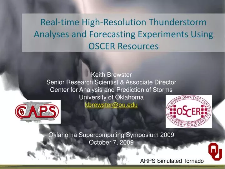
Real-time High-Resolution Thunderstorm Analyses and Forecasting Experiments Using OSCER Resources. Keith Brewster Senior Research Scientist & Associate Director Center for Analysis and Prediction of Storms University of Oklahoma kbrewster@ou.edu Oklahoma Supercomputing Symposium 2009

E N D
Real-time High-Resolution Thunderstorm Analyses and Forecasting Experiments Using OSCER Resources Keith Brewster Senior Research Scientist & Associate Director Center for Analysis and Prediction of Storms University of Oklahoma kbrewster@ou.edu Oklahoma Supercomputing Symposium 2009 October 7, 2009 ARPS Simulated Tornado
About CAPS • Research Center at the University of Oklahoma • Storm-Scale Weather Analysis and Prediction • Founded in 1989 as an NSF Science and Technology Center • Now supported through individual research grants • NSF, NOAA, FAA, NASA, ONR, Private Industry grants
CAPS Research Areas Applied Research Basic Research Bridge toOperations Mesoscale/Convective Processes Studies NWP &Real-Time NWP SPC/NSSL HazardousWeatherTestbed Data AssimilationResearch & Application
About CAPS – Computing • CAPS: Linux Workstations and Clusters • CAPS Ingest Cluster • Real-time Weather Data Ingest & Storage • Pre-processing of data for real-time experiments • Development Workstations & Servers • Code Development/Visualization/Local Storage • OU Supercomputing Center for Education & Research - OSCER • Sooner ~4000 cores • NSF TeraGrid • Really Big Iron Used for Large-scale Experiments • Ensemble Models run over 2/3 CONUS in Spring • Large Data Assimilation Experiments
CAPS Research Using HPCOSCER & TeraGrid • Storm-scale Process Studies • Storm Initiation (IHOP Project) • Tornadogenesis (Vortex & Vortex2 Projects) • Hurricane Intensity/Tracks • Storm-scale Data Assimilation Research • Doppler Radar Wind and Reflectivity • Dual-Polarization Variables • Radar Refractivity → Low-level Humidity • Linked Environments for Atmospheric Discovery (LEAD) • Democratization of NWP • Real-Time Numerical Weather Prediction Experiments • Post-processing Ensemble of WRF & ARPS Forecasts • High Resolution Forecast
Chickasha CASA Radar Network Rush Springs Cyril Lawton-E
Analysis and Prediction in Closed Loop System LDM Ingest Data Assimilation Other Data QC/Preprocessing Analyses/forecasts mesonet NWP grid End users 88D Radars Detection Scan steering and scheduling Scanning rules Verification Response CASA Radars
2009 CASA Analyses & Forecasts • Real-time wind analyses every 5 minutes, provided to forecasters at HWT warning facility. • Real-time forecasts up to 6-hours available within 30-90 minutes, assimilating CASA and all other data. Two forecasts can be run simultaneously.
Real-time Wind Vector Analysis • Provide intuitive products that non-experts can understand and use – difficult to interpret raw radial velocity data • Improve human-based detection and warning • Show benefits of multi-sensor data analysis and temporal consistency through model assimilation • Framework for modeling or automated extrapolation
2009 3DVAR Wind Analysis for HWT Using CASA, NEXRAD,OK Mesonet, and NAM background 24/7, every 5 minutes About 10 min delay 32 processors each task 100 total processors assigned OKC NEXRAD KSAO KCYR KRSP KLWE • dx = 400 m, dz=400 for z<2km • 160 x 160 km • 10 levels up to 10 km AGL • Integrated with display in HWT • Graphical products also posted on the web in real-time KFDR NEXRAD IP1 radar coverage (40 km range) NEXRAD (60 km range ring), OK Mesonet sites
May 14, 2009 (UTC) Anadarko Tornado Case Full attenuation Chickasha 0223 UTC (9:23pm CDT) May 13, 2009 Chickasha
Analysis and Detection of Feb 10, 2009 Case of Low-level Vortex 3DVAR analysis of low-level winds at 200-m resolution Velocity shear from WDSS-II Shear Algorithm Observed Reflectivity 4:10pm CDT 2/10/2009 (multi-radar merged)
2009 CASA NWP Experiment • Goals: Examine, in near real-time, the impact of IP1 data on convective storm forecast; provide forecast products to forecasters. • Up to two simultaneous on-demand forecasts at 1-km resolution, assimilating CASA radar and other available observations. • Using 800 processor cores each on OU OSCER supercomputer • 6 h forecasts produced within 1.5 hours • Forecast products available at http://www.caps.ou.edu/wx/casa as soon as they are produced. • Data sent to HWT in realtime – did not get evaluated in realtime due to focus on wind analysis products - will be in the future.
2009 Forecast Configuration t0 T0-0.5h t0+6h Using ARPS 3DVAR and the ARPS cloud analysis. Incremental Analysis Updating applied to smoothly insert dataand allowmodel adjustment 1.5 hours to complete each 6-h forecast Dx = 1 km 600x540x20 km 6-hour Forecast 40-min DA IAU IAU IAU IAU 0100 0050 0110 0120 0130 02 03 04 05 06 07
Assim. v.s. Analysis Wind Speed/Vectors at 500m AGL at 0216 UTC Chickasha Forecast /Assimilation Analysis
Assim. v.s. Analysis Wind Speed/Vectors at 500m AGL at 0220 UTC Chickasha Forecast/Assimilation Analysis
0220 UTC 0230 UTC Movie Pres 0240 UTC 0250 UTC Forecast temperature perturbation + Vort. at z =500m AGL
2010 Plan • 20 min reflectivity nowcasting every 1-2 minutes • 3DVAR wind analyses every ~2 minutes, • 30-minute NWP VSRFs every ~10 minutes.
Planned Forecast Configuration Rapidly updated forecasts 0140 0150 0200 0210 0220 0230 0100 0110 0120 0130
Concluding Thoughts • Wide range of weather research being pursued • 3 Real-Time experiments runsimultaneously each spring • Generated 3d assimilated data sets forprocess studies – e.g. tornadogenesis • Other Daily Weather Analyses & Forecasts provided 24/7/365http://www.caps.ou.edu/wxhttp://www.caps.ou.edu/ADAS.html • OSCER is enabling useful scientific discovery in storm-scale analysis and prediction at CAPS!! kbrewster@ou.edu