Download
1 / 10
120 likes | 509 Views
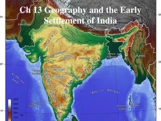
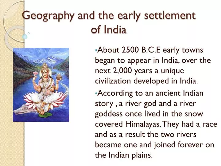
Geography and the early settlement of India. About 2500 B.C.E early towns began to appear in India, over the next 2,000 years a unique civilization developed in India.

E N D
Geography and the early settlement of India About 2500 B.C.E early towns began to appear in India, over the next 2,000 years a unique civilization developed in India. According to an ancient Indian story , a river god and a river goddess once lived in the snow covered Himalayas. They had a race and as a result the two rivers became one and joined forever on the Indian plains.
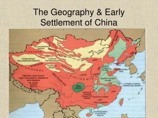
Brahmaputra River • India is a large triangular landmass that juts out from the southern part of Asia. • The Brahmaputra river runs through the steep Himalayas. Through there the Brahmaputra winds carry through the snowcapped mountains and narrow canyons. • The river becomes slower and deeper as it runs through the valley and every summer this part of the river receives added water from heavy monsoon rains. • Eventually the Brahmaputra river meets the Ganges river.
Deccan plateau • The Deccan plateau is a triangle shaped area that lies between two mountain ranges in Southern India. • The plateau is flat and hilly and fairly dry. • There are a few rivers, but the monsoon rains provide most of the water. • The soil on the plateau is rich in Iron and good for growing cotton although much of the rest of the land lacks minerals and is harder to grow crops.
Eastern and Western Ghats • The Eastern and Western Ghats are long mountain chains near the coast of India. • We see the Ghats form a large V on a map • The Western Ghats are higher than the Eastern and have steep slopes, narrow valleys, thick hardwood forests and heavy rains. • The Eastern Ghats are not as wet as the Western and have several rivers flow through the green mountains. Eastern Ghats Western Ghats
Ganges River • The Ganges River flows across most of Northern India. The river makes its way South through the Himalayas • As the river passes through the plains it leaves rich sediment behind making it some of the most fertile soil in the Northern plain. • During the Rainy season the river can flood and destroy crops planted along its bank.
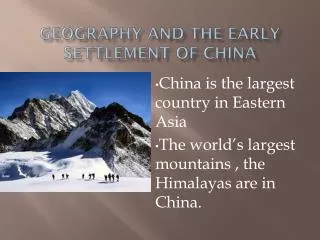
Himalaya Mountains • The Himalaya Mountains is located along India’s northern border. This mountain range is the highest in the world and the worlds tallest mountain Mt Everest is part of the Himalayas. • The Himalayas live up to their name , which means “home of snows.” The highest peaks are always covered and snow and ice. • With the Earth moving every year Mt. Everest rises slightly every year.
Hindu Kush Mountains • The Hindu Kush mountains form a rugged barrier between the Indus river valley and Afghanistan. • Some of its peaks are almost five miles high and snow and ice cover the steep slopes and peaks. • The Khyber pass forms a gap about 30 miles long in the mountains on the Afghanistan-Pakistan border.
Indus River • The Indus River begins in the Himalayas and gets its water from snow melting in The Hindu Kush Mountains. This runoff of melting snow and ice from the mountains keep the water level high. • The Indus River Valley contains some of the best farmland because of the silt from the mountains to the plains.
Thar Dessert • The Thar desert in Northern India is mostly sand and stone. • Huge rolling sand dunes stretch for hundreds of miles. There is very little plant life and rain is rare. • Many animals and birds live in the wildlife including more than forty five kinds of lizards and snakes. Animals include gazelles, quail, ducks, and geese.
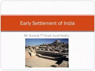
First Settlements in India • Like many other civilizations most people settle near water. The River could also be used for travel and trade. • The first known settlement in Ancient India was the Indus River Valley. They were farming communities set up along the Indus and Ganges River.