Download
1 / 67
670 likes | 813 Views
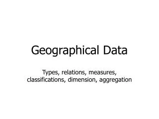
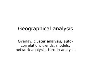
Geogra phical analys is. Overlay, cluster analys is , auto - correlati on , trends, model s , netw o rk analys is , spatial data mining. Geogra phical analys is. Combinati on of different geogra ph ic data sets or themes by overlay o r statisti cs Discovery of pat terns , dependencies

E N D
Geographical analysis Overlay, clusteranalysis, auto-correlation, trends, models, networkanalysis, spatial data mining
Geographical analysis • Combinationof different geographic data sets or themesby overlay or statistics • Discovery of patterns, dependencies • Discoveryof trends, changes (time) • Developmentof models • Interpolation, extrapolation, prediction • Spatial decision support, planning • Consequence analysis (What if?)
Soil type 1Soil type 2Soil type 3 Soil type 4 Birch forest Beech forest Mixedforest Example overlay • Two subdivisions with labeledregions soil vegetation Birch forest on soil type 2
Kinds of overlay • Two subdivisions with the same boundaries- nominal and nominalReligionandvoting per municipality- nominal and ratioVotingand income per municipality- ratio and ratioAverage income andage of employees • Two subdivisions withdifferentboundariesSoil type and vegetation • Subdivisionandelevation modelVegetationand precipitation
Kinds of overlay, cont’d • Subdivisionandpoint setquarters in city, occurrences of violence on the street • Twoelevation modelselevationandprecipitation • Elevation modelandpoint setelevationand epicentersofearthquakes • Twopoint setsmoney machines, street robbery locations • Network and subdivision, other network, elevation model
Result of overlay • New subdivision ormap layer, e.g. forfurtherprocessing • Tablewith combined data • Count, surface area Soil VegetationArea#patches Type 1 Beech 30 ha 2 Type 2 Birch 15 ha 2 Type 3 Mixed8 ha 1 Type 4 Beech 2 ha 1 …. ….
Buffer and overlay • Neighborhood analysis: data of a themewithinagivendistance (buffer) of objectsofanother theme Sightingsof nesting locations of the great blue heron (point set) Rivers; buffer withwidth 500 m ofa river Overlay Nesting locationsgreat blue heron near river
Overlay: ways of combination • Combination (join) of attributes • One layer as selectionfor the other • Vegetation types only for soil type 2 • Land use within 1 km of a river
Overlay in raster • Pixel-wiseoperation, ifthe rasters have the same coordinate (reference) system Pixel-wise AND Forest Population increase above 2% per year Both
Overlay in vector • E.g.theplane sweep algorithm as given inComputational Geometry (line segmentintersection), to get the overlay in a topological structure • Using R-trees as an indexing structure to find intersections of boundaries
Combined (multi-way) overlays • Site planning, new construction sites depending on multiple criteria • Another example (earth sciences):Parametric landclassification: partitioning of the land basedonchosen, classified themes
Elevation Annual precipitation
Typesof rock Overlay: partitioning based onthe three themes
Analysis point set • Points in an attribute space: statistics, e.g. regression, principal componentanalysis, dendrograms (area, population, #crimes) (12, 34.000, 34)(14, 45.000, 31)(15, 41.000, 14)(17, 63.000, 82)(17, 66.000, 79) …… …… #crimes #population
Analysis point set • Points in geographicalspacewithout associatedvalue: clusters, patterns, regularity, spread Actual average nearest neighbor distance versus expected Av. NN. Dist. for this number of points in the region For example: volcanoes in a region; crimes in a city
Analysispoint set • Points in geographicalspacewithvalue: up to what distance are measured values “similar” (or correlated)? 11 10 12 12 13 19 21 14 20 16 22 17 18 16 21 15
Analysis point set • Temperature at location x and 5 km away from x is expected to be nearly the same • Elevation (in Switzerland) at location x and 5 km away from x is not expected to be related (even over 1 km), but it is expected to be nearly the same 100 meters away • Other examples: • depth to groundwater • soil humidity • nitrate concentration in the soil
Analysispoint set • Points in geographicalspacewithvalue:auto-correlation (~ up to what distance are measured values “similar”, or correlated) 11 10 12 12 n points (n choose 2) pairs;each pair has a distance and a difference in value 13 19 21 14 20 16 22 17 18 16 21 15
2 difference Averagedifference observed expected difference 2 2 distance distance Classify distances and determine average per class
Model variogram (linear) Observed variogram Averagedifference observed expected difference 2 sill 2 nugget distance distance range Smaller distances more correlation, smaller variance
Importance auto-correlation • Descriptive statistic of a data set: describes the distance-dependency of auto-correlation • Interpolation based on data further away than the range is nonsense 11 10 12 16 20 13 14 ?? 21 16 22 17 19 18 12 21 15 range
Importance auto-correlation • If the range of a geographic variable is small, more sample point measurements are needed to obtain a good representation of the geographic variable through spatial interpolation influences cost of an analysis or decision procedure, and quality of the outcome of the analysis
Analysis subdivision • Nominal subdivision: auto-correlation(~ clustering of equivalent classes) • Ratio subdivision: auto-correlation PvdA CDA VVD No auto-correlation Auto-correlation
Auto-correlation nominal subdivision Join count statistic: • 22 neighbor relations (adjacencies) among 12 provinces • Pr(province A = VVDand province B = VVD) = 4/12 * 3/11 • E(VVD adj. VVD) = 22 * 12/132 = 2 • Reality: 4 times • E(CDA adj. PvdA) = 5.33; reality once PvdA CDA VVD 4/12 * 4/11 * 2 * 22
Geographical models • Properties of (geographical) models: • selective (simplification, more ideal) • approximative • analogous (resembles reality) • structured (usable, analyzable, transformable) • suggestive • re-usable (usable in related situations)
Geographical models • Functions of models: • psychological (for understanding, visualization) • organizational (framework for definitions) • explanatory • constructive (beginning of theories, laws) • communicative (transfer scientific ideas) • predictive
Example: forest fire • Is the Kröller-Müller museum well enough protected against (forest)fire? • Data: proximity fire dept., burning properties of land cover, wind, origin of fire • Model for: fire spread Time neighbor pixel on fire: [1.41 *] b * ws * (1- sh) * (0.2 + cos ) b = burn factor ws = wind speed = angle wind – direction pixelsh = soil humidity
Wind, speed 3 Forest; burn factor 0.8 Heath; burn factor 0.6 Road; burn factor 0.2 Museum Origin < 3 minutes< 6 minutes< 9 minutes> 9 minutes Forest fire Soilhumidity
Forest fire model • Selective: only surface cover, humidity and wind; no temperature, seasonal differences, … • Approximative: surface cover in 4 classes; no distinction in forest type, etc., pixel based so direction discretized • Structured: pixels, simple for definition relations between pixels • Re-usable: approach/model also applies to other locations (and other spread processes)
w = weight originj = distance decay parameter c = distance cost betweenoriginjand destinationi j ij Network analysis • When distance or travel time on a network (graph) is considered • Dijkstra’s shortest path algorithm • Reachability measure for a destination: potential value
Example reachability • Law Ambulance Transport: every location must be reachable within 15 minutes (from origin of ambulance)
Example reachability • Physician’s practice:- optimal practice size: 2350 (minimum: 800)- minimize distance to practice - improve current situation with as few changes as possible
Current situation: 16 practices, 30.000 people, average 1875 per practice Computed, improved situation: 13 practices
Example in table Original New Number of practices 16 13 Number of practice locations 9 7 Number of practices < 800 size 2 0 Number of people > 3 km 3957 4624 Average travel distance (km) 0,9 1,2 Largest distance (km) 5,2 5,4
Analysiselevation model • Landscape shape recognition:- peaksandpits- valleysandridges- convexity, concavity • Water flow, erosion,watershed regions,landslides, avalanches
Spatial data mining • Finding spatial patterns in large spatial data sets • within one spatial data set • across two or more data sets • With time: spatio-temporal data mining
Spatial data mining and computation • “Geographic data mining involves the application of computational tools to revealinteresting patterns in objects and events distributed in geographic space and across time” (Miller & Han, 2001) • Large data sets attempt to carefully define interesting patterns (to avoid finding non-interesting patterns) advanced algorithms neededfor efficiency
Clustering? • Are the people clustered in this room? How do we define a cluster? • In spatial data mining we have objects/ entities with a location given by coordinates • Cluster definitions involve distance between locations
Clustering - options • Determine whether clustering occurs • Determine the degree of clustering • Determine the clusters • Determine the largest cluster • Determine the outliers
Co-location • Are the men clustered? • Are the women clustered? • Is there a co-location of men and women? co-location pattern
Co-location • Like before, we may be interested in • is there co-location? • the degree of co-location • the largest co-location • the co-locations themselves • the objects not involved in co-location
Spatio-temporal data • Locations have a time stamp • Interesting patterns involve space and time • Example here: time-stamped point set
Trajectory data • Entities with a trajectory (time-stamped motion path) • Interesting patterns involve subgroupswith similar heading, expected arrival,joint motion, ... • n entities = trajectories; n = 10 – 100,000 • t time steps; t = 10 – 100,000 input size is nt • m size subgroup (unknown); m = 10 – 100,000
Trajectory data • Migration patterns of animals • Trajectories of tornadoes • Tracking of (suspect) individuals for security • Lifelines of people for social behavior
Example pattern in trajectories • What is the location visited by most entities? location = circular region of specified radius