Download
1 / 15
150 likes | 348 Views
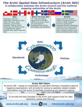
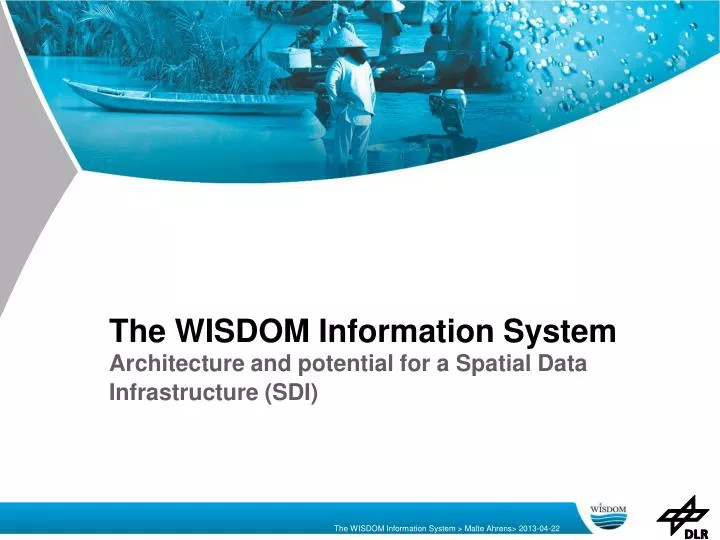
The WISDOM Information System Architecture and potential for a Spatial Data Infrastructure (SDI). The WISDOM Information System. Introduction WISDOM How it looks like Features Architecture Open Source Software Stack Architectural Overview Standards

E N D
The WISDOM Information SystemArchitecture and potential for a Spatial Data Infrastructure (SDI)
The WISDOM Information System Introduction • WISDOM • How it looks like • Features Architecture • Open Source Software Stack • Architectural Overview • Standards Potential for a Spatial Data Infrastructure (SDI) • Vietnam NSDI (VNSDI) • Potential for a Spatial Data Infrasructure
Context WISDOM Water-related Information System for the Sustainable Development Of the Mekong Delta in Vietnam • End of the 2nd phase: end of 2013 • 5 years of development • first a demonstrator version to get feedback • suggestions went into further development • Online available (free registration) • http://wisdom.eoc.dlr.de/Elvis(Server located in Germany) • http://wisdom-vn.org/elvis (Server located in Ho-Chi-Minh-City) • Project Homepage: www.wisdom.eoc.dlr.de
Features • Online tool for geoscientific data exchange and information platform • User Management (Register, Administer, User Rights Management) • Multilingual GUI / Multilingual Metadata • Data Search (Geodata / Literature / Contacts) • Visualize data on top of a base map • Data Upload • Data Download • Predefined Maps • View Field Data Photos • Visualize Sensor Measurement Data as a Diagram
Open Source Software Stack WISDOM Environment KVM Virtualization Environment
Architecture OGC Standards Offer Service Consume Service Server Client Manage Data User Interface
Standards • WMS (OGC Web Mapping Service) • UMN Mapserver + TileCache • SLD (Styled Layer Descriptor) • WPS (OGC Web Processing Service) • Standard to wrap a (geospatial) process and make it accessible via the internet (any process programmed in Matlab, IDL, Java, Python, etc.) • CSW (Catalog Service for the Web) • Metadata profile follows ISO standards • Translatable • Managing of Time Series Data • Keyword search • ISO 19115/19139 Metadata
Spatial Data Infrastructure Definition in legal document of the US Federal Government (1994) • SDI as a minimum infrastructure, includes applications, standards, technology and institutional governance necessary for effective and efficient spatial data and services management within or across organizations. • SDI on different levels (e.g. Europe: INSPIRE, National: GDI-DE) • The concept of National SDI (SDNI) is now being universally called the Spatial Enablement of Governments and Societies (UN Declaration from Kuala Lumpur, 2011) Source: http://www.asiageospatialforum.org/2012/proceeding/Hoang%20Lam%20Son.pdf
Vietnam NSDI (VNSDI) • Spatial data set • spatial data, framework spatial data and meta-data • Standards • Standard of spatial data contents, Standard of data exchange, Standard of meta-data and Standard of data services • Access to data • Data Discovery, Data Access and Data Process • Technology • Hardware and Software Equipment, Data Communication Network • Policy - Legislation • Mechanism, Policy and Legislation regulated by the State • Organization Institution • including Organizations Arrangement and Relationship between Organizations • Partnership • Investment Funding, Human Resources Development, Public Awareness Raising, Scientific Research and International Cooperation) Source: http://www.asiageospatialforum.org/2012/proceeding/Hoang%20Lam%20Son.pdf
Potential for a SDI Pros • availability • support of Standards • Service Orientated Infrastructure • adoptable for other regions • easy to transfer to other server due to Virtualization • platform for further development Cons • no synch between instances of the system • performance must be tested for larger scale application
Thanks! Thank you for your attention! Malte.Ahrens@dlr.de
Further readings WISDOM Information System (Location of server: Germany) www.wisdom.eoc.dlr.de/Elvis WISDOM Information System (Location of server: Vietnam) http://wisdom-vn.org/ Development Strategy of National Spatial Data Infrastructure For Vietnam http://www.asiageospatialforum.org/2012/proceeding/Hoang%20Lam%20Son.pdf