Download
1 / 15
150 likes | 276 Views
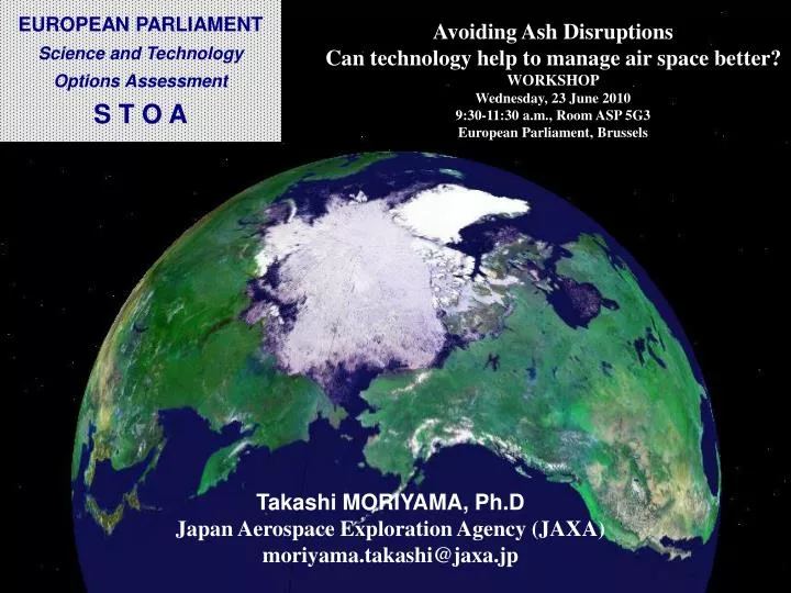
Avoiding Ash Disruptions Can technology help to manage air space better? WORKSHOP Wednesday, 23 June 2010 9:30-11:30 a.m., Room ASP 5G3 European Parliament, Brussels. Takashi MORIYAMA, Ph.D Japan Aerospace Exploration Agency (JAXA) moriyama.takashi@jaxa.jp. TANSO onboard GOSAT.

E N D
Avoiding Ash Disruptions Can technology help to manage air space better? WORKSHOP Wednesday, 23 June 2010 9:30-11:30 a.m., Room ASP 5G3 European Parliament, Brussels Takashi MORIYAMA, Ph.D Japan Aerospace Exploration Agency (JAXA) moriyama.takashi@jaxa.jp
TANSO onboard GOSAT TANSO=Thermal And Near infrared Sensor for carbonObservation TANSO-FTS(Fourier Transform Spectrometer) -NIR, SWIR and TIR TANSO-CAI (Cloud and Aerosol Imager) Ultraviolet , visible, NIR and SWIR
Organization • Sensor development • Satellite development • launch • Satellite operation • Data acquisition • Data processing (L1) • Calibration • Data distribution • Algorithms development • Data processing • (L2 or higher) • Data use for science • Validation • Data distribution • Sensor development • administration 3
Satellite Characteristics The picture of GOSAT flight model taken at the launch site
TANSO-CAI Specifications TANSO-CAI is operated together with TANSO-FTS to - detect aerosol spatial distribution and cloud coverage
In-Orbit CAI Operation Extent of the CAI observation Solar Ray Lunar Calibration
The Operation Network Svalbard Satellite Station, Norway to NIES Kiruna Tracking Station, Sweden Hatoyama, Japan Tsukuba Space Center, JAXA, Japan) Maspalomas Satellite Station, Gran Canaria Perth Satellite Station, Australia Santiago Satellite Station,
Data Productsof CAI JAXA Data transmission Measurement Level 1A processing - satellite downlink format to numerical data Receive and Record L1A Data NIES Level 2 and 3 Processing - cloud flag (L2) -global radiance distribution (L3) - global reflectance distribution (L3) Level 1B and L1B+ Processing - images Data distribution 8
Observation Results CO2 column averaged dry air mole fraction not observed April May June July August September Under Processing October November December January February March
Observation Results CH4 column averaged dry air mole fraction not observed April May June July August September Under Processing October November December January February March
An International Cooperative for Aerosol Prediction: Workshop on Aerosol Observability Issues EUMETSAT http://bobcat.aero.und.edu/jzhang/ICAP/ 27-29 April, 2010Monterey CA Send comments to jeffrey.reid@nrlmry.navy.mil angela.benedetti@ecmwf.int peter.r.colarco@nasa.gov
Workshop Rationale 1) There is a long history for global meteorology forecasting. This does not exist for aerosol forecasting or chemical weather forecasting (CWF) in general: Needed a venue for operational developers to discuss research to operations issues, protocols and metrics. 2) There are few “Operational” data sources and infrastructure for CWF: Needed to discuss currently available and future data products to support aerosol data assimilation/initialization and model verification. 3) CWF is in its infancy and needs to draw heavily from the research community. Conversely, many research programs are looking more like “Operations” and are operations/natural hazards relevant: Relationships needed to be developed across communities for the benefit of all Earth System Science (ESS) stakeholders.
Pressing Issues for Both Climate and Operational Communities. Future aerosol products: Terra/Aqua has been a cornerstone for research and development. There is concern as the community migrates to NPP, JPSS, EarthCARE, GCOM-C1, Decadal Survey, GOES-R etc… Model needs: Even with current aerosol products, most are not designed with model customers in mind . Error models and propagation of error are hardly ever addressed by developers. Multi-sensor fusion: You think working with one sensor is hard? Try 2, 3 or 4… How do we deal with the changing constellation of sensors and products with regards to initialization and data assimilation? Product versus radiance assimilation? Competition: Competitive products from the same data source are often seen as a bad thing by agencies. Actually, there is nothing farther from the truth-as long as they are available and supported.
MODIS: Still the workhorse with available NRT data from NRTPE and now NASA LANCE. AVHRR: Available for a long time over water, but with MODIS available operations has been hesitant to migrate. OMI: Data available with permission from LANCE. GOME-2: OMI like aerosol products under development. MSG/SEVERI: Best available geostationary platform for aerosol. GOES-GASP: Available but not yet fully investigated. Glory (2010-11): Aerosol microphysics, but limited swath and NRT capability. NPP/JPSS VIIRS (2012/2015): Expected to be the follow-on for MODIS users for both aerosol and fire. But: Different algorithm and only one 13:30 LST overpass per day (versus twice for Terra and Aqua). EarthCARE MSI (2013): Limited swath but great potential partner with VIIRS if NRT data is available. GCOM-C2 (2014): Will carry very powerful interdisciplinary moderate resolution imager with expected NRT data production. MeteoSat Third Generation-MTG(2015): Next generation European geostationary with good aerosol and fire capability. GOES-R (2015): Next generation American geostationary with good aerosol and fire. NASA Decadal Survey? Ocean imager and Atmosphere Clouds and Environment (ACE) have uncertain timelines. Passive Sensors of theNext Decade