Download
1 / 79
790 likes | 838 Views
Explore various methods like IR, visible, passive microwave, and integrated satellite methods for remote sensing of precipitation. Understand satellite types and advantages of Vis/IR sensors. Learn about IR and visible methods used in precipitation detection.

E N D
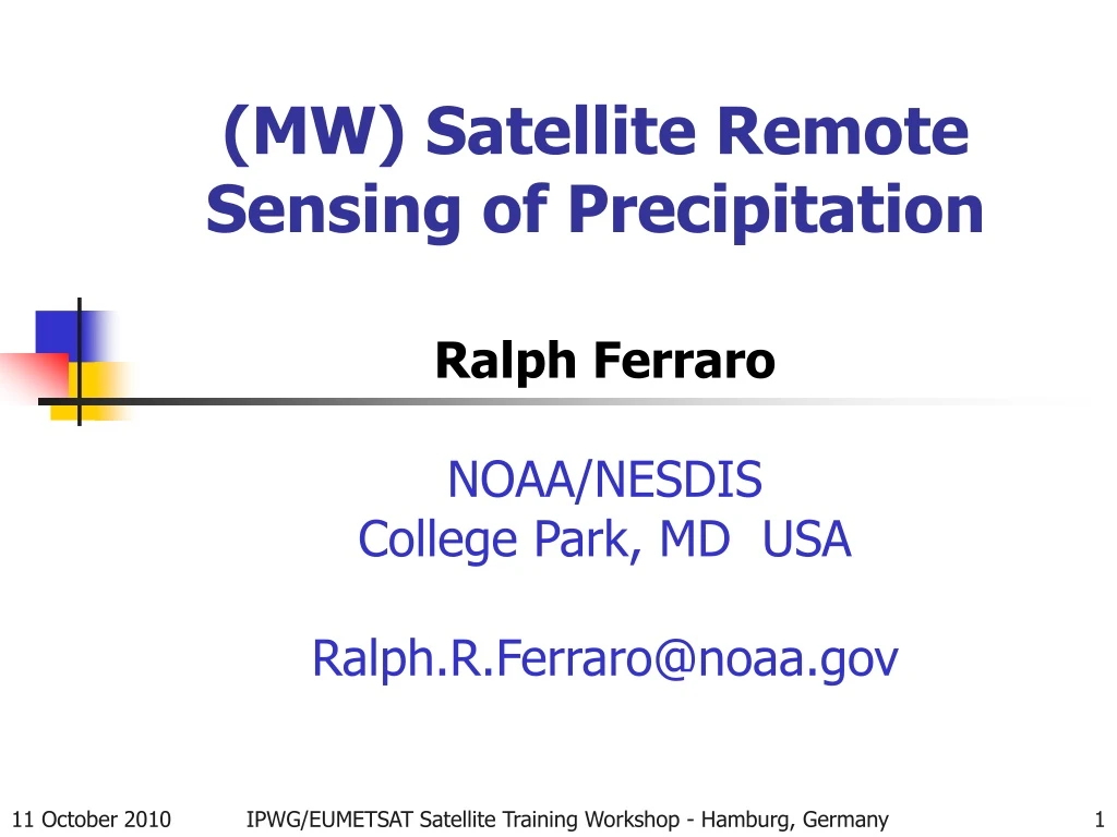
(MW) Satellite Remote Sensing of Precipitation Ralph Ferraro NOAA/NESDIS College Park, MD USA Ralph.R.Ferraro@noaa.gov IPWG/EUMETSAT Satellite Training Workshop - Hamburg, Germany
IPWG/EUMETSAT Satellite Training Workshop - Hamburg, Germany
Outline • IR Methods • Visible and near IR methods • Passive Microwave Emission Methods • Passive Microwave Scattering Methods • Integrated Satellite Methods • References IPWG/EUMETSAT Satellite Training Workshop - Hamburg, Germany
Remote Sensing of Precipitation • Depends upon spectral response of precipitation to wavelength being utilized • Cloud tops, motion, changes – IR • Cloud texture - vis • Cloud droplets and ice particles – vis, near IR, IR, MW • Precipitation phase - MW • Depends if passive or active • Radiometer • Radar • Depends on satellite type (POES or GOES) • Spatial and temporal sampling • Depends on nature of system • Tropical vs. high-latitude • Summer vs. winter IPWG/EUMETSAT Satellite Training Workshop - Hamburg, Germany
Satellites • Geostationary Satellites: are in orbit 22,238 miles above the equator, which means they orbit at the same speed as the Earth's rotation, keeping them above the same spot on Earth. U.S. geostationary satellites are called "GOES" for Geostationary • Polar (or Low Earth) Orbiting Satellites: orbit over the North and South poles about 530 miles above the Earth. Their lower orbits mean their view is more limited, but they have a more close-up view. Commonly referred to as “POES” or “LEO” IPWG/EUMETSAT Satellite Training Workshop - Hamburg, Germany
GOES Visible Imagery IPWG/EUMETSAT Satellite Training Workshop - Hamburg, Germany
GOES IR Imagery IPWG/EUMETSAT Satellite Training Workshop - Hamburg, Germany
Advantages of Vis/IR Sensors • High Temporal Sampling • 15 – 60 minutes • Storm evolution • Storm movement • Flash flood events • High Spatial Resolution • 1-4 km (could be less, e.g., MODIS) • Small scale features • Stream/River basins for flash flood/hydrological models IPWG/EUMETSAT Satellite Training Workshop - Hamburg, Germany
IR Methods • Most simple approach is to use IR cloud top temperatures to infer rain rate • The higher the cloud top, the heavier the rain is • Not a bad assumption in convective systems with little horizontal shear (e.g., tropics) • GOES Precipitation Index (GPI) – Arkin and Meisner, 1987 • TB<235 K indicator of tropical rainfall • Shortfalls • Non-convective systems (winter time); a lot of cirrus not associated with rainfall • Strong shearing convective systems • Mislocation of precipitation • Non-physical relationship between cloud top temperatures and surface rainfall • There are methods that try to look at: • Trends in the IR temperatures: NESDIS Auto-Estimator, Vicente et al, 1998, BAMS • Moisture environment (dry or moist): NESDIS AE • Corrections using surface radar/gauges, topography, stability indicies, etc.: NESDIS Hydro-Estimator, Scofield and Kuligowski, 2003 IPWG/EUMETSAT Satellite Training Workshop - Hamburg, Germany
GOES 10.7 µm and rain rate R = 1.1183*10**(11) * exp [-3.6382 10**(-2) * T**(1.2)] IPWG/EUMETSAT Satellite Training Workshop - Hamburg, Germany
Visible and near IR methods • Precipitation clouds can be detected by textural affects, brightness, evolution, etc from visible imagery • Difficulties in quantifying such approaches due to sun angle variations, sensor changes, etc. • Lead towards subjective, interpretative methods • NIR channels • Sensitive to cloud droplet sizes in absence of cirrus clouds • Attractive for “warm rain” processes • No ice phase • Orographic rainfall IPWG/EUMETSAT Satellite Training Workshop - Hamburg, Germany
Vis and IR Algorithms: GMSRA • GMSRA=GOES Multi-Spectral Rainfall Algorithm • Uses Data from 4 Different Channels: • Visible (0.69 μm)—discriminate between thin (nonraining) cirrus and thicker (raining) clouds • “Short” IR Window (3.9-μm)—use reflectivity to identify clouds that are warm but have large particles near cloud-top and are thus producing rain • Water Vapor (6.7-μm)—warm signature above overshooting cloud tops differentiates from cirrus • IR Window (10.7-μm)—texture screening of cirrus clouds (low texture=cirrus; high texture=rain) and calculation of rainfall rate (but dependent only on value at pixel of interest) IPWG/EUMETSAT Satellite Training Workshop - Hamburg, Germany
Use of MODIS data: Chen et al. (2007) • MODIS=Moderate Resolution Imaging Spectroradiometer (MODIS) onboard NASA’s Terra and Aqua satellites • 36 channel vis/NIR/IR sensor • EUMETSAT’s MSG-SEVERI contains many of these channels • NOAA’s GOES-R ABI (Advanced Baseline Imager) will contain many of MODIS channels • NIR channels are used during daytime to sense cloud droplet reflectance • Caveat – No cirrus clouds • Drop effective radius (DER) • Use 1.6 µm, 2.1 µm, and 3.7 µm • Various cloud absorption properties at these wavelengths allows for DER profiling • 3.7 µm cloud top • 1.6 µm cloud base • Larger drops at bottom indicate drizzle or light rain • Important in certain climate regimes IPWG/EUMETSAT Satellite Training Workshop - Hamburg, Germany
IPWG/EUMETSAT Satellite Training Workshop - Hamburg, Germany b) DER at cloud base
Advantages of MW Sensors • All Weather capability – can see through clouds (unlike visible and IR) • “Reasonable” data volume (but has poorer spatial resolution than VIS/IR) • Can fly on polar orbiters – global coverage (but not high temporal resolution like GOES satellites) IPWG/EUMETSAT Satellite Training Workshop - Hamburg, Germany
MW Rainfall Signatures • Over ocean, low emissivity of ocean surface allows us to utilize absorption/emission process by rain drops to retrieve rainfall intensity • Most direct physical connection of ANY technique • Limitations due to unknown freezing level heights, drop size distributions and “beam filling”/non-linear TB response • Over land, currently, can only rely on 85 GHz+ scattering due to ice present in precipitation layer (fairly similar to what a radar sees – bright band) • Indirect relationship between ice in cloud and surface rainrate • Still, more direct than IR, since it sees through cirrus • Emerging science starting to focus on emission signal over land… IPWG/EUMETSAT Satellite Training Workshop - Hamburg, Germany
Rainfall Signatures (Model Based) IPWG/EUMETSAT Satellite Training Workshop - Hamburg, Germany
Rainfall Over Ocean • Utilize both emission and scattering signatures of rainfall • Emission: 19-37 GHz/Scattering: 85+ GHz • Rain identification: • Emission: • CLW (Q) cloud/rain threshold (0.2-0.3 mm) • Function of freezing level, cloud base, DSD, etc. • Scattering: • Scattering “Index” (ice phase/falling snow) • Remove sea-ice signature IPWG/EUMETSAT Satellite Training Workshop - Hamburg, Germany
Rainfall Over Ocean (con’t) • Rain rate determination • Empirical tuning to co-incident radar • Could be surface radars • Could be from satellite radars like TRMM/PR or CloudSat • Physical tuning from cloud model simulations • RR=a Q b RR = a SI b • Accuracy and limitations • Instantaneous rain rate +/- 25%? • Questions on low and high end rates • Beam filling errors • Rain area fairly reliable IPWG/EUMETSAT Satellite Training Workshop - Hamburg, Germany
Rainfall Over Land • At present, only utilize scattering signature: • Emission is difficult; it’s there but signal is smaller (high emissivity) AND emissivity highly variable, but….GPM is moving forward to utilize improved land surface emissivity models…. • Less direct measure of rain • Mainly convective & widespread stratiform • Special care to remove “false” signatures: • Snow cover (melting snowpack), deserts • Empirical “sceens”; decision tree approach • Moving towards ancillary data sets for better sfc. identification • Non-uniqueness of signatures • conservative vs. aggressive screening IPWG/EUMETSAT Satellite Training Workshop - Hamburg, Germany
Rainfall Over Land (con’t) • Rainfall detection via scattering 85/89 GHz: • TB depressions indicate possible rain • Larger the depression, heavier rain • Proper rain/no-rain threshold to minimize noise • Scattering Index=f(TB19,TB22)-TB85 • Rain Rate - radar or CRM tuned; RR = a SI b • Accuracy and limitations: • Instantaneous rate +/- 50% • Summer season rain/no-rain most reliable • “W. Coast” land systems problematic: • maritime air mass/less ice/smaller precipitation particles? • Single SI-RR used (ie, global “Z-R” relationship) • Melting snow in winter and spring seasons IPWG/EUMETSAT Satellite Training Workshop - Hamburg, Germany
Use of high frequency measurements from AMSU and MHS • Physical retrieval of ice water path (IWP) and particle size (De) using AMSU-B 89 and 150 GHz: • De ~ (89)/(150) • IWP ~ De*(/(89,150)) • Assumptions made on size-distribution & density • IWP to rain rate based on limited cloud model data and comparisons with in situ data:RR = A0 + A1*IWP + A2*IWP2 • Effects of surface misidentification (desert & snow) reduced using 89 and 150 GHz IPWG/EUMETSAT Satellite Training Workshop - Hamburg, Germany
Some Operational Algorithms • GOES-Hydroestimator • DMSP/SSMI FNMOC • Goddard Profiling Algorithm (GPROF) - TRMM, AMSR-E, SSMI • NOAA/POES AMSU-B/MHS IPWG/EUMETSAT Satellite Training Workshop - Hamburg, Germany
Operational Algorithm Development • What does operational mean? • 24 hours/day, 7 days/week • It’s like your cell phone, radio and TV stations; you expect it to be working ALL OF THE TIME! • It has to be easy to fix if it breaks • You need to have full time support staff • Algorithm considerations: • Complexity, processing, delivery “balance” • Impact on other processing systems • User requirements • Simplify physical retrieval schemes & utilize appropriate channels on sensor (these are always carefully selected when sensors are designed – radiative transfer models)! IPWG/EUMETSAT Satellite Training Workshop - Hamburg, Germany
GOES HydroEstimator • Has its roots from early NESDIS work of Rod Scofield and Satellite Applications Branch (SAB) satellite analysts • An interactive approach which looked at trends of GOES-IR temperatures, moisture fields, etc. • To ease burden on analysts, an automated, more objective method was developed • The “AutoEstimator”; geared for convective systems • Next version of AE utilized ground data over US to better integrate satellite, NWP and in-situ data and work under all seasons • The “HydroEstimator” IPWG/EUMETSAT Satellite Training Workshop - Hamburg, Germany
Hydro-Estimator • Satellites: GOES • Spectrum: IR • Spatial Domain: Primarily CONUS, but is run in Mexico, Central and South America • Temporal Domain: Storm Scales • Physical Basis/Empirical Coefficients: • IR cloud top temperature and trends related to rain rate • Utilize in-situ data, NWP, topography to alter rain rates based on local conditions • Calibration: Ground Radar from U.S. • References: Vincente et al (1998), Scofield and Kuligowski (2003) IPWG/EUMETSAT Satellite Training Workshop - Hamburg, Germany
IPWG/EUMETSAT Satellite Training Workshop - Hamburg, Germany
IPWG/EUMETSAT Satellite Training Workshop - Hamburg, Germany
IPWG/EUMETSAT Satellite Training Workshop - Hamburg, Germany
HE Estimates for New England Flood, May 2006 Heavy rains over New England during mid-May 2006 produced the worst flooding in 70 years at many locations and causing tens of millions of dollars of damage. IPWG/EUMETSAT Satellite Training Workshop - Hamburg, Germany
NESDIS/FNMOC Algorithm • Satellites: SSM/I and SSMIS • Spectrum: MW • Spatial Domain: Global • Temporal Domain: Storm & Climate Scales • Physical Basis/Empirical Coefficients: • Grody 85 GHz “Scattering Index” • Land/Ocean Scattering approach + Ocean emission • Screening for anomalous surfaces (snow, desert, ice) • Calibration: Ground Radar from U.S., Japan and U.K. • References: Grody (1991), Ferraro and Marks (1995), Ferraro (1997) IPWG/EUMETSAT Satellite Training Workshop - Hamburg, Germany
IPWG/EUMETSAT Satellite Training Workshop - Hamburg, Germany
SSM/I Rain Retrieval Algorithm IPWG/EUMETSAT Satellite Training Workshop - Hamburg, Germany
IPWG/EUMETSAT Satellite Training Workshop - Hamburg, Germany
GPROF (Goddard Profiling Algorithm) • Satellites: TRMM/TMI, AMSR-E, SSM/I (and GPM/GMI) • Spectrum: MW • Spatial Domain: Global • Temporal Domain: Storm & Climate Scales • Physical • Couples CRM and RTE calculations • Bayesian retrieval • Matches actual satellite TB’s with database of hydrometeor profiles and surface rain rate • More recently, matching directly to TRMM PR profiles – more direct! • Same physical assumptions applied to any imager/sensor • Advantage – Unbiased retrievals across several sensors • Calibration: Cloud Resolving Model (CRM) • References: Kummerow et al (1996), Kummerow et al (2001), McCollum & Ferraro (2003), Wang et al (2009), Gopalan et al (2010) IPWG/EUMETSAT Satellite Training Workshop - Hamburg, Germany
How GPROF works GPROF Database • Develop database of precipitation systems • Diverse • “Real” data better (TRMM PR!) • Wide range of sensors • Match actual retrievals with “best fit” from data base (Bayesian Inversion) • Retrieval of surface rain rate and hydrometeor profiles • Limitations • Diversity of database • Too many degrees of freedom • GPM era data will greatly improve! Satellite Simulator TB1, TB2, …TBn Hydrometeor profiles GPROF Database RR, Hydrometeor profiles Atm. T, Q profile Surface T, Є, RR, etc. Surface T, Є, RR, etc. IPWG/EUMETSAT Satellite Training Workshop - Hamburg, Germany
GPROF Retrieval Aircraft - Radiometer Aircraft - Radar IPWG/EUMETSAT Satellite Training Workshop - Hamburg, Germany
IPWG/EUMETSAT Satellite Training Workshop - Hamburg, Germany
TRMM TMI Version 7 Land Rainfall Algorithm Nai-Yu Wang, Kaushik Gopalan, and Ralph Ferraro Cooperative Institute of Climate Studies, University of Maryland IPWG/EUMETSAT Satellite Training Workshop - Hamburg, Germany
Motivation Continuing support of the TRMM Microwave Imager (TMI) land precipitation algorithm to the science community Empirical approach chosen due to fast-approaching TRMM v7 deadline TMI rain rate (RR) found to have regional and seasonal biases; Precipitation radar rain rates thought to be more physically realistic than TMI v6 RR Can we make the TMI “more like” PR? IPWG/EUMETSAT Satellite Training Workshop - Hamburg, Germany
Overview TMI brightness temperature (Tb)- PR rain rate (RR) regressions for different storm types using University of Utah PF database Identifying convective storms using TMI Tb values Comparison of regression fit RRs with current TMI v6 IPWG/EUMETSAT Satellite Training Workshop - Hamburg, Germany
Part A : TMI Tb and PR RR functional fitting IPWG/EUMETSAT Satellite Training Workshop - Hamburg, Germany
TMI – PR collocations : Example The avg. of the 3 PR RRs is used as the “true” RR for this TMI pixel TMI EFOV : 7.2 km x 4.6 km Along-track PR footprints : ~4.5 km at edge of scan IPWG/EUMETSAT Satellite Training Workshop - Hamburg, Germany
Separation of regression fits by storm type Convective and Stratiform storms separated during training using PR rain type flag Seasonal variations and differences between storms in the tropics and sub-tropics (proxy for surface types) were investigated IPWG/EUMETSAT Satellite Training Workshop - Hamburg, Germany
Latitude and seasonal dependence Analyzed using Sep 2002 - Aug 2008 data Separation of high latitudes (>20) and low latitudes (<=20) Clear differences in rain rate regressions for the different cases IPWG/EUMETSAT Satellite Training Workshop - Hamburg, Germany
Filtering the Training set • Filter out pixels where there is surface scattering/water contamination • Pixels where TMI RR >= 1.5 PR RR are excluded from the convective regressions • Filter out pixels with warm rain where there is no corresponding depression in the 85V Tb • Pixels where TMI RR <= 0.5 PR RR are excluded from the stratiform regressions IPWG/EUMETSAT Satellite Training Workshop - Hamburg, Germany
Effect of filtering (Convective) IPWG/EUMETSAT Satellite Training Workshop - Hamburg, Germany
Effect of filtering (Stratiform) IPWG/EUMETSAT Satellite Training Workshop - Hamburg, Germany
Final regressions Cubic fit Linear fit IPWG/EUMETSAT Satellite Training Workshop - Hamburg, Germany
Part B : Identifying convective storms from TMI Tb values IPWG/EUMETSAT Satellite Training Workshop - Hamburg, Germany