Download
1 / 26
260 likes | 413 Views
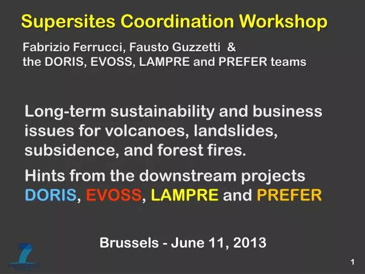
Supersites Coordination Workshop. Fabrizio Ferrucci, Fausto Guzzetti & the DORIS, EVOSS, LAMPRE and PREFER teams. Long-term sustainability and business issues for volcanoes, landslides, subsidence, and forest fires.

E N D
Supersites Coordination Workshop Fabrizio Ferrucci, Fausto Guzzetti & the DORIS, EVOSS, LAMPRE and PREFER teams Long-term sustainability and business issues for volcanoes, landslides, subsidence, and forest fires. Hints from the downstream projects DORIS, EVOSS, LAMPRE and PREFER Brussels - June 11, 2013
Outline • The FP7 collaborative projects stimulate development of downstream GMES services • “Downstream” : exploit “Core” services, be self-sustainable, address specific user segments • Projects • EVOSS 2010-13: volcanoes • DORIS 2010-13: landslides • PREFER 2012-15: wildfires/forest fires • LAMPRE 2013-15: landslides
EVOSS • EVOSS – European Volcano Observatory Space Services • Total cost is € 4.2 M, EC contribution is € 2.8 M • Lifetime is from 1 Jan 2010 to 30 Jun 2013 • where are the costs • Development • Research • Data • Service (high-temporal resolution) Service (high-spatial resolution)
DORIS • DORIS – Ground Deformations Risk Scenarios: an Advanced Assessment Service • Total cost is € 4.6M, EC contribution is € 3.4M. • Lifetime is from 1 Oct 2010 to 30 Sep 2013. • where are the costs • Development • Research • Data (high-spatial resolution) • Service (with a minimum number of sites within an assigned frame); otherwise
DETAILS • LAMPRE– Landslide modelling and tools for vulnerability assessment preparedness and recovery management • Total cost is € 2.5M, EC contribution is € 2.0M • Lifetime is from 1 Mar 2013 to 28 Feb 2015
DETAILS • PREFER– space-based information support for prevention and recovery of forest fires emergency in the mediterranean area. • Total cost is € 2.8M, EC contribution is € 1.9M • Lifetime is from 1 Dec 2012 to 30 Nov 2015 • where are the costs • Development • Research • Data • Service (high-spatial resolution)
WHO IS THE COSTUMER? • EVOSS • Countries, civil protection authorities, Communities who don’t have an observatory but feel/are exposed to volcanic risk. • Mandated Institutions, Observatories wanting to improve the extent of monitored parametres , all Institutions “in case of” • Airline companies, planning and managing routing, and deciding whether or not to fly across an area where a SIGMET is released by the VAAC
WHO IS THE COSTUMER? • DORIS • Civil Protection Authorities responsible for landslide and subsidence risk. • Environmental agencies dealing with slope processes & ground subsidence phenomena. • LAMPRE • CPA responsible for landslide risk. • EA dealing with slope processes & risk. • Transportation agencies & service providers.
WHO IS THE COSTUMER? • PREFER • Institutions and Entities responsible for the strategic management of land vs. forest fires, and forest fire preparedness
WHERE IS THE COSTUMER? EVOSS DORIS LAMPRE PREFER
WHAT IS UNIQUE? • EVOSS – satellite real time synoptical monitoring of volcanoes at global scale • DORIS– Long term deformation maps and time series & multi-sensors analysis • LAMPRE– Accurate event inventory maps & vulnerability assessments • PREFER – spacebornehigh-resolution mappingof fire hazard /damage
WHAT IS NOT UNIQUE? • EVOSS – SO2 emissions monitoring • DORIS– DInSAR maps for ground surface monitoring • LAMPRE– Landslide inventory maps & image processing techniques • PREFER – a part of image processing techniques, and indexing
The competitive advantage • Global reach is the undisputed advantage of space borne Remote Sensing. • Excluding military demand, the meteorological system is the sole example of need-driven remote-sensing.
Key market drivers • Observation: Everywhere, Anytime • Information: Robust, Accessible, Accurate • Price: Attractive, Sustainable
Lesson learnt by EVOSS & DORIS • Extensive marketsurvey and analysis was carried out to address their sustainability. • All user communities were involved, in the private and the institutional sectors. Both in the case of EVOSS and DORIS , an extensive market survey and analysis has been carried out in the last two years in order to address their sustainability. All the different User communities have been involved, both in the private and institutional sector. A main outcome is that there is an actual need mainly in the institutional sector, but usually where is the need there are no resources available. Therefore , the sustainability of operational and validated services such as EVOSS and DORIS must be supported further on by EC institutions
Lesson learnt by EVOSS & DORIS • Main need is in the institutional sector, but usually where is the need there resources are not available. • Sustainability of operational and validated services such as EVOSS and DORIS should be supported further by the EU.
ROADMAP • As the “market” is basically Institutional, • what is missing & needed: • Institutional support following extensive validation of the results of successful projects
DORISUSERS Main Users Secondary Users Civil Protection Capacity Extraction Industry Structural Engineering Risk Assessment Government Agencies Mineral Builders & Constructors Developers & home owners Public Authorities Oil & Gas Engineering consultants Information providers Regulators Water Utility Operators Insurers Transport Provides Environment & Heritage Industrial Infrastructures Media
EARTH OBSERVATION MARKET • Main EO markets concerned with landslide risk assessment & hazard mapping: • Disaster management (9%) • Environmental monitoring (9%) • Engineering (22%) • Others (60%) World Share EO Segments, 2012
EARTH OBSERVATION MARKET • Main EO markets concerned with landslide risk assessment & hazard mapping: • Disaster management (6 M€) • Environmental monitoring (6 M€) • Engineering (17 M€) European Market Relevant EO Segments, 2012
EVOSS USERS Main Users Secondary Users Key Stakeholders VAACs Aviation Stakeholders ICAO Volcano Observatories Civil Protection EC Other Users Industry / Institutions Local Authorities • Main User communities are: • Aviation Industry to support Ash Advisory • Volcano Observatories to provide complementary means
SWOT ANALYIS | WEAKNESSES • Lack of certification in EO industry hampers increase market share [Promotion & dissemination]. • Lack of benchmark on EO value adding processing & lack of metrics to judge the quality of products [Demonstration & Standards].
CONCLUSIONS • Operational costs are man power related rather than EO data costs. The availability of Sentinel free access policy will lower costs. • Need to confirmwhether Sentinel data can replace commercially available data (i.e., CSK, TSX). • A rigorous quality / achievement assessment of projects to be carried out • The EC support and ethical guidance to exploit worldwide the top achievements of best Space projects is welcome
CONCLUSIONS • Consolidation of service requestsis a benefit of DORIS, allowing to divide the costs among users. • To be relevant, service shall expand in and outside of Europe. • Need to educate users and ensure adoption of services in existing and new processes.
Thank you! Ferrucci@ipgp.fr Guzzetti@irpi.cnr.it