Download
1 / 24
240 likes | 260 Views
Delve into the evolution of geodetic datums in Alaska, from pre-earthquake leveling to modern NGS programs. Explore the significance of NAVD88 and its impact on surveying practices. Learn about CORS stations and NGS services.

E N D
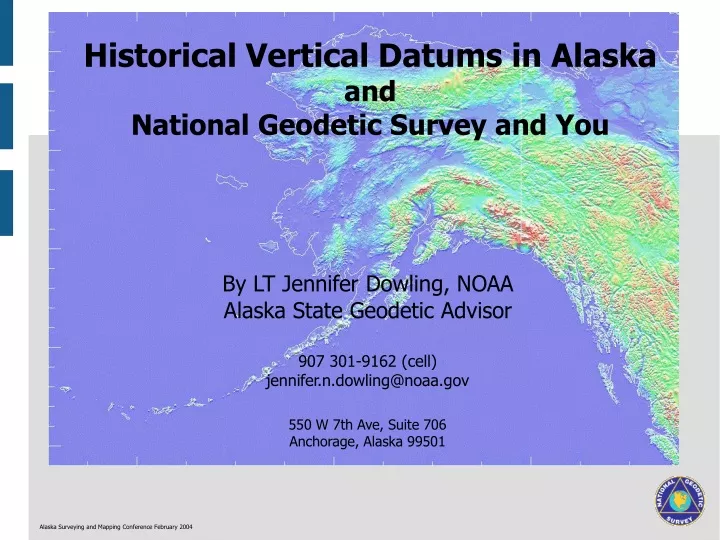
Historical Vertical Datums in Alaska and National Geodetic Survey and You By LT Jennifer Dowling, NOAA Alaska State Geodetic Advisor 907 301-9162 (cell) jennifer.n.dowling@noaa.gov 550 W 7th Ave, Suite 706 Anchorage, Alaska 99501 Alaska Surveying and Mapping Conference February 2004
Geodetic Datums in Alaska Pre-Earthquake Leveling Campaigns 1910 B Skagway - White Pass 1908 - 1910 B Takini - White Pass 1922 B Alaska Railroad 1923 B Fairbanks - Fox Farm Road, Valdez, Chitna 1943 B Alaska-Canada Highway Alaska Surveying and Mapping Conference February 2004
Geodetic Datums in Alaska Post-Earthquake Leveling Campaigns LEVELING PREVIOUS TO MARCH 27, 1964 LEVELING COMPLETED APRIL - OCTOBER, 1964 LEVELING COMPLETED MAY - AUGUST, 1964 EPICENTER Alaska Surveying and Mapping Conference February 2004
Federal Base Network http://www.ngs.noaa.gov/PROJECTS/FBN/states/AK/map.htm Alaska Surveying and Mapping Conference February 2004
Where Heights Come From Mountain Earth Mean Surface sea level Geoid Geoid undulation Geoid Ocean Ellipsoid undulation Normal to Normal Ocean geoid (plumb line) to ellipsoid Deflection of the vertical H=h-N H is orthometric height h is ellipsoid height N is geoid undulation After Smith, J, 1997. Introduction to Geodesy: The History and Concepts of Modern Geodesy. New York: Wiley-Interscience. Alaska Surveying and Mapping Conference February 2004
Geodetic Datums in Alaska Comparison of Vertical Datum Elements NGVD29 NAVD88 26 Tide Gauges in the US & Canada Father's Point/Rimouski Quebec, Canada Datum Definition Bench Marks 100,000 450,000 102,724 1,001,500 Leveling (KM) Distorted to Fit MSL Gauges Best Continental Model Geoid Fitting Datum is Frame, Points Adjusted to Fit Points are Frame, Datum Created to Fit Paradigm Alaska Surveying and Mapping Conference February 2004
Reasons to Use NAVD 88 Is a better reference to compute GPS-derived orthometric heights Surveys between bench marks will often close better Is a requirement of Federal surveys NGS and other agencies no longer publish nor adjust in NAVD29 Alaska Surveying and Mapping Conference February 2004
National Geodetic Survey Homepage http://www.ngs.noaa.gov Alaska Surveying and Mapping Conference February 2004
NGS Programs http://www.ngs.noaa.gov/INFO/WhatWeDo.html Aeronautical Survey Program Federal Base Network GPS Orbit Data Height Modernization Activities Mapping The Ionosphere National CORS Program National Shoreline National Spatial Reference System Online Mark Recovery Form State Advisor Program Shallow Water Positioning System (SWaPS) Program Vertical Datums Alaska Surveying and Mapping Conference February 2004
NGS Products http://www.ngs.noaa.gov/products_services.shtml Metadata Geoid Tidal and Orthometric Elevations Geodetic PC Software Programs NOS MapFinder DEFLEC99 Aeronautical Photos and Data IERS Terrestrial Reference Frame (ITRF) control points NGS Policy Statements GEOID99 Coastal Survey Maps Publications Available On Line Submitting Data for Inclusion into NSRS Data Sheets G99SSS Geodetic and Charting Publications booklet NGS "Blue Book" GPS Orbital Data NOAA Shoreline Data Explorer CORS: GPS Continuously Operating Reference Stations Alaska Surveying and Mapping Conference February 2004
NGS Services http://www.ngs.noaa.gov/products_services.shtml Field Services GPS Antenna Calibration Calibration Base Lines for EDMI Federal Base Network (FBN) Surveys NGS Field Operations Plan NGS Workshop Program State Geodetic Advisor Program Special Projects GPS Height Modernization Contracted Projects State Center of Population Program SWaPS Underwater Monitoring Device Wetlands Restoration Projects Data Contribution Online Mark Recovery Form Project Proposal Form Data Processing Geodetic Tool Kit Alaska Surveying and Mapping Conference February 2004
Continously Operating Reference Stations http://www.ngs.noaa.gov/CORS/ Alaska Surveying and Mapping Conference February 2004
Alaska CORS Sites as of November 2003 Alaska Surveying and Mapping Conference February 2004
Anchorage CORS Sites Alaska Surveying and Mapping Conference February 2004
Online Positioning User Service http://www.ngs.noaa.gov/OPUS/ Alaska Surveying and Mapping Conference February 2004
Finding NGS Data: Where to Start http://www.ngs.noaa.gov/cgi-bin/datasheet.prl Alaska Surveying and Mapping Conference February 2004
NGS Datasheets and You Alaska Surveying and Mapping Conference February 2004
NGS Datasheet AB7145 SUPERSEDED SURVEY CONTROL AB7145 AB7145.No superseded survey control is available for this station. AB7145 AB7145_U.S. NATIONAL GRID SPATIAL ADDRESS: 5VKQ836836(NAD 83) AB7145_MARKER: DB = BENCH MARK DISK AB7145_SETTING: 38 = PIER AB7145_STAMPING: 5760 K 1978 AB7145_MARK LOGO: NOS AB7145_MAGNETIC: N = NO MAGNETIC MATERIAL AB7145_STABILITY: C = MAY HOLD, BUT OF TYPE COMMONLY SUBJECT TO AB7145+STABILITY: SURFACE MOTION AB7145_SATELLITE: THE SITE LOCATION WAS REPORTED AS SUITABLE FOR AB7145+SATELLITE: SATELLITE OBSERVATIONS - May 06, 1996 AB7145 AB7145 HISTORY - Date Condition Report By AB7145 HISTORY - 1978 MONUMENTED NOS AB7145 HISTORY - 19960506 GOOD NOS AB7145 AB7145 STATION DESCRIPTION AB7145 AB7145'DESCRIBED BY NATIONAL OCEAN SERVICE 1996 (JGF) AB7145'THE STATION IS LOCATED AT THE NIKISKI TESORO OIL CO PIER (KENAI AB7145'PIPELINE COMPANY) ACROSS THE STREET FROM THE TESORO REFINERY. IT IS AB7145'APPROXIMATELY 200 FEET (61.0 M) NORTHEAST OF THE INSHORE END OF THE AB7145'PIER, 124 FEET (37.8 M) NORTH OF THE CENTER OF GRAVEL ROAD TO PIER, 45 AB7145'FEET (13.7 M) NORTHWEST OF A UTILITY POLE, 39 FEET (11.9 M) NORTH OF AB7145'THE NORTHEAST CORNER OF A PUMP HOUSE AND 2 FEET (0.6 M) ABOVE GROUND AB7145'LEVEL. IT IS SET IN A CONCRETE PIER SUPPORTING ABOVE GROUND PIPES AND AB7145'IS BETWEEN THE PIPES. AB7145 ******************************************** AB7145 TIDAL BM - This is a Tidal Bench Mark. AB7145 DESIGNATION - 945 5760 K TIDAL AB7145 PID - AB7145 AB7145 STATE/COUNTY- AK/ANCHORAGE BOROUGH AB7145 USGS QUAD - KENAI C-4 AB7145 AB7145 *CURRENT SURVEY CONTROL AB7145 ________________________________________________________ AB7145* NAD 83(1986)- 60 41 04. (N) 151 23 36. (W) SCALED AB7145* NAVD 88 - 10.499 (meters) 34.45 (feet) ADJUSTED AB7145 ________________________________________________________ AB7145 GEOID HEIGHT- 7.19 (meters) GEOID99 AB7145 DYNAMIC HT - 10.512 (meters) 34.49 (feet) COMP AB7145 MODELED GRAV- 981,816.5 (mgal) NAVD 88 AB7145 AB7145 VERT ORDER - FIRST CLASS II AB7145 AB7145.The horizontal coordinates were scaled from a topographic map and have AB7145.an estimated accuracy of +/- 6 seconds. AB7145 AB7145.The orthometric height was determined by differential leveling AB7145.and adjusted by the National Geodetic Survey in July 2002. AB7145 AB7145.This Tidal Bench Mark is designated as VM 1328 AB7145.by the Center for Operational Oceanographic Products and Services. AB7145 AB7145.The geoid height was determined by GEOID99. AB7145 Alaska Surveying and Mapping Conference February 2004
Why GEOID99 (GEOID96, GEOID03) Isn=t Alaskan www.ngs.noaa.gov/GEOID/ The GEOID99 geoid model is (in the Conterminous United States) a hybrid geoid model, combining the gravimetric geoid G99SSS with datum transformations and NAD 83 GPS ellipsoid heights on NAVD 88 leveled bench marks. Unfortunately, the areas of Alaska, Hawaii and Puerto Rico and the U.S. Virgin Islands do not currently have GPS on Bench Mark data sufficient to create a hybrid model, and in those three areas, the GEOID99 model is a purely gravimetric, geocentric geoid model. Alaska Surveying and Mapping Conference February 2004
Alaska GEOID99 www.ngs.noaa.gov/GEOID/GEOID99/datageo99apc1.html Alaska Surveying and Mapping Conference February 2004
GRACE www.csr.utexas.edu/grace The Gravity Recovery and Climate Experiment (GRACE) is a satellite mission of NASA with the Mission Objective of: "A new model of the Earth's gravity field with unprecedented accuracy every 30 days for five years." Alaska Surveying and Mapping Conference February 2004
Plate Boundary Observatory http://www.unavco.org/PBO/ Alaska Surveying and Mapping Conference February 2004
Height Modernization horizontal +vertical + gravity control networks = a unified national positioning system http://www.ngs.noaa.gov/initiatives/height_modernization.shtml $Improved aircraft navigational aids, and safer approach and landing procedures $Advanced surface transportation control and monitoring (shipping overhead and underkeel clearance) $Highly efficient fertilizer and pesticide spreading, resulting in reduced run-off water pollution $More accurate modeling of storm surge and pollution trajectories $Increased accuracy for improved resource management decision making $Significant time savings in field surveying $Improved disaster preparedness and earthquake detection Is Alaska ready? Alaska Surveying and Mapping Conference February 2004
How Lucky to be a Surveyor in the Lower48 Food for Thought GEOID03 VDatum Comprehensive CORS National Readjustment Legal Standards of Measurements Alaska Surveying and Mapping Conference February 2004