Download
1 / 10
100 likes | 227 Views
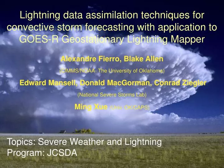
Lightning data assimilation techniques for convective storm forecasting with application to GOES-R Geostationary Lightning Mapper Alexandre Fierro, Blake Allen (CIMMS/NOAA- The University of Oklahoma) Edward Mansell, Donald MacGorman, Conrad Ziegler (National Severe Storms Lab)

E N D
Lightning data assimilation techniques for convective storm forecasting with application to GOES-R Geostationary Lightning Mapper Alexandre Fierro, Blake Allen (CIMMS/NOAA- The University of Oklahoma) Edward Mansell, Donald MacGorman, Conrad Ziegler (National Severe Storms Lab) Ming Xue(Univ. OK/CAPS) Topics: Severe Weather and Lightning Program: JCSDA
Two methods of lightning data assimilation are implemented: 1. Using lightning (time/location) to force convection initiation by nudging in water vapor where lightning is observed but convection is absent in the model. Forcing is maintained for 10s of minutes to achieve a model response to sustain the storms. (See Fierro et al. 2012, Mon. Wea. Rev.) 2. Ensemble Kalman Filter to modulate convection (e.g., strengthen or weaken) in the ensemble members. Ensemble covariances provide adjustments to all state variables (e.g., temperature, water vapor, winds, liquid water and ice particles). Pseudo Geostationary Lightning Mapper (p-GLM) data are assimilated on 1-3 minute intervals.
Lightning assimiation nudging function Water vapor mixing Qv within the 0°C to -20°C layer was increased as a function of 9-km gridded flash rates Nflash (X) and simulated graupel mass mixing ratio Qg and saturation vapor mixing ratio Qsat. Increasing Qv at constant temperature T increases buoyancy (virtual potential temperature θv) and ultimately generates an updraft. -Only applied whenever simulated RH ≤ A*Qsat and simulated Qg < 3 g/kg. -A controls minimum RH threshold (here 81%). -B and C control the slope (how fast to saturate) -D affects how much water vapor (Qv) is added at a given value of graupel mixing ratio (Qg). Qg = More graupel = less forcing
29 June 2012 Derecho Event Comparison of 3-km resolution forecasts at 22 UTC: No Assimilation (Control, 14 UTC starting time), 3D-var assim. of radar data (10-minute cycling, 14-16UTC), and lightning (ENTLN system) assimilation (14-16 UTC). Surface Temperature difference from reference value Simulated radar reflectivity
Real -time implementation into WRF-NSSL 4-km CONUS runs A quasi-operational system has been set up as a parallel forecast to the daily NSSL convection-allowing forecasts (4-km horizontal grid spacing). Lightning data (ENTLN) are assimilated for the first two hours of forecast to nudge in deep convection. Here again is the 2012 Derecho event in terms of convection initiation (CI) probability. The lightning assimilation spins up the ongoing severe convection (arrow) that fails to emerge from the initial condition alone in the control case.
Ensemble Kalman Filter (EnKF) Assimilation EnKF offers a means to an observation to adjust all state variables via covariances with a corresponding simulated observation (here, lightning flash extent rates) from the ensemble members. It cannot generate convection by itself, but can modulate convection forced by other means or help to suppress spurious deep convection. Figure: Observing Systems Simulation Experiment (OSSE): Example of a single lightning assimilation cycle damping a spurious storm cell in an ensemble member. Reduced updraft (vectors) and graupel mass (black contours) and radar reflectivity
-> Flash extent density ~ 1 min-1 -> Flash extent density ~ 80 min-1 Latitude May 8, 2003 22:09Z Longitude Pseudo-GLM EnKF Assimilation P-GLM flash extent density observations were generated from Lightning Mapping Array (LMA) data, using a flash separation algorithm (MacGorman et al 2008) to specify individual flashes. Various linear relationships between graupel mass and flash rate, graupel echo volume and flash rate, and non-inductive charging and flash rate were tested. Good results for strong and weak convection tests were found with the relationship: FED = (0.017)*(graupel volume) Here, graupel volume is the sum of grid cells with graupel mixing ratio > 0.5 g/kg in a 16-km box centered on the p-GLM pixel. Ensemble has 40 members at 1-km horizontal resolution. Comparison assimilation tests with radar radial velocity were also performed. Example of pseudo-GLM Flash extent density (FED) derived from Oklahoma LMA data.
P-GLM EnKF: 8 May 2003 Supercell Low-level analysis of radar reflectivity around the time of the first tornado (Moore/Oklahoma City, OK EF4 tornadic storm) 22:09Z 22:09Z 22:09Z Ens. Mean reflectivity Single member reflectivity Observed Reflectivity Some broadening of the storms is expected from the 8-km resolution of the pseudo-GLM data. Excessive coverage of high-reflectivity regions is not unexpected, but also not bad for a simple linear observation operator.
P-GLM EnKF: 8 May 2003 Supercell Probability of Vorticity > 0.016 s-1 at 1.75 km model height Radar radial velocity (Vr) assimilation 1 minute pGLM assimilation (Assimilation ended at 22:09) EnKF analyses of low-level mesocyclone (indicative of tornado potential) shows supercell storm character in the p-GLM assimilation. Rotation is not as strong as when radar radial velocity is assimilated, but has a similar average track and increases in probability near the time of the observed tornado formation. Forecast tests are planned but not yet executed.
Summary: Lightning effectively identifies deep convection and is useful for forcing convection in the early hours of a forecast. Sustained nudging of water vapor forms updrafts and allows storms to develop in a balanced manner within the model. For simple convection initiation, it is more efficient, e.g., than 3D-VAR radar analysis. The Ensemble Kalman Filter method can modulate convection (e.g., strengthen or weaken) or help suppress spurious storms using lightning or radar data. It requires an ensemble, which is computationally expensive, but eliminates the need to develop direct algorithmic adjustments of state variables (updraft, moisture, temperature, etc.) or complex 4D-var adjoint models. Lightning data can provide enhanced value to radar where available and are especially useful in radar voids (e.g., tropical storms at sea). It can serve as additional input, for example, in short-term (0-1 hr) forecasting of high-impact weather in the Warn-on-Forecast paradigm. ----------------------------------- Reference: Fierro, A. O., E. R. Mansell, C.L. Ziegler, and D.R. MacGorman, 2012: Application of a Lightning Data Assimilation Technique in the WRF-ARW Model at Cloud-Resolving Scales for the Tornado Outbreak of 24 May 2011, Mon. Wea. Rev. vol. 120, 2609-2627.