Download
1 / 58
600 likes | 830 Views
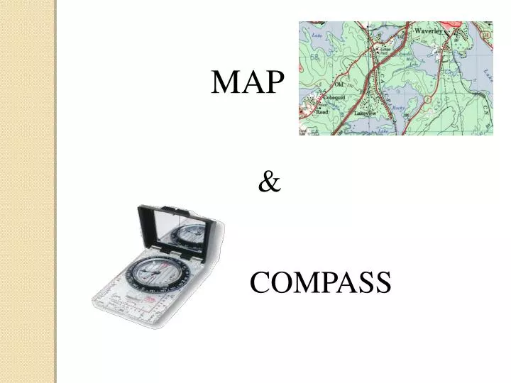
MAP. &. COMPASS. Objectives. Learn how to acquire information from a map Learn how to use and navigate with a compass Learn how to plot a route on a map and apply it to the field with your compass Become comfortable relying on your map and compass skills in the woods. Parts of a map.

E N D
MAP & COMPASS
Objectives • Learn how to acquire information from a map • Learn how to use and navigate with a compass • Learn how to plot a route on a map and apply it to the field with your compass • Become comfortable relying on your map and compass skills in the woods.
Parts of a map • Colours • Name • Index • Edition • Scale • Glossary • Grid square • Grid reference • Contour lines • Mean declination • Map Datum
Edition Where else on your map can you find the edition?
Index for 1:50 000 map of Halifax • # don’t always follow each other • Which map would you choose?
Scales A reference for distances on a map • we use maps with 1:50 000 scale and most commonly a 1:10 000 scale • The chequered squares in front of the 0 are for smaller increments
1:50 000 1:10 000
Glossary • Symbols representing objects on a map • NOTE: maps and their symbols can only be as accurate as the “map makers” can make them. The maps are made with from the data of that specific time period. • When was your map made? • North American Datum (NAD)? • 1983
How do you determine where you are?Grid Squares • The lines one your maps make squares called grid squares • They help you find yourself more easily • They can give you a very precise location • Grid squares are always 1 km by 1km (Canadian maps)
How to use the Grid Squares • UTM: Universal Transverse Mercator Grid • Maps have horizontal and vertical grid lines (like latitude and longitude) • Full grid numbers are found on the corners of the map (ex: left bottom corner 4929000 northing and 422000 easting) • Applicable grid numbers are found along the grid lines and correspond to the bold number
Reading the grid square • 1st Eastings: lines that describe your position eastward/westward, lines that are vertical • 2nd Northings: lines that describe your position north/southward, lines that are horizontal • To determine your grid square – start at the bottom left corner of the grid square and read ‘into’ it • OR get into the elevator then go up • OR jump over the line, then climb into the square
Grid Square 34_ 71_
Using a romer 45 46 47 48 49 50 A 9 7 5 3 1 1 3 5 7 9 B 69 68 67 9 7 5 3 1 1 66 3 5 7 9 65 A = 47_ 68_ 4 6 B= 48_ 66_ 3 3
MAP EXERCISE Describe what you find at the following grid references 1. 427 347 2. 358 474 3. 473 408 4. 367 308 5. 367 394 6. 537 521 Hatchet Lake Campground Building Cochrans Island Dan Hill Water Tower
CONTOUR LINES Contour lines connect a series of areas of EQUAL ELEVATION and are used to illustrate relief and dept on a map
Contour lines can determine the direction of water flow • Along waterways, contour lines form a ‘V’ shape • The ‘V’ points toward the origin of the river, and therefore, • The river flows away from its origin
Contour lines used to indicate direction of water flow
Water flow exercise • Go to 385 356 to McGrath Falls. There are two rivers north of it. Which direction is the river flowing from? • 410 308 Croucher Lake. There is a river south east of the lake. Which direction is the river flowing from? • Why does the direction of river flow important?
COMPASS • 360° dial with North sign • Direction of travel arrow • Index line • Orienteering lines • Magnetic needle • Base plate • Ruler • Scales
2 Ways to use your compass • Use it in the field • To get a bearing of the direction you are travelling • To orient yourself to a bearing you already have • Use the RED (action) arrow when you’re out being active! • Red in the Bed! • Use it to get your direction on a map • Use the orienteering lines within the dial to line up with the lines on the map
Bearing = a number in degrees that depicts a direction (from a map or from a compass)
1. Taking a compass bearing in the field • Hold your compass, cradled flat in your palm, in front and away from your body • Ensure the direction of travel arrow (arrow on the base plate) is pointed at your target • Turn the 360° dial until the Red Needle sits in the Red Bed (NOTE: this is North, but its not necessarily your bearing!) • Read your ‘magnetic’ bearing at the “index line” on the dial (it may be the same as your direction of travel arrow)
Back Bearing • Put the RED in the opposite bed. You get the complete opposite bearing, and it should correlate with where you were just coming from.
Outside effects on a compass Anything magnetic • Power lines • Cell phones • GPS Large amounts of metal • Large metal objects • Large metal veins in rocks
1. Getting a bearing from a map • Determine point A and B • Draw a line • Set the edge of your compass on the line **with your direction of travel arrow actually pointing towards your direction of travel !! • Turn the dial – **with the North on the dial pointing North (top of map) – and line up the orienting lines with the gridlines on the map • Read the bearing number at the index line (lines up with direction of travel arrow) • This is a MAP bearing
ORIENTING MAP & COMPASS N B A
Other ways to get a MAP bearing • Instead of using your compass to get the bearing, you can use a protractor. • You can also use a transparent square grid. • Using a ruler to calculate distance is very easy. 360°/0° 270° 90° 180°
360°/0° 315° 45° 270°90° 225° 135° 180° Quick bearing taking
MAP BEARING EXERCISE 060 1 160 1 2 = ______ S 2 226 2 3 = ______ 3 180 3 4 = ______ 080 4 F = ______ F 4 S 1 = ______
True North vs Magnetic North • There is a Rotational North/South Pole, and a Magnetic North/South Pole • The magnetic pole is located on Prince of Wales Island in northern Canada (about latitude 73° N, longitude 100° W) • The angle between the True North or Grid North and the Magnetic North is called the MEAN DECLINATION • Notice that the declination can be towards the east or towards the west, and there is no declination close to western Ontario (Thunder Bay). • The study of the planets magnetic fields is called Geomagnetism.
How to apply Mean Declination • In mainland Nova Scotia, we have an approximate 20° west ‘mean declination’ • When we apply magnetic information (compass) to a map, we have to subtract that 20° • When we apply map information to a compass, we have to add 20° MAP → +20 ° → MAGNETIC MAGNETIC →-20°→ MAP
Staying on course while going around barriers Direction of travel 20° 1. Stop at barrier 2. Pick landmark on other side 3. Walk around the landmark 4. Continue on original course Direction of travel 20°
Staying on course while going around a barrier you can’t see through Check back bearing 200° Resume direction of travel 20° 110° 100 Paces 20° Until the barrier is cleared 290° 100 Paces Direction of travel 20° Walk to barrier, and flag or mark point