Download
1 / 19
190 likes | 267 Views
Time Series for Access Canal at Hackberry Beach, La of the Louisiana Chenier Plain 1984 - 2006. Aerial Video Survey Program Pontchartrain Institute of Environmental Sciences University of New Orleans. Karen A Westphal.

E N D
Time Series forAccess Canal atHackberry Beach, La of the Louisiana Chenier Plain1984 - 2006 Aerial Video Survey Program Pontchartrain Institute of Environmental Sciences University of New Orleans Karen A Westphal
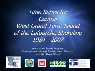
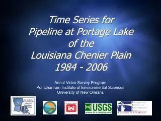
The Aerial Video Survey Program has been acquiring photography and video of the northern Gulf of Mexico shoreline since 1984. Oblique aerial photography does not produce exact matches due to variations in altitude, camera angle and distance from the shore (and different photographers). Photos that matched well were scaled and aligned to illustrate the landscape changes that have taken place between time periods. Occasionally a pointer or symbol was added to assist with the visual comparison.
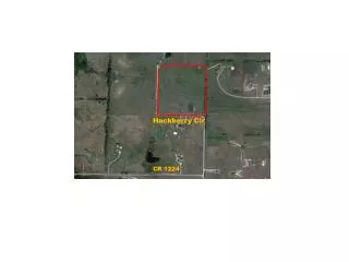
Location of the access canal at Hackberry Beach, Louisiana The access canal lies within BICM segment 4 “Hackberry Beach,” and diverges from the former Mermentau River.
1984 29º44’18"/93º02’51” - View to north
1985 - Post-Hurricane Juan 29º44’18"/93º02’51” - View to north
1986 29º44’18"/93º02’51” - View to the north
1988 29º44’18"/93º02’51” - View to the north
1989 29º44’18"/93º02’51” - View to the north
1991 29º44’18"/93º02’51” - View to the north
1992 29º44’18"/93º02’51” - View to the north
1993 29º44’18"/93º02’51” - View to the north
1996 29º44’18"/93º02’51” - View to the north
2001 29º44’18"/93º02’51” - View to the north
2005 - Post Hurricanes Katrina & Rita 29º44’18"/93º02’51” - View to the north
2006 29º44’18"/93º02’51” - View to the north
9 Years 1984 1993
13 Years • 1993 • 2006
22 Years • 1984 • 2006
Relevant Coastal Restoration Projects • East Mud Lake Marsh Management. State Project Number: CS-20 Project Priority List (PPL): 02 Federal Sponsor: Natural Resources Conservation Service (NRCS) Project Type: Marsh Management Construction Completion Date: 1996 Description: The project is intended to create a hydrologic regime conducive to restoration, protection, and enhancement of the Mud Lake area by using various types of water control structures and vegetation plantings. Structural components include culverts with flapgates, two variable crest weirs, three earthen plugs, and repair of an existing levee. http://dnr.louisiana.gov/crm/coastres/projectlist.asp