Download
1 / 11
110 likes | 193 Views
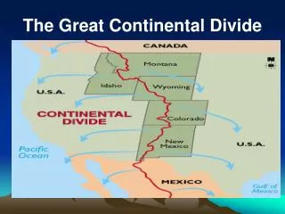
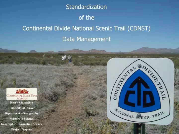
Standardization of the Continental Divide National Scenic Trail (CDNST) Data Management. Kerry Shakarjian University of Denver Department of Geography Masters of Science Geographic Information Science Project Proposal. ~3,100 miles crossing MT, ID, WY, CO, NM

E N D
Standardization of the Continental Divide National Scenic Trail (CDNST) Data Management Kerry Shakarjian University of Denver Department of Geography Masters of Science Geographic Information Science Project Proposal
~3,100 miles crossing MT, ID, WY, CO, NM • Multiple land management agencies: BLM, NPS, US Forest Service • Lead agency = US Forest Service (Lakewood, CO) • Lead partner = Continental Divide Trail Alliance (CDTA) Overview Purpose Can multiple agencies utilize the same data standardization protocol for CDNST? Can database management systems be used across multiple agencies to coordinate CDNST data after collection?
Varying trail management policies • Different methods/protocols among agencies • Need: Multi-jurisdictional collaboration • GIS attribute coding disagree • Agency road definitions differ • Creates potential for different interpretation • Need: One method of coding • Variety of sources • Inconsistent data collection • Need: Systematic data collection Data Consistency
Tool for Managing CDNST • FS Infrastructure database (Infra) • Accountability through accomplishments • Funding incentives • Spending wisely – future funding from Congress • Minimize redundancy to • achieve consistency • Multiple user interface across • agency boundaries Infra’s business flow chart (FS, 2004)
Data Required • Current Infra database access • Why? GIS stored in Infra (data layers, aerials, topos etc.) • Most up-to-date GIS and Strategic Plan Project Instructions for Completing and Updating CDNST GIS Data • Attribute metadata • List of key GIS/Infra specialists • Within agencies (data collection & integration knowledge) • Within the study area (key to pilot project support) • Most current GIS CDNST data • Data needs assessment (pilot project-New Mexico)
Methods • Compare current attributes of CDNST data to standards and criteria for trails • Use trail data to evaluate Infra in relation to CDNST data • Redefine data criteria and methods for collecting data • Determine best technologies for data collection & possible integration into Infra • Develop, test and modify data dictionaries for collecting • CDNST data for populating Infra • Determine best data dictionary for integration into Infra
Pilot Project Flow Chart Bureau of Land Management U.S. Forest Service National Park Service New Mexico CDNST Continental Divide Trail Alliance (CDTA) Data Attributes Data Dictionary Standardize Methodologies Data Collection Quality Control (Trail data criteria met?) Infrastructure Database (or similar format)
Timetable • June-August 08: Compile Trail data standards & criteria • September-October 08: Complete evaluation of CDNST attributes in a format compatible with Infra • November 08-February 09: Field work to determine best technologies and evaluate data dictionary • March-May 09: New Mexico project area data collection using final technology and data dictionary • Develop sample data entry forms for integration into Infra (non-GIS users) • June-August 09: Final evaluation of data collection method • September-December 09: Finalize thesis project report
Deliverables • Final data dictionary for CDNST feature attributes • Non-GIS Data Entry Form • User manual for CDNST data collection