Download
1 / 11
430 likes | 1.2k Views
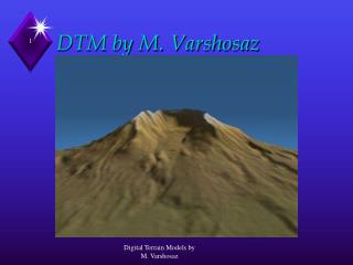
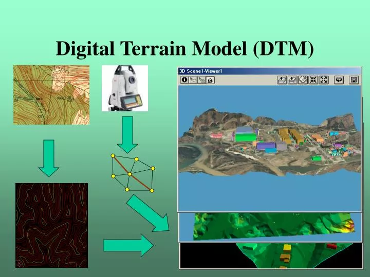
Digital Terrain Model (DTM). Idea of DTM. A digital terrain model (DTM) is a topographic model of the bare earth that can be manipulated by computer program (Wikipedia). Aim: height interpolation at any point based on measured/known points. Interpolation method.

E N D
Idea of DTM A digital terrain model (DTM) is a topographic model of the bare earth that can be manipulated by computer program (Wikipedia) Aim: height interpolation at any point based on measured/known points Interpolation method • Continuous interpolation preferred (0 order, 1st order, 2nd order continuity) • Good approximation of the surface of the earth Digital Elevation Modeling Journal
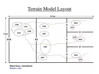
Layout of base points Regular layout base points (tesselation/GRID) Boundary restrictions (e.g. lakes) Break lines extremal points Irregular base points + +
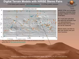
Collection of elevation data Topographic survey (irregular points and breaklines) Leveling of grid points Photogrammetry (grid, contours) Contour line digitizing (contours + extremal points + breaklines) Radar measurements (SRTM Shuttle Radar Topography Mission) 1” resolution (30 m) US only 3” resolution (100 m) GTOPO3030” resolution Sample data
Creation of a DTM Regular layout (Rectangular Grid, DEM) • Interpolated points from irregular base points • Inverse Distance Weight (IDW) • Kriging • Surface interpolation (trends) Triangulated Irregular Network (TIN) • Original base points are used • Optimal, non overlapping triangle network, • minimal sum of perimeters • Delaunay triangulation
IDW (Shepard 1968) w – weight f – function value at the base point t – distance between base point and interpolated point p – usual value is 2 Distance limit Direction restriction (quarters)
Kriging (Krige 1951) Linear combination the elevation of base points Conditions for the weight used: Unbiased estimation Estimate minimal standard deviation Least squares method Variograms (geostatistics) h – distance from base point Effective distance, (h) doesn’t change as h increased
Surface interpolation Polynom interpolation One continuous surface (global solution) Dynamic surfaces (local, patchwork) Spline interpolation 2nd order continuity between cubic polynoms Sample Sample 2
Delaunay triangulation (1934) Minimize the sum of the perimeter of the non overlapping triangles Algorithm (incremental): Start from an optimal triangle contains all the base points then add a new point and divide the triangle Condition: no points in the inscribed circle of the triangle Sample
Voronoi cells Dual problem of Delaunay Triangulation. Areas nearest to the base points. DTM manipulation: • Add point • Add breakline • Add triangle or polygon • Erase part
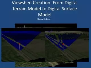
Areas of DTM applications Watershed analysis Contour line interpolation Flow directions Cross sections Modeling (e.g. erosion) Viewshed analysis Planning of roads, railways, pipelines Slope category map Aspect (slope direction) Visualization of the terrain Volume calculation Reduction (terrain correction) of gravity measurements Rectification of airbone or satellite photos Hydrologyexample 3D view of DTM