Download
1 / 57
610 likes | 922 Views
Satellite Communications. Learning Objectives:. At the end of this topic you should be able to: describe satellite communications, give examples of typical applications of satellite communications. explain the advantages and disadvantages of satellite communications,.

E N D
Learning Objectives: At the end of this topic you should be able to: • describe satellite communications, • give examples of typical applications of satellite communications. • explain the advantages and disadvantages of satellite communications,
What is a Satellite? Meteosat weather satellite Weight: 2000kg
What is a Satellite? • a satellite is any object that revolves around a planet • there are many manmade (artificial) satellites, • ~13,000 satellites are tracked in real time • some are inactive, some are debris from space missions … • the path a satellite follows is called an orbit, • to access a satellite requires ‘line of sight’ communication • the receiver (satellite dish) must be in the satellite’s ‘footprint’ • most satellites are custom built to perform a function.
What are satellites used for? • television broadcasting • satellite TV (e.g. Sky) • telephone communications, • satellite ‘phones (e.g. “Iridium”) • weather forecasting, • satellite images (visible, infra red, radar) • Internet communications, • scientific research, • climate monitoring, global disaster monitoring, …. • Global Positioning System • GPS satellite navigation (‘SatNav’) • satellite tracking, security
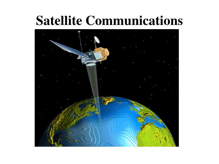
How does Satellite Communications work? Generally: • there is a transmitter on the ground • the transmitter sends signals to a satellite • using microwaves • signal is received & amplified by the satellite • signal is retransmitted back to Earth • signal reaches its recipient • or is 'bounced back' to another satellite
Where are these satellites? There are 2 main types of satellite orbit: • Geostationary orbit • always positioned over the same spot on Earth • orbit at 22,000 miles (36,000 km) • Low Earth Orbit (LEO) • orbit at 400-800km
Geostationary Satellite • always positioned over the same spot on Earth • orbits at the same rotational speed as the Earth • approx 10,000 km/h • orbits 22,000 miles (36,000 km) above the Earth, • about a tenth of the distance to the Moon • able to capture images of the whole Earth disc • used by TV and weather satellites • this is why a satellite TV dish is bolted in a fixed position.
LEO Satellites • much closer to Earth than a geostationary orbit, • orbit at 400-800km (aircraft fly at 11km, ISS ~300km), • orbit at ~27,000 km/h (17,000 mph) • each orbit takes ~ 90mins, • has a smaller footprint than a geostationary satellite • can resolve finer detail (optical resolution ~40cm in 2010) • usually employ a group of satellites, • each in the same orbit, • at least one satellite is visible at any time, • possible to access satellites from any point on Earth, • GPS & satellite navigation (‘Navstar’) • use satellite ‘phone in remote locations (‘Iridium’ satellites), • global Internet access.
Advantages of Satellite Communication • can reach remote places • so people can be contacted wherever they are • e.g. areas where there is no cellular/fixed line connection • high bandwidth • many simultaneous calls can take place • video & audio can be transmitted in real time • cost of communication is distance independent • whether message is sent 10 km or 6000 km
Disadvantages of using Satellites • are expensive to set up and maintain • needs line of sight • can lose signal out of footprint or in built up areas • affected by weather conditions/interference • leading to signal degradation • distance from Earth • means messages takes time • can cause unacceptable delay on communications • general congestion in space • limitation on number of satellites in geostationary orbit
Uses for Satellite • Weather satellites • Communications satellites • Scientific satellites • Navigational satellites • Earth observation satellites • Military satellites
Weather Satellite • can see what's happening at the moment.
Weather Satellite • can see what's happening at the moment. • help meteorologists predict the weather
Weather Satellite • can see what's happening at the moment. • help meteorologists predict the weather • typical weather satellites include the Meteosat, GOES and NOAA satellites.
Weather Satellite • can see what's happening at the moment. • help meteorologists predict the weather • typical weather satellites include the Meteosat, GOES and NOAA satellites. • satellites generally contain cameras that can return photos of Earth's weather,
Weather Satellite • can see what's happening at the moment. • help meteorologists predict the weather • typical weather satellites include the Meteosat, GOES and NOAA satellites. • satellites generally contain cameras that can return photos of Earth's weather, • use visible and infra red imaging
Weather Satellite • can see what's happening at the moment. • help meteorologists predict the weather • typical weather satellites include the Meteosat, GOES and NOAA satellites. • satellites generally contain cameras that can return photos of Earth's weather, • use visible and infra red imaging • use either geostationary positions or polar orbits.
Weather Satellite Hurricane Katrina (August 2005)
Weather Satellite Hurricane Katrina (August 2005)
Scientific & EO Satellites • climatic phenomena
Scientific & EO Satellites • climatic phenomena • monitor, analyse and forecast future changes
Scientific & EO Satellites • climatic phenomena • monitor, analyse and forecast future changes • chart sea-surface temperatures
Scientific & EO Satellites • climatic phenomena • monitor, analyse and forecast future changes • chart sea-surface temperatures • global ocean colour • phytoplankton are a major influence on the amount of carbon in the atmosphere
Scientific & EO Satellites • climatic phenomena • monitor, analyse and forecast future changes • chart sea-surface temperatures • global ocean colour • phytoplankton are a major influence on the amount of carbon in the atmosphere • NASA monitors lake and reservoir height variations for approximately 100 lakes
Scientific & EO Satellites • climatic phenomena • monitor, analyse and forecast future changes • chart sea-surface temperatures • global ocean colour • phytoplankton are a major influence on the amount of carbon in the atmosphere • NASA monitors lake and reservoir height variations for approximately 100 lakes • track natural events in progress, • fires, floods, volcanic eruptions
Scientific & EO Satellites • climatic phenomena • monitor, analyse and forecast future changes • chart sea-surface temperatures • global ocean colour • phytoplankton are a major influence on the amount of carbon in the atmosphere • NASA monitors lake and reservoir height variations for approximately 100 lakes • track natural events in progress, • fires, floods, volcanic eruptions • deforestation
Scientific & EO Satellites • climatic phenomena • monitor, analyse and forecast future changes • chart sea-surface temperatures • global ocean colour • phytoplankton are a major influence on the amount of carbon in the atmosphere • NASA monitors lake and reservoir height variations for approximately 100 lakes • track natural events in progress, • fires, floods, volcanic eruptions • deforestation • astrophysical observations - Hubble Space Telescope
Scientific & EO Satellites 1975 1985 1992 Deforestation in Brazil
Scientific & EO Satellites 1975 1992 2006 Deforestation in Brazil http://earthobservatory.nasa.gov/IOTD/view.php?id=35891
Scientific & EO Satellites Mineral Exploration Image displays the mineral abundance layer. Red = Mica, Cyan/Green= Kaolinite, Blue= Alunite, Beige = Carbonate, Brown = Silica, Mauve = Iron