1 / 0

“ Map of Batanes ”

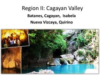
“ Map of Batanes ”. “BATANES”. The provincial capital is Basco . With fewer than 16,000 inhabitants Land area: 230 square kilometers, Population: 18,000 Pristine islands posses a rich Ivatan culture Locals wear traditional articles of clothing

levia
Download Presentation

“ Map of Batanes ”

An Image/Link below is provided (as is) to download presentation Download Policy: Content on the Website is provided to you AS IS for your information and personal use and may not be sold / licensed / shared on other websites without getting consent from its author. Content is provided to you AS IS for your information and personal use only. Download presentation by click this link. While downloading, if for some reason you are not able to download a presentation, the publisher may have deleted the file from their server. During download, if you can't get a presentation, the file might be deleted by the publisher.

E N D

Presentation Transcript


  1. “Map of Batanes”
  2. “BATANES” The provincial capital is Basco. With fewer than 16,000 inhabitants Land area: 230 square kilometers, Population: 18,000 Pristine islands posses a rich Ivatan culture Locals wear traditional articles of clothing Known for their stone houses, Ivatan kitchen which is built separately around a great stove Different kinds of houses: the panyisanan or farm house, the pangasinyan or “house where salt is made”, and the kamadid or boat house.   Local cuisine features is simple yet hearty Authentic Ivatan cuisine Their houses are made of bricks and stones designed to withstand typhoons that visit the province several times a year.
  3. Places of Interest in Batanes: ● House of Dakay (1887) a UNESCO heritage building. ● Lighthouses of Batanes ● St. Dominic de Guzman Parish Cathedral ● Mt. Iraya - A 1008-meter mountain on Batan Island. ● Mahatao View Deck ● Burial Caves - Pre-historic burial caves in the town of Itbayat. ● Sumhao Wind Power Plant ● Nakaboang Beach, Ark & Cave ● Songsong Ruins ● Beaches - Chadpidan Beach, White Beach and more. ● Payaman - known as "Marlboro Country", a pasture overlooking farm fields & the Pacific Ocean.
  4. Its terrain consists of rolling hills and mountains. Travellers like to call the islands Little Hawaii due to its spectacular landscapes. The people of Batanes are mostly Ivatans and Ilocano migrants from the Ilocos and Cagayan Valley Regions. The island province of Batanes is accessible by air and served by the following airlines: SEAIR (http://www.flyseair.com/destinations/batanes) SKYPASADA (http://www.skypasada.com/ Batanes holds one of the most festive town fiestas. It also offers numerous exciting places of interest such as the Ivatan houses  which are made of thick lime and stone walls with cogon grass roof. Another interesting spots to visit are the theMarlboro Country and the Y'ami. 
  5. Hotels and Inns in Batanes: ● Brandon's Lodging - 11 tastefully decorated rooms each with TV, aircon and toilet & bath. Contact: Madeleine Siazon at +63 919 366 2158 for reservations. ● Batanes Resort - P550 /day and up. Tel. #  9229621 local 327 (Ivatan Center, Q.C.) ● Batanes Seaside Lodge P450 /day and up Tel. # 0981-993613 ● Ivatan Lodge - P100/1 pax, P400/ 1 or more pax/day. Email: ivatanlodge@ yahoo.com ● Shanedel's Inn - P200 /day 0920-4470737 ● Troy Lodge - near airport Tel. # 0920-4470726
  6. Batanes is subdivided into 6 municipalities: Batanes has only one congressional district. Basco Itbayat Ivana Mahatao Sabtang Uyugan
  7. “Map of cagayan”
  8. “CAGAYAN” "The Land of Smiling Beauty” capital is TuguegaraoCity land area of 9,002.70 square kilometers showcased in museums, historical buildings and archeological sites spread across the province. has a variety of areas with outstanding scenic beauty ranging from beaches, picturesque mountains, bird sanctuaries, game refuges, limestone caves, fluvial attractions, museums, historical landmarks and centuries-old churches. was enjoyed exclusively by tourists from Mainland China, Hong Kong, and now they are ready to open the doors to Filipinos.
  9. The majority of people living in Cagayan are of Ilocano descent, mostly from migrants coming from the Ilocos Region. Callao cave in Penablanca Blue waters in Baggao The first suspension bridge in Asia in Lallo and many more there is 1 airport in Cagayan located in Tuguegarao City. accessible by land, air, and sea. celebrating its annual fiesta celebration in honor of patron saint St. Augustine. The Kagay-an Festival 2010′s list of activities for August . New events : “Garbosa Oro 2009: Outstanding Kagay-anons”- a recognition of exceptional Kagay-anons who brought honor and pride to the city which will be held at the Rodelsa Hall, Liceo de Cagayan University on August 28; “Serenata at the Park” at KioskoKagawasan in Divisoria on August 28; “Regional Trade Fair 2009”, a wide array of display and sale of locally-made products of the region based on “One-Town, One-Product” (OTOP) concept to be staged at the Limketkai Rotunda from August 20 to August 28.
  10. Among the crowd-drawing festival activities include; “Kagayan Dance Festival”, a street dancing competition showcasing Northern Mindanao indigenous people’s dances on August 24; “Ms. Kagay-an 2009”, a beauty and talent search of the city’s finest, gorgeous and witty Kagay-anon ladies vying for the title as Cagayan de Oro City’s Ambassadress of Goodwill and Tourism on August 25 “Kagay-an 3rd Golden Float Parade”, a float competition depicting the city’s growth and development, history, people, culture and event on August 26 “Lambagohan-River Festivities”, a fluvial procession and river rafts competition at the Cagayan de Oro River on August 27; “Kumbira 2009”, a culinary show and live competitions to be held at the Limketkai Atrium from August 13 to 15; “National Horseshow and Competition”, a 3-day event showcasing equestrian events and horseback games at the Mountain Meadows, Fil-Estate Grounds in barangayGusa from August 21 to 23; “Kapuso Mall Show” at the Limketkai Atrium on August 26.
  11. Tourist spots in Cagayan Province Cathedral of Sts. Peter and Paul- in Tuguegarao City San Raymundo De Penaforte Church in Rizal Our Lady of Piat Basilica - a pilgrimage site Santa Maria Bell - oldest bell in the Philippines, in Camalaniugan Pamplona Church built in 1614 St. Philomene Church in Alcala built in 1881. Calvary Hills in Iguig - a favorite pilgrimage site during Holy Week Callao Caves in Penablanca BaggaoBluewater Falls and cave Palaui Island - for highendgamefishing Chico River - good for white water rafting Magapit Suspension Bridge in Lal-lo Cape Engano Lighthouse in Sta. Ana Beaches in Claveria, Sanchez Mira, Aparri, Ballestores, and Gonzaga Lallo as Ciudad Nueva Segovia (Nueva Segovia City) Provincial Museum in Tuguegarao Iguig Pottery Making
  12. Cagayan has 28 municipalities and one city divided into three congressional districts. It has 820 barangays. Abulug Alcala Allacapan Amulung Aparri Baggao Ballesteros Buguey Calayan Camalaniugan Claveria Enrile Gattaran Gonzaga Iguig Lal-Lo Lasam Pamplona Peñablanca Piat Rizal Sanchez-Mira Santa Ana Santa Praxedes Santa Teresita Santo Niño (Faire) Solana Tuao
  13. “Map of Isabela”
  14. “ISABELA” second largest province of the Philippines next to Palawan. capital is Ilagan the most populated province among the five provinces in Cagayan Valley. population of 1,401,495 people and comprising 45.93 percent of the 3 million people in the region. land area of 10,665 square kilometers, representing almost 40 percent of the regional territory. one of the most volcanically active islands in the world. For all ages, the sex ratio in Isabelawas about 105 with 660,627 males and 626,948 females in the 2000 Census of Population and Housing (Census 2000). There are more males than females below 50 years old. Ilocanos are the most prominent group fertile fishing ground on the Pacific Coast. The reservoir of the Magat Dam is utilized for fish cage operations, such as tilapia production for domestic markets.
  15. There are 2 airports in the province - Cauayan Airport  and in Palanan. Accessible by air and sea Hotels: La Casa de Marita Red Mangrove Isabela Lodge Iguana Crossing Hotel Albemarle Beto's Beach Bar Hotel There are also Tagalog migrants in the province. Tigkalalag Festival of the Municipality of Isabela celebrated every 2nd day of November is the most peculiar festival of Negros Occidental. 
  16. Tourist spots in Isabela Province Northern Sierra Madre National Park - a spectacular eco-sanctuary covering 350,000 hectares, the largest in the country Palanan - a historic town where Emilio Aguinaldo was captured by the Americans. Also a wilderness area where the Disadsad Waterfalls is located St. Mathias Parish Church - a heritage structure in Tumauini Church of Alicia Magat Dam in Ramon Town World's Largest Butaka (armchair) in Ilagan Isabela Museum and Library Isabela is subdivided into 35 municipalities and 2 cities.
  17. “Map of Nueva Bizcaya”
  18. “NUEVA VISCAYA” aprovince of the Philippines located in the Cagayan Valleyregion in Luzon. capital is Bayombong. land area of 4,378.80 square kilometers, which accounts for 16.30% of the total land area of Region II.  Majority of the people in Nueva Vizcaya are Ilocanos. Gaddangs, Ibanags, Ifugaos, Bungkalots, and Kankanais form the minority.  traces of the culture and customs of its early settlers - theIlongots (Bugkalot), Igorots, Ifugaos, Isinays, and the Gaddangs - can still be seen. very mountainous attracts visitors to Mt. Pulog National Park.  Accessible by land
  19. Festivals: Panagyaman Festival / Nueva Vizcaya Day (May 19-24)Celebrated with parades, beauty pageant, trade shows, and agro-industrial fair, among others. Citrus Festival (Malabing Valley, Kasibu; August)During the festivities, visitors are allowed to pick-and-pay in the town’s popular citrus farms. Kalanguya FestivalCelebrates the indigenous way of life of the Kalanguya tribe in the town of Sta. Fe. The influx of civilization and the infusion of modern technology to the life stream of the province induced many immigrants from adjacent provinces to migrate to this province.
  20. Nueva Vizcaya have two Universities: Nueva Vizcaya State University Saint Mary's University Nueva Vizcaya is subdivided into 15 municipalities. Alfonso Castañeda Ambaguio Aritao Bagabag Bambang Bayombong Diadi Dupax del Norte Dupax del Sur Kasibu Kayapa Quezon Santa Fe Solano Villaverde
  21. “Map of Quirino”
  22. “QUIRINO” province of the Philippines located in the Cagayan Valleyregion in Luzon. capital is Cabarroguis and was named after ElpidioQuirino, the sixth President of the Philippines.  province is generally mountainous, with about 80 percent of the total land area covered by mountains and highlands. population of the province was 148,575, with a density of roughly 49 persons per square kilometer of land. major language is Ilocano, which is widely spoken in the lowlands by 71.46 percent of the total populace. Although most of the people in the province are Ilocanos, a large number of them are migrants from Ifugao.  Accessible by land The province celebrates the Panagdadapun Festival on the second week of September to showcase the province's tribal culture.
  23. TOURIST ATTRACTIONS/DESTINATIONS:  NAGBUKEL CAVE  AGLIPAY CAVES AND CAMPSITE  GOVERNOR RAPIDS  AGLIPAY TOWN  NAGTIPUNAN TOWN  BISANGAL FALLS  MACTOL FALLS/SAN PUGO FALLS STA. VICTORIA FALLS and ADDALAM DAM & WATERSHED Quirino is subdivided into 6 municipalities. Aglipay Cabarroguis (capital) Diffun Maddela Nagtipunan Saguday
  24. THE END … THANK YOU FOR LISTENNING … PREPARED BY: ARIATE, DAISY FEME C. GOD BLESS!!!
More Related