Download
1 / 31
350 likes | 776 Views
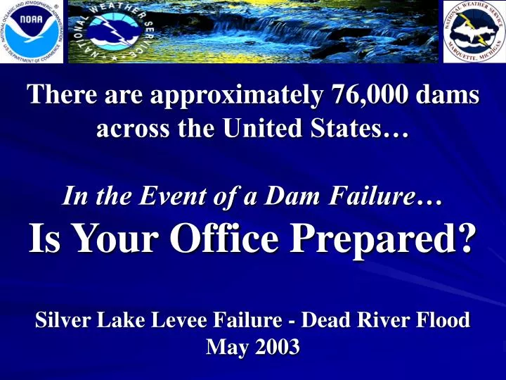
There are approximately 76,000 dams across the United States… In the Event of a Dam Failure… Is Your Office Prepared?. Silver Lake Levee Failure - Dead River Flood May 2003. Outline:. Overview Upper Michigan and the Dead River Basin The storm and heavy rainfall

E N D
There are approximately 76,000 dams across the United States… In the Event of a Dam Failure…Is Your Office Prepared? Silver Lake Levee Failure - Dead River Flood May 2003
Outline: • Overview • Upper Michigan and the Dead River Basin • The storm and heavy rainfall • The Silver Lake levee failure • Best Practices • Lessons Learned & Actions Taken • Credits
High-Resolution Topography Image: This AWIPS image illustrates the higher elevations of the Huron Mountains over North-Central Upper Michigan. Orographic effects regularly enhance rainfall and snowfall amounts in this area, which include the headwaters of the Dead River Basin. Huron Mountains Dead River Basin Marquette *
Of the five Dams on the Dead River Basin, four are rated as High Hazard! Tourist Park Dam Forestville Dam Mc Clure Dam Hoist Dam Silver Lake Dam
MSAS & ETA MSLP, and ETA 3hr Accumulated Precipitation… The ETA MSLP and MSAS MSLP analysis are both plotted to show the ETA model had a fairly accurate depiction of the system. Track of the low allowed for a nearly continuous upslope flow across the Huron Mountains and the headwaters of the Dead River Basin. Click To Start Loop…
Coop Reports Vs. ETA… Actual Rainfall Amounts… ETA Accumulated Precipitation… Valid at 00Z, May 13th
At the Breach… • It is estimated 9.8 billion gallons (30,000 acre-feet) of water was released downriver. This created a new channel 100 yards wide and 25 feet deep, and rejoined the original channel a quarter mile downstream. • A State of Emergency declared at 1:30 am EDT on May 15, 2003. Former Location of levee Silver Lake Bed
Dead River Flooding Continued… • On May 15, 2003 homes and camps along the Dead River Storage Basin behind Hoist Dam were damaged by flood waters as the level rose about 10 feet above normal. Many residents did not realize they were in a flood plain.
The Flood Wave At Tourist ParkOn May 15, 2003 1000 AM 140 PM 210 PM 240 PM
Tourist Park Flooding… • Despite being drawn down 5 feet, water levels eventually over-topped the Tourist Park Dam and eroded it away in a manner of hours. • Tourist Park is a recreation area located right in the city of Marquette, as seen in the background of the picture above. Former Location of Levee
Tourist Park Flooding Video Just After the Breach… Click to Begin Video… Time of video is around 140 pm EDT on May 15, 2003.
Tourist Park Flooding at Peak River Flow… • Aerial photos show the widespread inundation at the Tourist Park Dam during peak flows.
Tourist Park Flooding Video At The Peak River Flow… Click to Begin Video… Time of video is around 240 pm EDT on May 15, 2003.
Tourist Park Flood Damage Video… Click to Begin Video… Time of video is around 400 pm EDT on May 15, 2003.
Flooding in Marquette Continued… • Flood waters caused the Presque Isle power plant (top left) to shutdown for approximately six weeks • The only bridge to Presque Isle Park, the Presque Isle Marina, and the LS&I ore dock was washed out (bottom right)
Flooding at the Presque Isle Power Plant… • Considerable damage was done to the 620 Megawatt power plant, with the shutdown costing as much as $1 million per day • Nearby mines which relied on the power were forced to temporarily lay off 1100 workers, and voluntary power conservation was asked until the power plant was fully operational • Access to the Dead River was restricted by an order from the Governor.
Local Impacts… • Six units of Government affected • Major employers impacted: • WE Energies • Cleveland-Cliffs Iron Company • Northern Michigan University • Marquette Board of Light and Power • Argonics • Pioneer Labs • At least 8 small to medium employers affected • 20 homes and 3 businesses were damaged
Dead River Flood • 3 dams or dikes damaged and 2 dams or dikes destroyed • Damage to 2 parks and 3 public access sites • Persons sheltered or fed by Red Cross: 57 • Roads and 9 bridges damaged or destroyed: $3,000,000 • Major river channel realignments and significant environmental damage including fisheries, soils, and trees: $4,000,000 Source: FERC Investigation of Activation of Fuse Plug Spillway
Dead River Flood • Substantial mobilization of emergency response system and support services: $127,000 • Utility Facilities Damaged: $10,400,000 • Energy conservation instituted as a result of power plant shutdown • Potential for significant personal property loss, carried off in flood waters • Community Economic Impact: $84,000,000 Source: FERC Investigation of Activation of Fuse Plug Spillway
Best Practices… • A nearly continuous presence by NWS personnel at the Emergency Operations Center (EOC) • Establishment of good working relationships with local users facilitated early notification. • Networking is key…it is all about who you know! Aggressive outreach and networking allowed for efficient and effective interaction with other agencies.
Best Practices Continued… • Gutsy decision making without knowing all of the facts led to increased lead time downstream • Product update frequency was driven by the event • Point of contact established early on allowed for continuity in statements and services • A point of contact was established to assure all incoming communication and information was properly logged. • An effective briefing procedure was developed to pass along critical information to succeeding shifts.
Best Practices Continued… • A well-documented hydrology program, workshops, and proficiency drills enabled staff to handle the event in the absence of the focal point and the supporting service hydrologist. • Learn from past events…analyze hydrologic products and services after every event. • Previously setup templates in WarnGen for all EAP’s allowed for quick issuance of the initial warning. • Emergency Action Plans were well maintained, up to date, and readily available to the staff.
Best Practices Continued… • River forecast center went to extended hours. • Consistency of WFO and RFC personnel during the event. • Superb support and expertise was provided by regional staff and supporting service hydrologist. • Prompt notification of the event to high-level NWS and NOAA officials by WFO and region. • WFO made concerted effort to provided photos to the river forecast center and region as they became available.
Best Practices Continued… • Increased data collection during the event. • Early activation of amateur radio operators resulted in collection of valuable information during the event. • Extensive field surveys and documentation were conducted during and after the event. • Forecast grids played a valuable role in providing specific high resolution forecast data to other agencies.
Findings - Actions Taken • Information inconsistent between EAP and Damcat. • WFO will ensure consistency between EAP and Damcat. • Staff was unsure of HPM’s availability. • All Program Managers will inform staff of availability and travel plans. • There was some confusion regarding the appropriate wording for the initial FFW. • WFO will work with users to establish appropriate wording of preformatted FFW/FFA for dams, and will review the products during table top exercises. WFO should encourage participation by all staff members as appropriate.
Findings Continued… - Actions Taken Continued… • There was a lack of data on reservoir pool elevations and river levels downstream. • WFO will encourage development of automated monitoring systems, and incorporate the data into WHFS. • Emergency Management officials seemed unsure regarding the issuance of a CEM. • WFO will reiterate the capabilities of the NWS to disseminate critical information via NWR and the CEM product. • EOC was staffed by various personnel, and it was not always clear as to who was performing what function. • WFO must become familiar with EOC operations concepts and continue networking.
Findings Continued… - Actions Taken Continued… • WFO did not take full advantage of available state resources. • WFO will establish working relationship with state dam safety engineer. • Remoteness of location made collection of data and information difficult. • WFO will formalize a plan to ensure the collection of critical information during and after the event. • WFO did not coordinate issuance of “For The Record” (FTR) report with RFC. • WFO will coordinate issuance of the FTR when appropriate.
Findings Continued… - Actions Taken Continued… • EOC operators did not seem to fully understand the NWS’ capability to disseminate information and alert the public and media. • WFO will explain warning dissemination capabilities at table top exercises and outreach opportunities with EM’s and other local officials. • Cable television broadcasts were not interrupted for the initial FFW. • WFO will work with cable television companies to ensure broadcasts are interrupted for appropriate NWS products. • Normal update cycle for AHPS webpages was not frequent enough to capture the rapidly evolving event. • WFO should increase update cycle for AHPS webpages during fast-responding, short-fuse events.
Findings Continued… - Actions Taken Continued… • NWS not always invited to EAP table top exercises. • NWS should actively participate in EAP table top exercises to explain warning dissemination capabilities. • Regional support of office visits between WFO and RFC paid big dividends. • Region should continue to support these inter-office visits. • RFC did not have a copy of all EAPs. • WFO will ensure RFC has all EAPs and is on the mailing list. • WFO was low on the EAP notification flow chart. • HPM will work with EAP owners to show benefits of being placed higher on the EAP notification charts.
Credits… • Service Assessment Team: • James LaRosa Hydrology Program Manager, WFO Marquette • Mark Walton Service Hydrologist, WFO Grand Rapids • Robin Turner Warning Coordination Meteorologist, WFO Marquette • Tom Hultquist Science and Operations Officer, WFO Marquette • Ed Fenelon Meteorologist In Charge, WFO Marquette • Other Valuable Contributors Include: • Noreen Schwein Water Program Leader, Services Division, Central Region Headquarters • Dan Luna Hydrologist In Charge, North Central River Forecast Center • Derek Frey Information Technology Specialist, WFO Marquette • Jack Rice Electronics Systems Analyst, WFO Marquette • Marv Taulbee Data Acquisition Program Manager, WFO Marquette • Susan McCrate Administrative Assistant, WFO Marquette • Don Rolfson Lead Forecaster, WFO Marquette • Mike Dutter Journey Forecaster, WFO Marquette • Andy Just Associate Forecaster, WFO Marquette • Heather Phillips Student Volunteer, WFO Marquette • Mark Ziemer Senior Hydrologist, North Central River Forecast Center (NCRFC) • John Hultquist Development and Operations Hydrologist, NCRFC
Credits continued… PHOTO AND VIDEO CREDITS: • City of Marquette • Marquette Weather Forecast Office • Michigan State Police • Gene Bertram – Skywarn Spotter • Michigan Department of Environmental Quality • Michigan Department of Natural Resources • Marquette County Sheriff • Marquette County Conservation District/Central Lake Superior Watershed Project