Download
1 / 14
140 likes | 301 Views
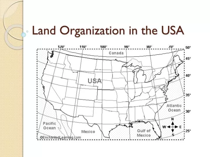
Land Organization in the USA. Land Survey Example. Common to the areas around Louisiana, long lots allowed access to waterways and/or roads by all landowners. Land Survey Example.

E N D
Land Survey Example Common to the areas around Louisiana, long lots allowed access to waterways and/or roads by all landowners.
Land Survey Example Though functional in the short-run, the use of the metes-and-bounds method of designating land sections could cause problems in proving or retaining ownership if landmarks are destroyed.
The East 32.0 feet of Lot 2 and the West 38.00 feet of Lot 3 Block 4. NORTH ROSEDALE, as recorded in Plat Book 15, Page 12, of the Public Records of Hillsborough County, Florida
Land Ordinance of 1785 A series of base lines and principal meridians function as the x and y axis respectively to form graph paper like grids. Base lines follow latitude and principal meridians follow longitude.
Land Ordinance of 1785 Divided much of the country into a system of townships and ranges to facilitate the sale of land to settlers in the West
Land Ordinance of 1785 Each township is 6 miles long and 6 miles wide AND divided into 36 one mile square sections numbered from 1 to 36 starting in the top right corner and snaking down to 36 as illustrated below.
Each township is identified on a grid much like the plotting of points on a graph in math class EXCEPT here you are locating township areas (6 miles square) not points. Each square can be subdivided using cardinal and intermediate directions.
Land Ordinance of 1785 T = Township N = North S = South R = Range E = East W = West
Settlers to the US West purchased 160 acres plots for small sums of money… the government’s means of staking claim to the open lands of the country. 160 acres = ½ mile square 160 acres ≈ 6 city blocks square
R. 7 E. R. 8 E R. 9 E T. 44 N ◄ Worksheet grid includes these four SECTIONS = 2 square miles. T. 43 N
To read the legal description you should read from right to left. Read the descriptions for which the answer is already marked to assist you in decoding the methodology of the system. A: N 1/2 of NW 1/4 of sec. 19, T.44 N., R.8. E. B: S 1/2 of SE 1/4 of sec. 25, T.44 N., R.7 E. F: E 1/2 and SW 1/4 of SW 1/4 of sec. 30, T.44 N., R.8 E. G: S 1/2 of SE 1/4 of SE 1/4 of sec. 24, T.44 N., R.7 E.
Sources • Peterson, Donald D., The 160 Acre Farm, 2007 • Rubenstein, James M., An Introduction to Human Geography: A Cultural Landscape, 2005 - page 11