Download
1 / 68
700 likes | 898 Views
NOAA’s Satellite and Information Service. The Nation’s Civil Operational Environmental Satellite Agency. FY 2006 Constituent Budget Brief March 3, 2005. Gregory W. Withee Assistant Administrator for Satellite and Information Services. Agenda. NOAA Budget Highlights

E N D
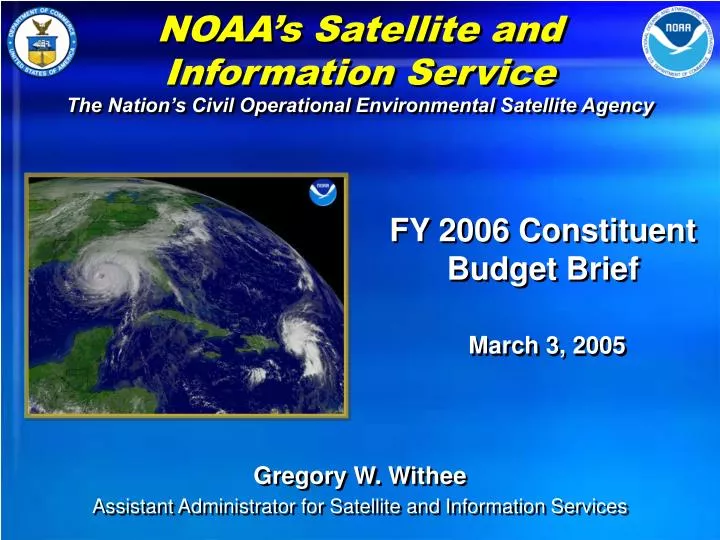
NOAA’s Satellite and Information Service The Nation’s Civil Operational Environmental Satellite Agency FY 2006 Constituent Budget Brief March 3, 2005 Gregory W. Withee Assistant Administrator for Satellite and Information Services
Agenda • NOAA Budget Highlights • FY 2004 Accomplishments • FY 2005 Highlights • FY 2006 Budget Overview • Environmental Satellite Services • Data and Information Services • Satellite Systems • Other Systems and Construction Projects
NOAA’s Mission • To describe and predict changes in the Earth’s environment. • To conserve and manage the Nation’s coastal and marine resources to ensure sustainable economic opportunities.
FY 2004 Service Accomplishments • Provided Outstanding Service for Hurricane Season • Issued Operational Air Quality Forecasts in New England • Issued New Operational Climate Forecast Model • Rebuilt 4 Fisheries Stocks • Restored 5,562 Acres of Coastal Habitat and Wetlands. • Charted Over 2,070 Square Miles of Ocean • 220 American lives saved with Satellite Rescue System (SARSAT)
FY 2004 Management Accomplishments • Issued Strategic Plan for an Global Earth Observing System • Began Critical Fisheries Survey Vessel Modernization • Issued 5 Year Research Plan and 20-Year Research Vision for NOAA • Realigned Administrative Support Services • Began Grants On-Line. Improved Timely Grant Issuance by 12% • Earned Unqualified Audit Opinion for 6th Year in a Row • Updated NOAA Strategic Plan and Improved Internal Planning
Historical NOAA Budget Trends ($ in Billions)
NOAA Budget Priorities($ in Millions) • Support People and Infrastructure • Contribute to a Global Earth Observing System • Invest in Ecosystems Management • Expand Climate Services & Observations • Improve Weather Forecasts and Warnings • Facilitate Intermodal Transportation • Support Facilities Maintenance & Construction
Expand Tsunami Warning Network ($ in Millions) • U.S. contribution to a Global Tsunami Warning Network • Commits additional $24M over next 2 years • Provide 35 additional DART buoys by mid 2007 • 7 in the Atlantic and Caribbean • 25 in the Pacific • 3 additional spare systems in Alaska • Upgrades and adds 38 tide and water level stations • Expands community preparation programs, inundation mapping, and 24/7 tsunami warning coverage
NOAA Satellite and Information Mission To provide timely access to global environmental data and information services from satellites and other sources in support of the larger NOAA mission.
NOAA’s Operational Environmental Satellites NOAA provides an OPERATIONAL remote sensing capability for acquiring and disseminating GLOBAL and regional imagery and measurements of the environment, including METEOROLOGICAL, CLIMATIC, OCEANOGRAPHIC,SOLAR-GEOPHYSICAL, and HAZARDS data in support of the NOAA mission and the benefit of the Nation.
NOAA observations and data are essential for… Health Water Weather Energy Management Ecosystems Disasters Oceans Climate Agriculture
An End-to-End Responsibility Launch Requirements & Planning Command & Control Acquisition Real-Time Product Development & Distribution Assessments, Status & Trends Data Archive & Access User Services
Continuity of Operational Satellite Programs NOAA Satellite Launches* Scheduled to Maintain Continuity 2004 2005 2006 2007 2013 2014 2016 2008 2009 2010 2011 2012 2015 2017 2018 2019 2020 GOES 10 GOES West GOES 11 (stored in orbit) GOES East GOES 12 GOES N GOES O GOES P GOES R*** NOAA 16 (PM) GOES S*** NOAA 17 (AM) NOAA N (PM) NOAA N’ (PM) 1st METOP (AM) ** European Coordination 2nd METOP 3rd METOP NPOESS C1 (mid-AM) NPOESS C2 (PM) NPOESS C3 (AM) NPOESS C4 (mid-AM) NPOESS C5 (PM) NPOESS C6 (AM) * Actual launch dates are determined by the failure of on-orbit assets Satellite is operational beyond design life ** Assumes METOP will provide the morning orbit and NOAA-N’ will provide afternoon orbit instruments On-orbit GOES storage *** GOES R-Series may be single or suite of satellites (distributed constellation) Extended operation
Selected FY 2004 Accomplishments • NESDIS Provided Critical Hurricane Support • 99.9% delivery rate for images during Hurricane Frances and 100% delivery rate for images during Hurricane Charlie • Provided 12 months of nearly flawless operation of three satellite constellations with a 99.5% success rate for providing mission critical data • NOAA provided international leadership in Earth observations • Chair of the Committee on Earth Observation Satellites • Played an active role in June 2004, U.S.-India Conference on Space Science Hurricane Frances
Selected FY 2004 Accomplishments (cont.) • COSPAS-SARSAT System Aided 252 Rescues during 2004 • The system has helped save more than 17,000 lives worldwide since it became operational in 1982 • New Environmental Data Products • NOAA’s National Data Centers developed or improved over 100 climate, oceanic and geophysical data products • Experimental Satellite Products Transitioned from Research to Operations • 14 experimental products were transitioned to operations including surface vector winds from NASA’s QuickSCAT satellite
Selected FY 2004 Accomplishments (cont.) • Maintained Requirements for Continuity of Satellite Data • Plan Presented for Integrated Earth Observation and Data Management System • 12 GOES-R Architecture Studies Completed
FY 2005 Highlights • Launch NOAA-N • Launch GOES-N • Complete construction of the NOAA Satellite Operations Facility (NSOF) in Suitland, MD • Issue GOES-R Request for Proposal
FY 2006 Budget Overview • Requests $963.9 million, which represents a $72.3M or 8.1% requested increase over the FY 2006 current program • Maintains environmental satellite and information services budget • Supports NOAA strategy of integrated global observations and data management • Includes continued development of GOES-R, the National Polar-orbiting Operational Environmental Satellite System (NPOESS), and the CLASS data archive and access system • Provides for NOAA operations of the Jason 2/OSTM mission • Funds first year operations of the new NOAA Satellite Operations Facility (NSOF)
NOAA Satellite and Information ServiceFY 2006 Budget Request$963.9M
Environmental Satellite Observing Services—$100.3M • Satellite Command and Control—$44.6M • Command, control, communicate, and acquire data from GOES, POES, DMSP on-orbit satellites, with an estimated value of $4.5 billion, on a 24 hours per day, 365 days per year basis. • Operates command center in Suitland, Maryland, and Command and Data Acquisition facilities in Wallops, Virginia and Fairbanks, Alaska • Functions include: • Data Acquisition • Spacecraft Navigation • Commanding GOES to perform special image acquisition (RAPID IMAGE SCAN OPERATIONS) • Orbit Determination • Onboard Tape Recorder Scheduling • NSOF Operations and Maintenance
FY 2006 Environmental Satellite Observing Services—$100.3M (cont’d) Product Processing and Distribution—$27.6M 24-hour, 365 day operational support for severe weather and environmental forecasting • Collect, process, and distribute GOES, POES, DMSP satellite products and services • Provide interpretation of non-NOAA satellite data into operational products and services • Mission critical support to NWS, DoD, FAA, Dept. of Homeland Security • Support satellite-derived search and rescue • NWS and wildland fire community • Data collection platforms • National Ice Center operations • Support Shared Data Processing Facility
FY 2006 Environmental Satellite Observing Services—$100.3M(cont’d) Product Development, Readiness, and Application—$26.2M • Ensures development of pre-operational satellite products to support land, oceanic, and atmospheric applications • Algorithm development in partnership with NASA and DoD at the Joint Center for Satellite Data Assimilation • Pre-operational development of ocean remote sensing products • Development of products to monitor harmful algal blooms. • Development of satellite-derived land applications products • Support mission critical research at Cooperative Institutes • Global Winds Demonstration project using Wind LIDAR
FY 2006 Environmental Satellite Observing Services—$100.3M(cont’d) Commercial Remote Sensing Licensing and Enforcement—$1.2M On behalf of the Secretary of Commerce, NOAA's Satellite and Information Service grants licenses to the commercial remote sensing industry pursuant to April 25, 2003, U.S. Commercial Remote Sensing Space Policy Credit: Space Imaging • Coordinate review of license applications with Departments of State, Defense, and the Intelligence community • Protect critical US requirements during licensing process. • Support US based remote sensing imagery and services Credit: Digital Globe Credit: Digital Globe
FY 2006 Environmental Satellite Observing Services—$100.3M(cont’d) Space Commercialization—$0.6M Beginning in FY 2006, the NOAA Budget Request includes funding for the Office of Space Commercialization. These activities were previously performed by the Technology Administration. Activities include: • policy development, market analysis, and outreach/education with commercial space industry sectors • satellite navigation, satellite imaging, national space policy and other space-related issues Credit: Digital Globe
Environmental Satellite Observing Services Program Changes—+$3.5M Jason 2/OSTM —+$1.6M • Preparation for operations of the Jason 2/OSTM satellite altimetry mission; following launch, we will operate Jason 2, and retrieve, and deliver its data • NOAA’s 24x7 operations of Jason 2 would leverage national and international partnerships for the mission • Jason 2 observations support performance of NOAA’s mission goals, especially Weather and Climate • Improved hurricane intensity forecasts • Advanced warning of El Nino/La Nina events • Improved measurements and prediction of global sea level changes • Supports Ocean Commission recommendations; transitions capabilities from research to operations • Increase contained in Satellite Command and Control ($0.8M), Product Processing and Distribution ($0.4M), and Product Development, Readiness and Application ($0.4M)
Environmental Satellite Observing Services Program Changes—+$3.5M (cont’d) NSOF Operations— +$0.6M (Satellite Command and Control) • Provides for the first full fiscal year of rent, operations and maintenance costs for the new NOAA Satellite Operation Facility (NSOF) in Suitland, MD • Joint Center for Satellite Data Assimilation—+$1.1M • Supports acceleration of the application of vast new amounts of satellite data in operational forecast models • Coral Reef Monitoring— +$0.04M • As part of NOAA’s overall corals effort, provides funding for use of satellite technology in coral reef observation • Commercial Remote Sensing Licensing and Enforcement—+$0.12M • Provides for the full implementation of the Department of Commerce’s responsibilities for licensing and compliance of commercial systems
NGDC Boulder, CO NODC Silver Spring, MD NCDC Asheville, NC NCDDC Bay St. Louis, MS Archive, Access, and Assessment—$33.6M NOAA operates the National Data Centers, including 7 World Data Centers, that provide long-term preservation, management and ready accessibility of environmental data. 32
Archive, Access, and Assessment Program Change—+$0.9M Supports archive, access, and assessment activities at NOAA’s National Data Centers: Climatic Data at National Climatic Data Center Geophysical and Solar-terrestrial Data at National Geophysical Data Center Oceanographic Data at National Oceanographic Data Center NOAA Library system Nationwide
FY 2006—Other Data and Information Activities • $6.1M Climate Database Modernization • Rescues at-risk data from loss due to deteriorating media • $9.4M Environmental Data Systems Modernization • Provides essential ongoing maintenance of systems modernization efforts • Supports Scientific Data Stewardship activities • $4.6M Coastal Data Development • Improves on‑line access of data to the Nation’s coastal user community and GIS applications
NOAA Satellite and Information ServicePolar Orbiting Systems
FY 2006 Polar Orbiting Satellites—$434.7M • $102.7M NOAA K-N Prime • Continue support for NOAA K-N Prime and Metop • Supports N’ rebuild for December 2007 launch • $321.0M NPOESS (DOC/NOAA portion) • Continue contract with Northrop Grumann for NPOESS spacecraft, instruments, and ground systems • Continue activities to support NPP launch $11.0M LANDSAT • Provide for integration of LANDSAT sensor on first NPOESS satellite
Polar-orbiting Satellites NOAA K-N Prime Polar-orbiting satellites provide continuous global environmental observations in support of operation requirements for: • Weather Forecasting and Space Environment • Detection of significant environmental events (e.g., fires, oil spills, volcanic eruptions) • Measurement of climate variables (e.g., atmospheric ozone) • Ocean observations (e.g., sea surface temperature) • Collection of data from surface platforms (e.g., buoys) • Search and rescue
NOAA K-N Prime Program Overview • Provides a continuous flow of global environmental information in support of national operational environmental requirements • Requires two satellites on-orbit (one in an afternoon orbit and one in a morning orbit) to ensure continuous coverage • NOAA-N planned for launch in May 2005 (date under review) • NOAA-N Prime contract with Lockheed Martin finalized to rebuild satellite and launch by December 2007
National Polar-orbiting Operational Environmental Satellite System (NPOESS) • Provide a national, operational, polar-orbiting remote-sensing capability • Merge POES and DMSP to single polar program and achieve savings through convergence • Incorporate new technologies from NASA • Encourage international cooperation
Accurate forecasts are critical to the protection of life, safety, and property NPOESS data will improve forecasts and warnings Improved forecasts will Reduce loss of life and property Benefit US industry through increased productivity Weather permeates all aspects of military operations Improved climate data for long-term forecasting and climate record NPOESS Benefits the Nation
NPOESS Program Change—+$16.1M • Continues development of NPP and NPOESS toward 2007 and 2010 launch dates, respectively • Provides funding for instruments, spacecraft, ground systems and program costs • NPP will provide critical risk reduction activities for NPOESS • NPOESS will meet the nation’s civil and military environmental information needs • Transitions select NASA sensors to operations
Polar Program Estimates FY 2007-2010
LANDSAT Program Change—+$11.0 M • Provides for integration of LANDSAT sensors on NPOESS spacecraft • Planned for NPOESS C1 and C4 • Part of a partnership with NASA and USGS • NASA will develop the sensors for NPOESS C1 and C4 spacecraft • USGS will process the data • Implements government plan for the continuity of the LANDSAT mission
FY2006 GOES Budget Request—$358.1M • $0.6M GOES I-M • complete support of post-launch requirements for GOES 8-12 • $117.0M GOES-N series • continue procurement of satellites, instruments, ground systems and systems support • $240.5M GOES-R • continue development of GOES-R series satellites, instruments, ground systems and systems support
FY 2006 GOES N Series Request—$117.0M • Consists of 3 satellites (N, O, P) Planned Launch Dates • GOES-N May 2005 • GOES-O April 2007 • GOES-P October 2008 • Instruments: Imager, Sounder, and Solar X-Ray imager
Geostationary SatellitesSupport NOAA’s Mission Goals Ecosystems Determine environmental impacts of chaotic processes, i.e. diurnal ocean color as a function of tides Climate Provide diurnal signature for weather and climate prediction and analysis Weather and Water Real time weather data to accurately track and analyze severe weather events Commerce and Transportation Uninterrupted hemispheric observations and products for safe and efficient transportation and commerce systems