Download

1 / 35
360 likes | 481 Views
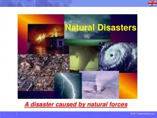
Lecture Outlines Natural Disasters, 5 th edition. Patrick L. Abbott. Floods Natural Disasters, 5 th edition, Chapter 13. Christiane Stidham, Stonybrook University. Floods. Rainfall varies in intensity and duration In small drainage basin, short-lasting maximum floods

E N D
Lecture OutlinesNatural Disasters, 5th edition Patrick L. Abbott
FloodsNatural Disasters, 5th edition, Chapter 13 Christiane Stidham, Stonybrook University
Floods • Rainfall varies in intensity and duration • In small drainage basin, short-lasting maximum floods • In large drainage basin, maximum floods for weeks • Events of past forecast of future events • Largest past event likely to be exceeded at some point • Floods of River Arno through Florence
A Different Kind of Killer Flood • Unusually hot January in Boston caused molasses in heated tank to expand and burst container • 2.3 million gallons of molasses flooded out as 9 m high wave • Killed 21 people and injured 150 people • Many trapped in molasses after it cooled and congealed
How Rivers and Streams Work Longitudinal Cross Section of a Stream • Cross-sectional plot of stream’s bottom elevation vs. distance from source • Profile for almost any stream is smooth, concave upward, with steeper slope near source and flatter slope near mouth • Base level – level below which stream can not erode • Ocean, lake, pond or other stream that stream flows into • Profiles are similar for all streams because of equilibrium processes
The Equilibrium Stream • Streams act to seek equilibrium, state of balance • Change causes compensating actions to offset • Factors: • Discharge: rate of water flow, volume per unit of time • Independent variable (stream can not control) • Available sediment to be moved • Independent variable (stream can not control) • Gradient: slope of stream bottom • Dependent variable (stream can control) • Channel pattern: sinuosity of path • Dependent variable (stream can control)
Case 1 – Too Much Discharge Too much water stream will flow more rapidly and energetically Response: • Excess energy used to erode stream bottom and into banks • Sediment produced by erosion – energy is used up carrying sediment away • Erosion of stream bottom results in less vertical drop flatter gradient slower, less energetic water flow • Erosioninto stream banks creates meandering pattern longer stream path, lower gradient slower, less energetic water flow
Case 2 – Too Much Load Too much sediment stream becomes choked Response: • Excess sediment builds up on stream bottom • Buildup results in increased gradient water flows faster and more energetically can carry away more sediment • Channel pattern becomes straighter minimum energy needed to flow distance • Islands of sediment form within channel, creating braided stream pattern • Similar to stream overflowing and eroding away landslide dam
Graded Stream Theory • Delicate equilibrium maintained by changing gradient of stream bottom graded stream • Typical stream: • Too much load, too little discharge in upstream portion braided pattern • Too much discharge, less load in downstream portion meandering pattern • Change in response to seasonal changes, changes in global sea level, tectonic events
The Floodplain • Floors of streams during floods • Built by erosion and deposition • Occupied during previous floods, and will be occupied again in future floods • About 2.5% of U.S. land is floodplain – home to about 6.5% of population
Feedback Mechanisms • Negative feedback: system acts to compensate for change, restoring equilibrium • Positive feedback: change provokes additional change, sending system in “vicious cycle” dramatically in one direction • Desirable in investments accumulating interest • Undesirable in debts accumulating interest charges
Flood Frequency • Larger floods longer recurrence times between each • Analyze by plotting flood-discharge volumes vs. recurrence interval, construct flood-frequency curve • Can be used to estimate return time of given size flood • 100-year flood used for regulatory requirements • Difference between yearly probability, cumulative probability • Flood-frequency curves different for different streams
Constructing Flood Frequency Curves Impossible to know exactly when floods will occur, but can predict statistical likelihood over period of time Steps in construction: • Record peak discharge for each year, rank years accordingly • For each year’s maximum flood, calculate recurrence interval = (N + 1) / M, where N = number of years of records, M = rank • Plot recurrence interval vs. discharge for each year, connect points as best-fit line Longer records of floods better flood frequency curves
Flood Styles Several causes: • Local thunderstorm flash (upstream) flood lasting few hours, building and ending quickly • Rainfall over days regional (downstream) floods lasting weeks, building and dissipating slowly • Storm surge of hurricane flooding coastal areas • Broken ice on rivers can dam up, block water flow fail in ice-jam flood • Short-lived natural dams (landslide, log jam, lahar) fail in flood • Human-built levees or dams fail in flood
Flash Floods • Thunderstorms can release heavy rainfall, creating flash floods in steep topography • Flash floods cause most flood-related deaths • 50% of flood-related deaths are vehicle-related • Only two feet of moving water required to lift and carry away average car
Flash Floods Antelope Canyon, Arizona, 1997 • Narrow slot canyons of tributaries to Colorado River • Thunderstorm releasing rain to form flash flood may occur too far away to hear or see • 12 hikers killed by flash flood in 1997 Big Thompson Canyon, Colorado, 1976 • Centennial celebrations brought thousands to canyon • Stationary thunderstorm over area dumped 19 cm of rain in four hours • Runoff created flash flood up to 6 m high, 25 km/hr • 139 people killed, damage totaling $36 million
Flash Floods Rapid Creek, Black Hills, South Dakota, 1972 • Pactola Dam built in 1952 to give flood protection and water supply to Rapid City, on Rapid Creek increased development of floodplain • Stationary thunderstorm poured up to 38 cm in six hours • Canyon Lake overflowed as Canyon Lake dam broke, flooding Rapid City • 238 people killed, $664 million in damages • Floodplain remains undeveloped greenbelt • “No one should sleep on the floodway.”
Regional Floods Inundation of area under high water for weeks • Few deaths, extensive damage Red River of the North: unusual northward flow (spring floods) • Geologically young – shallow valley • Very low gradient – slow flowing water tends to pool • As winter snow melts, flows northward into still frozen sections, causing floods • 1997 record floods: • 1996 rainfall four times greater than average • Winter 1996 freezing began early, causing more ice in soil • Winter 1996-7 snowfalls three times greater than average • Rapid rise in temperature melted snow and ice in soil • Floodwaters flowed slowly northward, flooding huge areas of North and South Dakota, Minnesota and Manitoba
Mississippi River System • Greatest inundation floods in U.S. • Third largest river basin in world • Drains all or part of 31 states, two Canadian provinces • System includes almost half of major rivers in U.S. • Average water flow in lower reaches is 18,250 m3/sec • Water flow can increase fourfold during flood
Mississippi River System Some Historic Floods • New Orleans’ first large flood in year of founding, 1717 • Built levees to prevent future flood – same response in place today • Continuous efforts to build levees to prevent flooding result in more destruction in next flood when levees fail • 1927 floods breached levees in 225 places, killed 183 people • 1973 floods extended along 1,930 km of river, inundating 50,000 km2
Mississippi River System The Great Midwestern Flood of 1993 • Biggest flood in 140 years – more than 20 million acres • Wet winter, spring even wetter summer, caused by low pressure from bend in jet stream • High water levels from April to August • Levees created higher water levels, by confining rivers • Levees damaged by waves, overtopping erosion, slumping, piping • 1,083 out of 1,576 levees in upper Mississippi River system overtopped or damaged • Submerged 75 towns, caused $12 billion of damage • Mississippi River wants to change course to join shorter, steeper Atchafalaya River but held in place by Army Corps of Engineers
China • Attempts to control Yellow River go back to 2356 B.C.E. • In last 2,500 years, river has undergone ten major channel shifts moving location of mouth up to 1,100 km • Sediment deposition on channel floor builds up channel in elevation eventually may be higher than surrounding floodplain • During next flood river may adopt lower elevation course outside of old banks avulsion • 1887 avulsion sent Huang River to join Yangtze River, with floods that resulted in over 1 million deaths • 1938 dynamiting of levees resulted in 1 million deaths • Huang River today is 20 m higher than adjacent floodplain – kept in place by levees
Societal Responses to Flood Hazards • Structural responses: • Dam construction • Building levees • Straightening, widening, deepening and clearing channel to increase water-carrying ability • Sandbagging • Nonstructural responses • More accurate flood forecasting • Zoning and land-use policies • Insurance programs • Evacuation planning • Education
Dams • Dam construction to create reservoirs gives sense of protection from floods, but dams do not control floods • Life spans of dams are limited by construction materials, construction style, rate at which sediment fills reservoir • Major floods occur downstream due to • Overtopping • Heavy rainfall below dam • Dam failure • 1981 study of dam safety by Army Corps of Engineers: • 2,884 of 8,639 dams unsafe
Levees • Cost of building levees may be more than value of structures intended to protect • Sense of security encourages further development of floodplain • Research shows that peak floodwater heights increased 2 to 4 m (for same water volume) in last 150 years in upper Mississippi River sections with levees and engineered channels, while staying the same on unengineered upper Missouri River • Floods in St. Louis crested at 11.6 m in 1903, 15.1 m in 1993 for same water volume
Sandbagging • Temporary levees of bags of sand and mud • Estimated about 26.5 million sandbags used in 1993 floods • Lessened damage in some places, but not in others • Therapeutic value Forecasting • Forecasts of height and timing of regional floodwaters have significantly reduced loss of life • Do not offset ever-greater damages, losses Zoning and Land Use • National Flood Insurance Program, FEMA: ban building on floodplain covered by 100-year flood • Discourages construction at frequently flooded sites but does not prevent all flooding of structures
Insurance • Flood insurance available from National Flood Insurance Program since 1950s, rarely purchased • Of 10,000 flooded households in Grand Forks, North Dakota in 1997, only 946 had flood insurance • $300,000 media campaign by FEMA 73 households bought flood insurance • U.S. Congress comes to rescue – 1993 flood victims received $6.3 billion bill providing aid Presidential Disaster Declarations • “Such severity and magnitude that effective response is beyond the capabilities of the state and the affected local governments” • Severity of flood damages, increase in population and wealth over time, political concerns: differences in number of declarations for different presidents
Hydrograph • Hydrograph: plots volume of water (or stream depth) against time • Time lag after rainfall for runoff to reach stream channel, then stream surface height rises quickly (steep rising limb of hydrograph) • Stream level falls more slowly as underground flow of water continues to feed stream (gently sloped falling limb of hydrograph)
Urbanization and Floods • Urbanization changes shape of hydrograph, making curve much steeper • Good news: urban flood might only last 20% as long • Bad news: urban flood could be four times higher
Flood Frequencies • Urbanization increases surface runoff of rainwater higher stream levels in shorter times (flash floods) Channelization • Try to control floodwaters by making channels clear of debris, deeper, wider and straighter • Push stream into “too much discharge” case • Stream response to regain equilibrium: erodes bottom and banks to pick up sediment and decrease gradient • Extreme approach: Los Angeles – concrete lined channels
The Binational Approach: Tijuana and San Diego • Tijuana River passes through Tijuana, Mexico, then through San Diego, California on way to Pacific • U.S. and Mexico agreed to construct concrete channel for river • U.S. backed out after Mexico constructed channels • High-velocity floods from Mexican channels inundate open farms and subdivisions of southern San Diego The Uncoordinated Approach: San Diego • Army Corps of Engineers constructed 245 m wide channel at mouth • Mission Valley was developed along natural channel, 7.5 m wide • Part of Mission Valley has 110 m wide channel feeding into natural channel
The Hit-and-Miss Approach: Tucson • Flooding of Santa Cruz River in 1983 was 1.76 times bigger than FEMA estimates of 100-year flood • Six of seven largest floods were between 1960 and 1983, during years of peak city growth and urbanization • Desert floods have damage due to bank erosion, not inundation • Some Tucson stream banks moved laterally more than 300 m, so that 100-year floodplain moved also • Protective walls concentrate erosion at end of wall
The Biggest Floods: Ancient Tales of Deluge • Tales of ancient floods are part of many cultures • Are these floods larger than those today, or 1,000-year floods? • Flooding of fertile ground adjacent to rivers (floodplains) where entire ancient cultures thrived would have seemed like flooding of “whole world”
Ice-Dam Failure Floods • Biggest floods during melting of continental ice sheets lakes behind ice dams that failed suddenly • Evidence of flood from Lake Missoula after melting of ice dam: • Lake sediments • Land stripped of soil, sediment cover • High-elevation flood gravels • Integrated system of braided channels • Abandoned waterfalls • High-level erosion • Large-scale sediment deposits