Download
1 / 32
320 likes | 402 Views
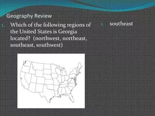
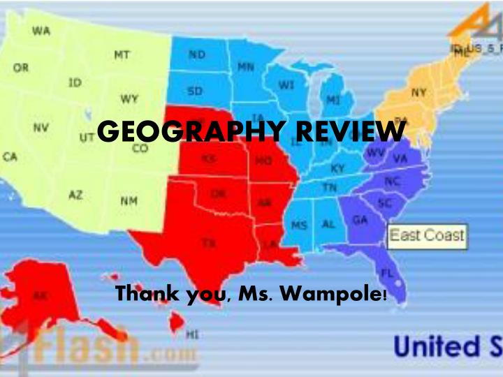
GEOGRAPHY REVIEW. Thank you, Ms. Wampole !. Mapmakers often use the color blue on maps to stand for A. Mountains B. the Eastern Hemisphere C. the North Pole D. oceans. D. OCEANS. Which types of lines go vertically and tell us how far east or west we need to go to locate a place?.

E N D
GEOGRAPHY REVIEW Thank you, Ms. Wampole!
Mapmakers often use the color blue on maps to stand for • A. Mountains • B. the Eastern Hemisphere • C. the North Pole • D. oceans
Which types of lines go vertically and tell us how far east or west we need to go to locate a place?
LINES OF LONGITUDE
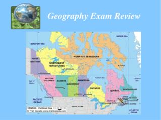
Use your map to answer the question. • Go to the 120th meridian of longitude. • What are the 4 U.S. states this meridian passes through?
WASHINGTON • OREGON • NEVADA • CALIFORNIA
NORTH • SOUTH • EAST • WEST
The prime meridian divides the Earth into which two hemispheres?
EASTERN HEMISPHERE • WESTERN HEMISPHERE
A global grid is a set of crisscrossing lines (the lines of longitude and latitude)
When you stand facing south, you are looking toward the • A. prime meridian • B. Eastern Hemisphere • C. North Pole • D. South Pole
NORTHEAST • NORTHWEST • SOUTHEAST • SOUTHWEST
True or False • Maps show sizes and distances as they really are.
FALSE • Of course not! • They are always much smaller than the part of the Earth they represent.
Using your map, locate the city of New Orleans. What is the location of New Orleans (using lines and degrees of latitude and longitude)?
LINES OF LATITUDE ARE IMAGINARY LINES THAT RUN HORIZONTALLY AROUND THE EARTH AND TELL US HOW FAR NORTH OR SOUTH OF THE EQUATOR A PLACE IS LOCATED
NORTHEAST • SOUTHEAST • MIDWEST • SOUTHWEST • WEST
Which line of latitude divides the Earth into two halves, the Northern Hemisphere and the Southern Hemisphere?
Fill in the blank. • Mapmakers use a _____________ to explain their symbols.
Using your map, answer the following question. • Which state is located at 45°N latitude, 120°W longitude?