Download
1 / 68
680 likes | 817 Views
Chapter Intro 1. Chapter Objectives. Describe the dominant landforms and natural resources of Latin America. . Discuss Latin America’s climate and vegetation. Click the mouse button or press the Space Bar to display the information. Chapter Intro 2. The Land. Objectives.

E N D
Chapter Objectives • Describe the dominant landforms and natural resources of Latin America. • Discuss Latin America’s climate and vegetation. Click the mouse button or press the Space Bar to display the information. Chapter Intro 2
The Land Objectives • Explain how geographers divide the large region known as Latin America. • Identify the factors that have shaped the formation of Latin America’s landforms. • Discuss how the Latin American landscape has influenced patterns of human settlement. • List the natural resources that make Latin America an economically important region. Click the mouse button or press the Space Bar to display the information. Section 1-1
The Land Terms to Know • cordillera • gaucho • hydroelectric power • estuary • altiplano • escarpment • llano • pampa Click the mouse button or press the Space Bar to display the information. Section 1-2
The Land Places to Locate • Amazon River • Mexican Plateau • Patagonia • Mato Grosso Plateau • Rio Grande • Río de la Plata • Middle America • Central America • West Indies • South America • Sierra Madre • Andes Click the mouse button or press the Space Bar to display the information. Section 1-3
The Dominican Republic, a small Caribbean country with a population only slightly greater than that of New York City, publishes ten daily newspapers. El Listín Diario, read by 50,000 people every day, is the oldest Spanish-language newspaper in the Caribbean. Section 1-5
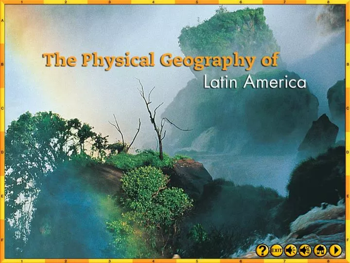
A Vast Region • Latin America covers 8 million square miles of land, from the United States-Mexico border to the southern tip of Argentina in South America. • The name “Latin America” refers to the languages (Spanish and Portuguese, derived from Latin) spoken in this geographic region. • Geographers divide Latin America into three regions: Middle America, the Caribbean, and South America. (pages 193–194) Click the mouse button or press the Space Bar to display the information. Section 1-6
A Vast Region (cont.) Why do you think geographers divide Latin America into three distinct areas? Each area of this vast region has a distinct physical geography. Dividing the region in this way allows geographers to discuss features of the region more specifically and accurately. (pages 193–194) Click the mouse button or press the Space Bar to display the answer. Section 1-7
Mountains and Plateaus Latin America’s rugged landscape is the result of its location on the Pacific Ring of Fire, where plates of the earth’s crust have collided for millions of years, causing earthquakes and creating mountains and volcanoes. (pages 194–196) Section 1-8
Mountains and Plateaus (cont.) • Mountains of Mexico, Central America, and the Caribbean Mexico’s Sierra Madre and the Central Highlands in Central America rise above the landscape of Middle America. • Many Caribbean islands are part of the Central Highlands mountain range. (pages 194–196) Click the mouse button or press the Space Bar to display the information. Section 1-9
Mountains and Plateaus (cont.) • Andes of South America The Andes mountain ranges run along the western edge of South America and are the world’s longest mountain range (4,500 miles). • Their parallel ranges, called cordilleras, are arranged in deep folds. • In southern Argentina, hills and lower flatlands form a plateau known as Patagonia. (pages 194–196) Click the mouse button or press the Space Bar to display the information. Section 1-10
Mountains and Plateaus (cont.) • Highlands of BrazilMuch of Brazil consists of broad plateaus, such as the Mata Grosso Plateau and the Brazilian Highlands. (pages 194–196) Section 1-11
Mountains and Plateaus (cont.) What advantages and disadvantages does Latin America’s rugged landscape offer to residents? The mountains provide abundant natural resources and relief from the heat of the lowlands, but they impede travel and communications, create natural hazards, and make construction of infrastructure difficult. (pages 194–196) Click the mouse button or press the Space Bar to display the answer. Section 1-12
Lowlands and Plains • Narrow coastal lowlands hem the Gulf of Mexico, the Caribbean Sea, and the Atlantic and Pacific coasts of South America. (pages 196–197) Section 1-13
Lowlands and Plains(cont.) • Inland areas of South America hold vast grasslands that provide wide grazing for beef cattle. (pages 196–197) Section 1-15
Lowlands and Plains (cont.) What economic activities might Latin America’s lowlands and plains support? Fertile land in lowland areas supports tropical crops, such as bananas; plains areas favor ranching and the growing of grains such as corn and wheat. (pages 196–197) Click the mouse button or press the Space Bar to display the answer. Section 1-17
Water Systems • Rivers of South America Navigable rivers, such as the Amazon, serve as transportation routes and provide hydroelectric power. • Lakes Latin America has few large lakes. • Lake Titicaca in the Andes of Bolivia and Peru is the world’s highest navigable lake. (pages 197–198) Click the mouse button or press the Space Bar to display the information. Section 1-18
Water Systems (cont.) Why are rivers important to Latin Americans? The rivers often are used to transport goods and people to and from remote, mountainous, or densely vegetated areas. (pages 197–198) Click the mouse button or press the Space Bar to display the answer. Section 1-19
Natural Resources • Latin America’s significant natural resources include minerals, forests, farmlands, and water. • Major deposits of oil and natural gas occur along the Gulf of Mexico and southern Caribbean Sea. • Mexico and Venezuela are leading petroleum producers. (page 198) Click the mouse button or press the Space Bar to display the information. Section 1-20
Natural Resources (cont.) • Venezuela’s Orinoco River area contains 11 percent of the world’s gold. • Brazil is also rich in gold, and Peru and Mexico are known for their silver deposits. • Chile is the world’s leading exporter of copper. • Geographic inaccessibility, lack of capital, and social and political divisions hinder fuller development and distribution of natural resources in Latin America. (page 198) Click the mouse button or press the Space Bar to display the information. Section 1-21
Natural Resources (cont.) What challenges to the further development of its natural resources does Latin America face? Technology has not yet overcome the mountain ranges and other physical barriers between countries. Trade and communication are difficult. Unstable governments have made investors wary of investing in the region. Education systems are undeveloped in some areas, which hampers technological innovation. Health issues remain a challenge. (page 198) Click the mouse button or press the Space Bar to display the answer. Section 1-22
Checking for Understanding Define Match each definition in the left column with the appropriate term in the right column. B __ 1. Spanish for “high plain,” a region in Peru and Bolivia encircled by the Andes peaks __ 2. the cowhands of Argentina and Uruguay __ 3. steep cliff or slope between a higher and lower land surface __ 4. parallel chains or ranges of mountains __ 5. an area where the tide meets a river current A. cordillera B. altiplano C. escarpment D. llano E. pampa F. gaucho G. hydroelectric power H. estuary F C A H Click the mouse button or press the Space Bar to display the answers. Section 1-23
Checking for Understanding Define Match each definition in the left column with the appropriate term in the right column. G A. cordillera B. altiplano C. escarpment D. llano E. pampa F. gaucho G. hydroelectric power H. estuary __ 6. electrical energy generated by falling water __ 7. grassy, treeless plains of southern South America __ 8. fertile plains in inland areas of Colombia and Venezuela E D Click the mouse button or press the Space Bar to display the answers. Section 1-24
Critical Thinking Identifying Cause and Effect How do the physical features of Latin America affect everyday life? Give examples. Possible answer: Mountains are rich in natural resources, but they also block movement and trade and isolate regions and people. Click the mouse button or press the Space Bar to display the answer. Section 1-25
Critical Thinking Drawing Conclusions Why does much of South America have the potential to produce hydroelectric power? Mountainous terrain creates fast-moving rivers and streams that can be dammed for generating electricity. Click the mouse button or press the Space Bar to display the answer. Section 1-26
Critical Thinking Making Inferences What factors make Latin America important to the global economy? Latin America has mineral wealth, such as gold, silver, emeralds, copper, aluminum, tin, and iron. It also has forest products and good agricultural produce, oil, and natural gas. Swift rivers and geothermal regions have the potential to produce electricity. Click the mouse button or press the Space Bar to display the answer. Section 1-27
Analyzing Maps Region Study the physical-political map on the right. What part of South America is dominated by mountains? The western part, especially near the coast, is dominated by the Andes. Click the mouse button or press the Space Bar to display the answer. Section 1-28
Applying Geography Effects of Landforms Think about the physical features of South America. Write a descriptive paragraph explaining how landforms affect the course of South America’s water systems. Section 1-29
Climate and Vegetation Objectives • List the climate regions that are represented in Latin America. • Describe how Latin America’s location and landforms affect climates even within particular regions. • Discuss how the natural vegetation and agriculture of Latin America are influenced by climatic factors. Click the mouse button or press the Space Bar to display the information. Section 2-1
Climate and Vegetation Terms to Know • canopy • tierra templada • tierra fría • tierra caliente Places to Locate • Amazon Basin • Argentina • Uruguay • Atacama Desert • Colombia • Venezuela Click the mouse button or press the Space Bar to display the information. Section 2-2
The rain forests of Latin America are the source of many medicines. For example, the poisonous bark of certain curare plants is used to treat such diseases as multiple sclerosis and other muscular disorders, and as a surgical anesthetic. Scientists use the chemical structures of rain forest plants as models from which they can synthesize drug compounds. Rain forest plants also aid in research. Some plant compounds show scientists how cancer cells grow, for example. Section 2-4
ClimateandVegetationRegions Most of Latin America lies between the Tropic of Cancer and the Tropic of Capricorn; thus, much of its area has a tropical climate. However, there is a great variety of climates in the region. • Tropical Regions Mexico, eastern central America, some Caribbean islands, and such parts of South America as the Amazon Basin have a tropical rain forest climate and vegetation, with hot temperatures and abundant rainfall occurring year-round. (pages 199–202) Click the mouse button or press the Space Bar to display the information. Section 2-5
ClimateandVegetationRegions (cont.) • The Rain Forest The Amazon Basin, with the earth’s largest rain forest, covers one-third of South America and has trees that form a dense canopy that soars as high as 130 feet over the forest floor. • Tropical Savanna In the tropical savanna climate typical of the coast of southwestern Mexico, most Caribbean islands, and north-central South America, the grasslands have hot temperatures, abundant rainfall, and a dry season lasting several months. (pages 199–202) Click the mouse button or press the Space Bar to display the information. Section 2-6
ClimateandVegetationRegions (cont.) • The Humid Subtropics In the humid subtropical climate of southeastern South America, the winters are short and mild, and the summers are long, hot, and humid. (pages 199–202) Section 2-7
ClimateandVegetationRegions (cont.) • Desert and Steppe Areas Parts of northern Mexico and the southwestern region of South America have desert climates and vegetation; in Chile the rain shadow effect of the Andes has produced the dry, arid Atacama Desert, whereas other areas have a steppe climate, with hot summers, cool winters, and light rainfall. (pages 199–202) Section 2-8
ClimateandVegetationRegions (cont.) What kinds of vegetation might be found in rain forest areas of Latin America? Hardwood trees, palms, tree ferns, and bamboo might be found in the rain forests of Latin America. (pages 199–202) Click the mouse button or press the Space Bar to display the answer. Section 2-10
Elevation and Climate • The climates of Latin America depend more on elevation than on distance from the Equator. • The tierra caliente lies between sea level and 2,500 feet and has average annual temperatures from 68F to 91F.The main crops include bananas, sugar, rice, and cacao. (pages 202–203) Click the mouse button or press the Space Bar to display the information. Section 2-11
Elevation and Climate (cont.) • The tierra templada lies between 2,500 and 6,500 feet and has average daily temperatures between 60F and 72F. Coffee and corn are the main crops. • In the tierra fría, frosts are common in the winter months. Potatoes and barley grow at these elevations. (pages 202–203) Click the mouse button or press the Space Bar to display the information. Section 2-12
Elevation and Climate (cont.) Why do you think most Latin Americans live in the tropical zones rather than high in the Andes Mountains? It is easier to survive in a tropical climate. People can grow food, and they will not suffer from severe winters. High in the mountains, the temperatures are much colder, and farming is much more difficult. Travel, communications, and access to services such as education, cultural events, and health care are all more difficult. (pages 202–203) Click the mouse button or press the Space Bar to display the answer. Section 2-13
Checking for Understanding Define Match each definition in the left column with the appropriate term in the right column. __ 1. Spanish term for “cold land”; the highest altitude zone of Latin American highlands climates __ 2. Spanish term for “hot land”; the lowest altitude zone of Latin American highlands climates __ 3. top layer of a rain forest, where the tops of tall trees form a continuous layer of leaves __ 4. Spanish term for “temperate land”; the middle altitude zone of Latin American highlands climates A. canopy B. tierra caliente C. tierra templada D. tierra fría D B A C Click the mouse button or press the Space Bar to display the answers. Section 2-14
Critical Thinking Making Inferences Why might some Latin Americans live in areas in which climate and agriculture are unfavorable? Possible answer: Some Latin Americans might live in these areas because of tradition and natural resources (for example, minerals and timber) that can support them economically. Click the mouse button or press the Space Bar to display the answer. Section 2-15
Critical Thinking Determining Cause and Effect How does elevation affect climate and vegetation in Latin America? Possible answer: Higher elevations have cooler temperatures and less varied vegetation. Click the mouse button or press the Space Bar to display the answer. Section 2-16
Critical Thinking Comparing and Contrasting Compare the pampas to your region. How do the climate and vegetation help define the economic activities in each place? Section 2-17
Analyzing Maps Place Study the vegetation map on the right. Which two types of vegetation cover most of South America? Tropical rain forest and tropical grassland cover most of South America. Click the mouse button or press the Space Bar to display the answer. Section 2-18
Section 1: The Land (pages 193–198) Key Points • Latin America includes Middle America, the Caribbean, and South America. • Latin America’s physical features include high mountain ranges, less rugged highlands, vast central plains, and volcanic islands. • The water systems of Latin America, especially the mighty rivers of South America, are key to human activity in the region. • Although the region is rich in natural resources, geographic, political, and economic obstacles have kept resources from being developed fully or shared equally. Click the mouse button or press the Space Bar to display the information. Summary and Study Guide 1
Section 2: Climate and Vegetation (pages 199–203) Key Points • Much of Latin America lies in the Tropics; however, landforms and wind patterns give the region great climatic diversity. • Tropical climates such as tropical forest and tropical savanna are the most common climates in Latin America. • The natural vegetation of Latin America consists mainly of rain forests and grasslands. • The tropical highlands in Latin America include three vertical climate zones that are based on latitude and elevation. Click the mouse button or press the Space Bar to display the information. Summary and Study Guide 2
Reviewing Key Terms Insert the key term that best completes each of the following sentences. cordilleras altiplano escarpment llanos pampas gaucho estuary canopy tierra caliente tierra templadatierra fría hydroelectric power 1. The Andes consist of parallel mountain ranges, or ___________________. 2. The high plain encircled by the Andes of Bolivia and Peru is known as the ___________________. 3. The plateau of the Brazilian Highlands plunges sharply to the Atlantic Ocean, forming a steep cliff called an ___________________. cordilleras altiplano escarpment Click the mouse button or press the Space Bar to display the answers. Chapter Assessment 1
Reviewing Key Terms Insert the key term that best completes each of the following sentences. cordilleras altiplano escarpment llanos pampas gaucho estuary canopy tierra caliente tierra templadatierra fría hydroelectric power 4. Cattle are raised on the broad grasslands called ___________________ in Colombia and Venezuela and ___________________ in Argentina and Uruguay. 5. The Río de la Plata is typical of an ___________________, an area where the tide meets a river current. llanos pampas estuary Click the mouse button or press the Space Bar to display the answers. Chapter Assessment 2
Reviewing Key Terms Insert the key term that best completes each of the following sentences. cordilleras altiplano escarpment llanos pampas gaucho estuary canopy tierra caliente tierra templadatierra fría hydroelectric power 6. Highlands climates are divided into vertical zones, including the hot ___________________, the temperate ___________________, and the cold ___________________. tierra caliente tierra templada tierra fría Click the mouse button or press the Space Bar to display the answers. Chapter Assessment 3
Reviewing Facts Section 1: The Land What are the three major geographic areas within Latin America? Middle America, the Caribbean, and South America are the three major geographic areas within Latin America. Click the mouse button or press the Space Bar to display the answer. Chapter Assessment 4