Download
1 / 41
410 likes | 417 Views
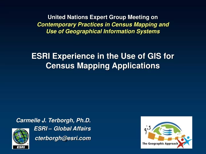
United Nations Expert Group Meeting on Contemporary Practices in Census Mapping and Use of Geographical Information Systems ESRI Experience in the Use of GIS for Census Mapping Applications. Carmelle J. Terborgh, Ph.D. ESRI – Global Affairs cterborgh@esri.com. Outline.

E N D
United Nations Expert Group Meeting onContemporary Practices in Census Mapping and Use of Geographical Information SystemsESRI Experience in the Use of GIS forCensus Mapping Applications Carmelle J. Terborgh, Ph.D. ESRI – Global Affairs cterborgh@esri.com
Outline • GIS Technology for Census Mapping • Pre-Enumeration – Data Design, Collection, and Preparation • Enumeration – Conducting the Census • Post-Enumeration – Data Analysis, Dissemination • Presented with examples from work around the globe • Recommendations for the 2010 Round
Benefits in both effectiveness and efficiency for: data creation/collection geodatabase development digital mapping data analysis web mapping GIS web services These include: productivity gain and time savings, cost savings/cost avoidance, greater credibility and authority of map products, better service, increased accuracy, improved consistency, income generation, improved analysis, improved policy-making, improved data sharing, and improved outreach. Benefits of using GIS for Census Activities Source: United Nations, DESA - Statistical Division, Handbook on geographic information systems and digital mapping, 2000
Collect Use Serve Author Census MappingGIS is the platform
Pre-Enumeration - Data Design, Collection, and Preparation (Data Management) • Data Design • Census Data Models • Development of Census Geographies • Defining Enumeration Areas • Coding Schemes
Geocoding in many countries… not an easy task! • “Situs Addressing in Africa” workshop • United Nations Economic Commission for Africa (UNECA) – Committee on Development Information (CODI IV) meeting in 2005 • Identified five (5) types of geocoding systems that would be needed to effectively locate settlements in an African context: • Urban Street Addressing - planned communities • Urban Situs Addressing - less planned communities (no street names/numbers) • Urban Informal Settlements Addressing - in slum areas • Rural Area Addressing - few settlements • Traditional Area Addressing - tribal areas
Statistics South Africa (Stats SA) • Stats SA has developed a geo-referenced dwelling frame which is a complete, up-to-date database of all dwellings and other structures in the country. • a coding scheme for dwelling units such that their location can be found • Methodologies for: • Urban Formal Areas • Informal Areas • Lesser Dense Urban Informal Areas • Dense Urban Informal Areas • Traditional Areas • Farms Source: GeoReferenced Dwelling Frame Project http://mapserver.statssa.gov.za/geographywebsite/docs/dwell/detail_specification_docv6.pdf
Geodatabase Development • Scanning, georeferencing, and vectorization of existing paper maps to develop digital datasets; • Conversion of existing digital maps and datasets into the desired data structure; • Updating of digital datasets since the last census activity to ensure that new settlements and roads are included and obsolete settlements are omitted from the enumeration activities; and/or • Collection of aerial or satellite imagery followed by digital feature extraction and ground-truthing with GPS to ensure proper georeferencing of the images.
The Hashemite Kingdom of Jordan – Department of Statistics (DOS) Images courtesy of David Rain, Ph.D., GWU
Department of Statistics, Royal Hashemite Kingdom of Jordan, with cooperation from USAID Amman, ESRI, and InfoGraph - a Jordanian GIS firm 1 3 District boundaries of part of Amman city are converted to digital form using center lines on cadastral maps from the Jordan Land & Survey Department 2 Source of street names Building numbers and land parcels from municipal government
Hong Kong - Census and Statistical Department (CASD) of the Government of the Hong Kong Special Administrative Region of the People’s Republic of China • Digital Mapping System (DMS) • Updating the sampling frame • linking the spatial data and textual records of buildings/structures to facilitate the updating process and delineating boundary segments, • Allocation of assignments • Itinerary planning • Production of tailor-made and up-to-date maps of good quality to support fieldwork operation • Data compilation from several agencies: • Lands Department • Planning Department • and the Census and Statistics Department
Enumeration – Conducting the Census • Perhaps the biggest new opportunity for census work in 2010 - • Enumerators enabled with Mobile Computing Devices that include GIS and GPS • More on this in a moment…
Analysis of the results with Desktop GIS, such as ArcGIS Desktop products Development of maps for dissemination to the public Post-Enumeration - Data Analysis Source: NOAA Coastal Services Center – Community Vulnerability Assessment
Costa Rica – INEC • Map Distribution from Website Internal Migration of Population Percentage of Population with Water
Improved GraphingEnriching the Understanding of GIS Data Sets • New Graphing Engine • Exploratory Spatial Data Analysis • Linked Maps, Graphs & Tables • Dynamic Feature Selection • Animation • Time
ArcGIS Desktop 9.2: Graphing - More Control • Color matching between graph and map layer • Enhanced control over all graph elements
Post-Enumeration - Dissemination • Web Mapping and GIS Services • Web browsers • Geovisualization applications • Database and Mapping Application on CD • Free, embeddable mapping application • Free data viewer
Costa Rica – National Office for Census and Statistics (INEC) www.inec.go.cr
US - Census Bureau American Fact Finder • Thematic Maps (Data) • Reference Maps (Boundaries)
Japan - Statistics Bureau, Ministry of Internal Affairs and Communications • Statistics GIS Plaza • http://gisplaza.stat.go.jp
Area Selection Cadastral Map Graph Settings Graph and Map Japan - Statistics Bureau, Ministry of Internal Affairs and Communications
Getting Ready for 2010! The 1891 Census in the UK Cartoon from "Punch", nineteenth century
US - Census Bureau - Preparing for 2010 CensusA paperless census?
US - Census Bureau - Preparing for 2010 Census Mobile Computing Devices (MCDs) with GPS and ArcPad
ESRI is getting ready for 2010… • ArcPad mobile GIS platform • Field Data Collection Automation (FDCA) project for the 2010 Decennial Census • Harris Corporation selected by the U.S. Census Bureau • FDCA program supports census field enumerators • GPS-enabled mobile devices • ESRI’s ArcPad software selected • performance, productivity, enterprise GIS integration, and customization options
ESRI is getting ready for 2010… • Districting for ArcGIS • Updated for Version 9.2 of ArcGIS Desktop • Create defined groupings of geographic data • census tracts, districts, ZIP codes, and precincts • by creating a districting plan • Functionality • Redraw political boundaries • Set up sales territories • Define voting, school, and fire districts • Analyze population densities, housing breakdowns, income and race statistics
ESRI is getting ready for 2010… • Local Update of Census Addresses (LUCA) • A new extension for ArcGIS • Built with CityGate GIS • Part of the Census Bureau’s LUCA program • Replicates the task and technical functionality of the census Master Address File/ Topologically Integrated Geographic Encoding and Referencing (MAF/TIGER) Partnership Software (MTPS) • To be delivered later this year in the August – October timeframe to 40,000 local governments
Mobile GIS Desktop GIS 3D Explorer Enterprise Service Bus Web Map Viewer Open APIs Use Serve Server GIS Author Desktop GIS Managing and Disseminating Geographic Knowledge
Scalable Hardware Server Cluster Blade Server Server • Faster • Multi Processors • Loosely Coupled • Connected Web Services Desktop . . . and Services Oriented Laptop Tablet PC PDA Cell Phone
GIS Clients Web Browsers 3D GeoVisualization Tools Desktop GIS PDAs/MCDs Mobile Phones GIS Services Routing Geocoding Gazetteer Custom services Now many GIS Clients - Consuming GIS Services
Complex geographies In 2007, more people live in an urban context than in a rural one 50% of the urban settlements that will exist in 2050 have not yet been constructed Informal settlements Source: UN HABITAT Source: Rosario Giusti de Perez
Recommendations for the 2010 Round • Consider appropriate GIS technology for each phase of the Census • Desktop GIS • Data collection and preparation • Automated raster-to-vector conversion • Imagery integration • Development of enumeration areas • Allocation of assignments • Data analysis • Strong cartographic tools • Data Dissemination with free data viewers • Mobile GIS • Integrates with GPS • Field data collection • Geographic location verification • Navigation • Server GIS • Data dissemination • Web map publishing • GIS Services (geocoding, gazetteer, etc.) • GeoVisualization tools
Recommendations for the 2010 Round • Consider the benefits of using GIS and imagery in areas of complex geography • Rural areas • Informal settlements • Adapt best practices to suit specific census requirements • Partner with the private sector • Builds the geospatial component of your local, knowledge economy • Work jointly on coding efforts with telecom, postal service, etc. • Value added solutions – higher demand for census data
Let’s make sure that everyone counts!..and is counted! Source: World Resources Institute Source: Robert Ford, LLU
Support GIS Day! GIS Day: November 14, 2007An Opportunity to Share Your Knowledge…in 2009 – a focus on census mapping ???