Download
1 / 15
150 likes | 156 Views
Explore the virtual camera controls used in developing two landscape animations for a pilot test. Discover the settings for vegetation and landscape appearance, motion parameters in world construction, and the design of camera trajectories. Evaluate the results of different altitude trajectories and their impact on the landscape experience.

E N D
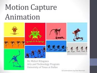
The making of Landscape Animations: Camera Motion A description of the virtual camera controls used in developing two animations for a pilot test
Outline • Setting up the model: settings for vegetation and landscape appearance • The Motion parameters in World Construction Set • Design of camera trajectories • Results: low and high altitude trajectories
Setting up the model • The model of the terrain is a realistic digital “map” of Santa Catalina Island • The model of vegetation, although visually realistic, is not ecologically realistic: the actual location and distribution of plants is a variable controlled in the experiment • Vegetation subdivided in three main bands (high-medium-low) according to altitude
Vegetation textures • The vegetation is drawn using repeated 2D textures rendered with a 3D look
Motion parameters • Camera and target are defined by the x,y coordinates of the location on the map, plus altitude • The rate of change of each parameter is controlled by a TimeLine, a graph that specifies the parameter value for any given frame of animation
Design of trajectories • Different camera trajectories might produce different reactions: the goal is to design trajectories that represent a distinctive way to approach landscape. • The vertical dimension is especially important. Here considered are low and terrain following versus high and uniform trajectories, which are to be compared experimentally.
Change in altitude: camera high above the terrain, uniform motion
Preliminary conclusions • The impression is that the effect of camera trajectory on landscape experience exists but needs to be investigated in a pilot study before running the final experiment. • The appearance of landscape seems suitable for realism and for supporting the information needs of the experiment
Further ideas • Instead of controlling altitude as the only isolated variable, the experiment will consider several different parameters, including target motion, in meaningful groups. • For example, a low altitude, terrain following and look-ahead trajectory will be compared to a high altitude, uniform and fixed-target trajectory, even without considering all the intermediate combinations
Further ideas (2) • Other issues include: • Few and long versus many and short animations: memory, “immersion” and experimental variety problems. • Control on vegetation can be further extended: more information to be extracted