Download
1 / 56
560 likes | 571 Views
Using Information Technology in the Field. Peter Knoop University of Michigan Sakai Foundation / School of Information / Department of Geological Sciences. Using Information Technology in the Field. Equipping Yourself Examples Field Mapping Mobile Classroom Feedback.

E N D
Using Information Technologyin the Field Peter Knoop University of Michigan Sakai Foundation / School of Information / Department of Geological Sciences
Using Information Technologyin the Field • Equipping Yourself • Examples • Field Mapping • Mobile Classroom • Feedback
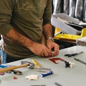
Equipment:Hardware, Software, and Logistics • Geopad and GeoPocket • Not products, just short-hand • Tablet PC and Pocket PC GeoPadis short-hand for a field-durable Tablet PC equipped with Geographic Information System (GIS) software, Global Positioning System (GPS) receiver, wireless networking, electronic notebook and other pertinent hardware and software.
Durability:Ruggedized versus Consumer • Water-proof! • Dust-proof ! • Drop-proof! (resistant?) • Screen – weak-point • “None of the above” • Overheats in cases • Not bright enough • Inexpensive!
GeoPad Tablet PCs • Panasonic CF-19 • Getac V100 • Xplore iX104C4 • Other options? (Non-ruggedized but outdoor viewable) • Fujitsu (OtterBox for semi-ruggedizing) • HP 2710p (no ruggedizing option yet) • (GeoPockets – Pocket PCs – HP iPAQs, etc.)
Ergonomics:Comfort, Convenience and Safety • Slate versus Convertible Tablet PCs • Converting in field versus at camp • Learn how to use the pen! • Use the rest of the year? • External USB Keyboard • More flexibility for touch-typists • Practical Experiences • Slates more durable • Convertibles easier to utilize year-round • Useful life-cycle of ruggedized much longer
Ergonomics:Comfort, Convenience and Safety • Hands-free harness • Avoid opportunities to drop it • Out of the way when necessary • No easy one-size solution • Integrate with student’s backpack
Ergonomics:Comfort, Convenience and Safety • Cables • Avoid entanglement • Leverage operating system capabilities • left-hand vs. right-hand configuration • screen calibration • accessibility features
Daylight Viewable Displays • Need to be able to see in direct sunlight • Not quite there yet? (Bright desert sun…) • Things that can help • Position body to block or reflect • Adjust contrast or color scheme of aerial photos
Screen Size • Tablet PC vs. Pocket PC screen • Screen real estate is key for those developing spatial reasoning, not so important for those that already have such skills. • What is the goal of your exercise and what skills are involved? • Spatial-reasoning? • Point-based data collection and simple trending?
Screen Orientation • Landscape • Portrait • Easy to switch, really just a personal preference
The Stylus • Erasers are convenient and intuitive! • Not necessarily ruggedized • Tether? • Left-handed and Right-handed • Dual-mode Screens: the stylus and touch together
Memory • 1GB RAM Minimum Recommended (2007) • Key to smooth application switching, and uninterrupted thinking and learning experience
Disk • Generally large amounts unnecessary • One project at a time • Not long-term repositories
Wireless: Wi-Fi, Bluetooth, Cellular • Reduces battery life • What are your goals? • Data distribution and backup • Collaboration (Mobile classroom) using networking in the field or between vehicles • Cable-less external GPS units • Internet access in field
Ports • Minimize use for safety; consider wireless alternatives • Protective covers can break-off • Ruggedized ports; peripherals with proprietary connectors can be expensive
Cameras • What are you using it for? • Documentation • Collaboration • Microscope • External - more charging, wireless connectivity to avoid cable • Integrated - no cabling, may be awkward to point where needed
GPS • Internal versus External – very similar in precision and accuracy these days • External needs charging • External needs cable (wireless preferred, but drains batteries faster) • Internal more likely to be ruggedized
Data Backup (and Distribution) • USB flash drives • Wireless network • Only need to focus on critical information (student work) • NetSupport
Configuration Management • Easily restore a computer to a known state • Set-up a unit with everything you want • Takes 15-20 minutes to restore image • Can do in the field (w/ cross-over cable) • Symantec Ghost, Microsoft Sysprep • What’s already in use locally? • Rely on your tech staff’s preferences or existing university licensing options
Batteries and Power • Long-life batteries; fewer things to charge • Battery calibration, if only in-use occasionally • External battery chargers • Charge while in the field • Charge multiple batteries • Generator (and gas can, extension cords, power strips) • Ultra-quiet • Electronic Equipment sensitive
Printer • What are your goals? • Ruggedized printer? • Interpreted survey data for reference • Large-format size • Water-proof paper
IT Security • Will you be “on the net”? • Virus Scan software, firewalls, etc. • Use accounts and passwords • Don’t cut corners!
Leverage Local Expertise • Will you have IT support or are you on your own? • What is your support staff comfortable with? • What educational discounts do you already have for hardware? • What software is already licensed to your University? • GeoPad Community Email List (geopad@umich.edu)
Course Focus and Pre-requisites • Spectrum of approaches • Geology and already know GIS • Geology and teach GIS • Geology and GIS as black-box • Key factors to consider • Educational Goals • Instructor Background and Skills • Student Background and Skills
GIS Software • ESRI ArcGIS and ArcPad • Other GIS options? (MapIt!, microDEM) • Compelling reason not to give student experience with industry “standard”? • What are your educational goals?
Learning GIS and Geology • Create an ArcMap project • Gathering data • Generating data • Clipping data • Personal geodatabase • Sub-Types • Feature Classes • Symbology • Contact Mapping • Snap-to-feature • building polygons from contacts • Structural Data (e.g., strike-and-dip) • Fault • Observation Point
Black-box GIS and Learning Geology • Instructor creates ArcMap (and ArcScene) project • Customize and simplify interface for students • Domains • Base Heights • Linking to notes and photos • Outcrop mapping • Mapping with polygons • Final map • Arcmap and ArcScene together • Survey Mapping (Magnetics, Gravity) • Sketch Mapping
Non-GIS Software Examples • OneNote – note taking • ArcScene/iView3D/Pokescope – 3D visualization • ArcSketch • Stereonet • NetSupport - collaboration • Word – reports • Excel - modeling • General (email, web browsing, digital photography, etc.) – gain familiarity with technology
Stereo 3-D in the Field… …with ArcScene andPokescope. geopad.org
Mobile Classroom “Shared-pointer” CB Audio Students still need down-time Collaborative Activities geopad.org