Download
1 / 26
270 likes | 371 Views
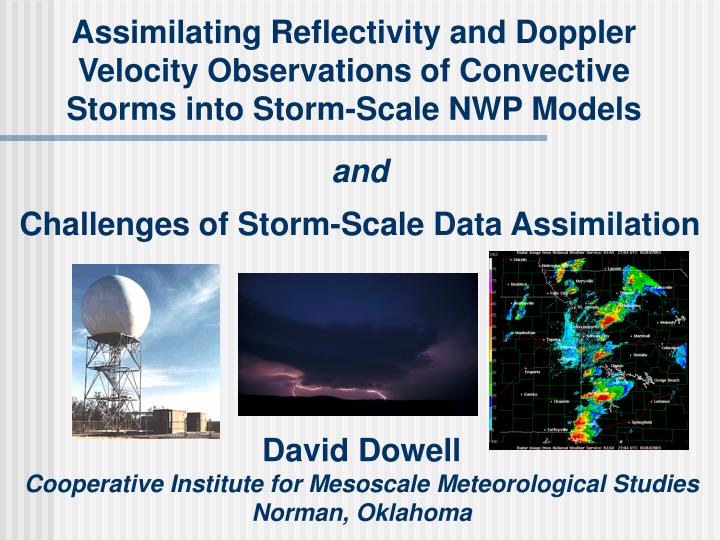
Assimilating Reflectivity and Doppler Velocity Observations of Convective Storms into Storm-Scale NWP Models. and Challenges of Storm-Scale Data Assimilation. David Dowell Cooperative Institute for Mesoscale Meteorological Studies Norman, Oklahoma. Acknowledgments.

E N D
Assimilating Reflectivity and Doppler Velocity Observations of Convective Storms into Storm-Scale NWP Models andChallenges of Storm-Scale Data Assimilation David Dowell Cooperative Institute for Mesoscale Meteorological Studies Norman, Oklahoma
Acknowledgments Jeff Anderson Bill Skamarock Alain Caya Chris Snyder Mike Coniglio Dave Stensrud Mike French Lou Wicker Ted Mansell Qin Xu Also, thank you Fuqing and Chris, for organizing the workshop!
Challenges ofStorm-Scale Data Assimilation • Isolated, small, and unbalanced phenomena • Multiple scales • Influence of larger scale systems on storm initiation and evolution • Larger scale response to heating and cooling by deep, moist convection Trier et al. 2000
Challenges ofStorm-Scale Data Assimilation • Unobserved fields • Observations • Doppler velocity -- scatterer motion toward or away from radar • Reflectivity -- measure of hydrometeor size and number concentration • Model fields • Velocity, pressure, temperature, mixing coefficient, water-vapor mixing ratio, cloud-water mixing ratio, hydrometeor mixing ratios (rain and ice) • Assimilation focused on retrieving unobserved fields • Relatively little information available for diagnosing errors in analyses
Challenges ofStorm-Scale Data Assimilation • Sensitivity to precipitation microphysics parameterization • Heating and cooling by condensation and evaporation strongly affect later storm evolution. • There is a general feeling that the current “standard” scheme (Lin et al. 1983; “LFO”) too quickly produces cold pools that are too strong. Markowski et al. 2002
Storm-Scale EnKF Assimilation of Doppler Radar Observations • Simulated data, perfect model • Snyder and Zhang 2003 -- Doppler velocity • Zhang et al. 2004 -- velocity, surface obs. • Caya et al. 2005 -- velocity and reflectivity • Tong and Xue 2005 -- velocity and reflectivity • Xue et al. 2006 -- velocity and reflectivity • Real data • Dowell et al. 2004a -- velocity and reflectivity • Dowell et al. 2004b -- velocity and reflectivity • Simulated data, imperfect model • Some results shown today
Observing System Simulation Experiments:Supercell and Squall Line • NCOMMAS reference simulations • Weisman sounding with half-circle hodograph (supercell) or straight-line hodograph (squall line) • Dx=2 km, Dz=0.5 km • LFO/Gilmore precipitation microphysics • Cloud water, rain, ice crystals, snow, hail/graupel squall line supercell 200 km 100 km
Observing System Simulation Experiments(OSSEs) • 50-member ensemble with randomness in initial conditions • Warm bubbles added in random locations to initiate storms • Sensitivity of assimilation results to observation type • Reflectivity only • Doppler velocity only • Both reflectivity and Doppler velocity • Impact of model error on assimilation results (later presentations) • Perfect model • Microphysics scheme same in both reference simulation and assimilation • Imperfect model • Different microphysics schemes in reference simulation and assimilation
Synthetic Observations:Effective Reflectivity Factor (“Reflectivity”)
Synthetic Observations:Reflectivity • For point values of fields in ref. sim., compute sum of reflectivity for each hydrometeor category (Smith et al. 1975, Ferrier 1994) • Convert to logarithmic scale. • Standard meteorological units (dBZ) • Appropriate scale for expressing random error (assume 2 dBZ here) • Produce volumetric observations every 5 min.
Synthetic Observations:Doppler Velocity • “Radar” observes u wind component in reference simulation, only where reflectivity > 15 dBZ (no “clear air” data). • Add random errors with 2.0 m s-1 standard deviation. • Produce volumetric observations every 5 min.
assimilation begins at 1200 s Supercell Perfect-Model Experiments:Assimilate ZdB only, Vr only, or both
Squall Line Perfect-Model Experiments:Assimilate ZdB only, Vr only, or both
Conclusions fromPerfect-Model Experiments • Comparable results are obtained for the supercell and squall line. • Assimilating both reflectivity and Doppler velocity observations is better than assimilating one or the other. • Assimilating only reflectivity observations is better than assimilating only Doppler velocity observations. • Spurious cells develop in velocity-only assimilation • Reflectivity-only assimilation produces storms in correct locations, and since model is perfect, these storms develop the correct characteristics
Experiences with Real Data • Single-radar assimilation • 8 May 2003 Oklahoma City, OK supercell • 15 May 2003 Shamrock, TX supercell (M. French) • 11 June 2003 southwest OK multicell (M. Coniglio) • NCOMMAS • LFO precipitation microphysics (cloud, rain, snow, ice crystals, hail/graupel) • Homogeneous environment • Ensemble size ~50 • Variability from sounding perturbations and from randomness in locations of warm bubbles that initiate storms
8 May 2003 Oklahoma City Storm:Single-Radar Assimilation vs. Independent Dual-Doppler Analysis Reflectivity and Wind at 300 m AGL Dual-Doppler (WSR-88D and TDWR) Analysis Single-Doppler (KOUN) Assimilation image provided by Arthur Witt
prior reflectivity innovation and ensemble spread (8 May 2003) innovation dBZ ensemble spread Evidence of Precipitation Microphysics Errors • In these real data experiments, ensemble spread in reflectivity is too small (RMS innovation >> spread). • How do the observed and simulated reflectivities typically disagree? (What are the spatial patterns in bias?)
Time-Height Diagrams:Prior Innovations for Reflectivity Mean of (ob. - prior ensemble mean) reflectivity, in dBZ 15 May 2003 supercell (M.French) 11 June 2003 multicell (M. Coniglio) 8 May 2003 supercell
8 May 2003 Supercell:Sensitivity to Precipitation Microphysics • Reflectivity computation for hail/graupel category • Assume hail/graupel has a dry surface above the melting level and a wet surface below the melting level. • Assume all hail/graupel is dry. • Intercept parameter for rain category • n0=8106 m-4 (default -- Marshall-Palmer) • n0=8105 m-4 (fewer drops, larger mean size)
8 May 2003 Supercell:Sensitivity to Precipitation Microphysics Mean of (ob. - prior ensemble mean) reflectivity, in dBZ fewer and larger raindrops, dry hail/graupel LFO, dry hail/graupel LFO, wet hail/graupel
8 May 2003 Supercell:Sensitivity to Precipitation Microphysics Pert. Temperature at 250 m AGL (after assimilation for 85 min) fewer and larger raindrops, dry hail/graupel LFO, dry hail/graupel
Problems Encountered withReal-Data Experiments • Precipitation microphysics errors (LFO) • Analyses are sensitive to choices for microphysics parameters. • Reflectivity statistics indicate problems. • Although peak reflectivity is generally overpredicted by the model, areal coverage of moderate reflectivity is generally underpredicted. • Observation operator that assumes all hail/graupel below melting level is wet produces reflectivity that is too high. • Observation bias could be a problem, too, but it is probably less significant than other problems. • We need a flexible precipitation microphysics scheme that can be corrected for bias.
Problems Encountered withReal-Data Experiments (not shown) • Sensitivity of forecasts to virtually all aspects of model and assimilation • Precipitation microphysics • Observation resolution • Grid resolution • Sounding estimate • … • Spurious temperature perturbations produced by assimilating “clear air” Doppler velocity data • Verification
Encouraging EnKF wind analyses obtained from single-Doppler observations Recent interest in improving precipitation microphysics parameterizations (Univ. of Illinois, NSSL, OU) VORTEX2 (proposed for 2008 and 2009) Mobile radars, dual-polarization Unmanned aerial vehicles (UAVs) Precipitation microphysics probes High-density surface observations Assess model errors on storm scale? Cause for Optimism -- Research
Dual-polarization upgrade to WSR-88D (2009?) It seems unrealistic to expect the filter to retrieve several microphysical parameters from just reflectivity and velocity obs. Polarimetric radar measurements provide additional information about hydrometeor shape and size distribution. Improved mesoscale observations (surface mesonets, satellite) Cause for Optimism -- Operations Ryzhkov et al. 2005
Current Work as NSSL(to be presented at the workshop) • Mesoscale ensemble forecasting and data assimilaton (Fujita/Stensrud) • Radar data assimilation in numerical cloud models with homogeneous environments (Dowell, Wicker, Coniglio) • Precipitation microphysics sensitivity studies (Mansell, Wicker) • Radar data quality control and compression (Xu)