Download
1 / 1
20 likes | 109 Views
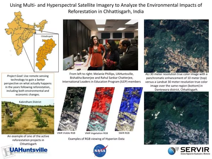
Using Multi- and Hyperspectral Satellite Imagery to Analyze the Environmental Impacts of Reforestation in Chhattisgarh, India. From left to right: Melanie Phillips, UAHuntsville , Bishakha Banerjee and Rahul Sankar Chatterjee , International Leaders in Education Program (ILEP) members.

E N D
Using Multi- and Hyperspectral Satellite Imagery to Analyze the Environmental Impacts of Reforestation in Chhattisgarh, India From left to right: Melanie Phillips, UAHuntsville, Bishakha Banerjee and Rahul SankarChatterjee, International Leaders in Education Program (ILEP) members ALI 30 meter resolution true color image with a panchromatic enhancement of 10 meter (top) versus a Landsat 30 meter resolution true color image over the same region (bottom) in Dantewara district, Chhattisgarh. Project Goal: Use remote sensing technology to gain a better perspective on what actually happens in the years following reforestation, including both environmental and economic changes. Kabirdham District VNIR Visible RGB SWIR RGB VNIR Vegetation RGB An example of one of the active reforestation projects in Chhattisgarh Examples of RGB viewing of Hyperion Data