Download
1 / 28
280 likes | 419 Views
Acadia Learning Culverts and Stream Ecology. Sampling locations 2012. Burnt Cove Stream, Edmunds September 25, 2012. Burnt Cove Stream, Edmunds September 25, 2012. Photo taken from road looking downstream. Burnt Cove Stream, Edmunds September 25, 2012.

E N D
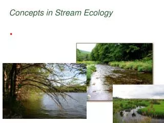
Acadia Learning Culverts and Stream Ecology Sampling locations 2012
Burnt Cove Stream, Edmunds September 25, 2012 Photo taken from road looking downstream
Burnt Cove Stream, Edmunds September 25, 2012 Photo taken from road looking upstream
Pug Brook, Old Town September 26+27, 2012 Photo taken from road looking downstream
Pug Brook, Old Town September 26+27, 2012 Photo taken from road looking upstream
Pug Brook, Old Town September 26+27, 2012 Photo taken from below culvert looking upstream
Pug Brook, Old Town September 26+27, 2012 Photo taken from above culvert looking downstream
Smelt Brook, Surry September 28, 2012 Photo taken from below culvert looking upstream
Smelt Brook, Surry September 28, 2012 Photo taken from above culvert looking downstream
Smelt Brook, Surry September 28, 2012 Photo taken from above culvert looking upstream
Bike Path marsh stream, Old TownOctober 1, 2012 Photo taken from above culvert looking upstream
Bike Path marsh stream, Old TownOctober 1, 2012 Photo taken from above culvert looking downstream
Bike Path marsh stream, Old TownOctober 1, 2012 Photo taken from below culvert looking upstream
Black Brook, LincolnvilleOctober 12, 2012 Photo taken from the road looking downstream
Black Brook, LincolnvilleOctober 12, 2012 Photo taken from road looking downstream
Black Brook, LincolnvilleOctober 12, 2012 Photo taken from below culvert looking upstream
Black Brook, LincolnvilleOctober 12, 2012 Photo taken from road looking upstream
Southwest Creek, JonesportOctober 23, 2012 Photo taken from below culvert looking upstream
Southwest Creek, JonesportOctober 23, 2012 Photo taken from below culvert looking downstream
Southwest Creek, JonesportOctober 23, 2012 Photo taken from above culvert looking downstream
Some questions: Looking at these sampling locations… Did all of the streams and creeks look the same?If not, which ones did look similar and which ones did not? Did all of the locations look the same above and below the culvert?If not, which ones did look the same and which ones did not?Remember back to sampling… Did the water your sample came from look the same above and below the culvert?Was either sample clear? Was either sample murky (so that it was hard to find the macroinvertebrates?Was the water moving at the same rate above and below your culvert? How would any of these observations (looking different or the same, observed water quality, flow rate) change the macroinvertebrate community?